-
Home
-
Data & Publications
-
Regional Portals
- About Regional Portals
- Florida
- Navassa Island
- Puerto Rico
- Flower Garden Banks
- U.S. Virgin Islands
- American Samoa
- Commonwealth of the Northern Mariana Islands
- Federated States of Micronesia
- Guam
- Main Hawaiian Islands
- Republic of the Marshall Islands
- Northwestern Hawaiian Islands
- Republic of Palau
- Pacific Remote Island Areas
-
CRCP Activities
- Glossary
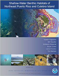
Shallow-Water Benthic Habitats of Northeast Puerto Rico and Culebra Island

This report describes the development and assessment of shallow-water (<35 m) benthic habitat maps for Northeast Puerto Rico and Culebra Island. The objective of this effort, conducted by NOAA's National Centers for Coastal Ocean Science (NCCOS) in partnership with the Departamento de Recursos Naturales y Ambientales (DRNA), was to provide spatially-explicit information describing the benthic habitat types and live coral cover present in and around the Northeast Reserves, a region selected by local managers as a priority area. The habitat map, generated using a combination of semi-automated classification and visual interpretation techniques, represent the first digital maps that describe nearly 100% of the seafloor in the area. The effort also marks the first time a high resolution satellite mosaic representing the seafloor has been provided for the full extent of this location, as well as a multi-resolution depth model combining all available hydrographic data in the region.
This report consists of four primary components:
- a description of the classification scheme used to categorize the different seafloor habitats;
- a description of the techniques used to create the habitat maps;
- an assessment of the habitat maps' thematic accuracies; and
- a discussion and summary of the habitats in each area.
Citation
Kågesten, G., Sautter, W., Edwards, K., Costa, B., Kracker, L., Battista, T. (2015). Shallow-Water Benthic Habitats of Northeast Puerto Rico and Culebra Island. NOAA Technical Memorandum NOS NCCOS 200. Silver Spring, MD. 112 pp.
Related project information can be found here.


