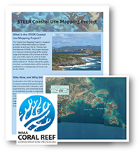
The STEER Coastal Use Mapping Project was designed to collect critical information on human activities in and near the St. Thomas East End Reserves (STEER). The project purpose is to improve understanding of the spatial range and intensity of key human activities and uses in this region in order to better inform resource management. Workshops were held on St. Thomas in May 2012, where local experts participated in creating maps of ocean uses for the STEER. Draft maps were presented to the workshop participants and other stakeholders in October 2012 for feedback and edits. The maps were finalized in November 2012. Products include a map book, a supplemental map product, and GIS data files.
Coral reefs in the USVI are facing increasing pressures from a growing variety of ocean uses, as well as increased coastal development and watershed impacts. The STEER contains extensive mangroves, seagrass beds and coral reefs. It houses a variety of commercial activities and is adjacent to a landfill, marinas, an EPA Superfund Site, and residential areas served by individual septic systems.
The Coastal Use Mapping Project is intended as a step to improving coastal and watershed management activities. The information collected through this project will provide a better understanding of human uses, issues, and constraints in the STEER. It can help inform management decisions to better protect the ecosystem, while minimizing impacts on those who depend on marine resources and reducing user conflict. The project included the collection and mapping existing watershed information, and conducting participatory mapping workshops to gain a better understanding of key human uses and use motivations that affect the STEER.
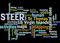
STEER coastal uses word cloud
The STEER Coastal Use Mapping Project is a partnership of the U.S. Virgin Islands Department of Planning and Natural Resources (DPNR), NOAA's Coral Reef Conservation Program (CRCP), NOAA's Office of Ocean and Coastal Resource Management (OCRM), NOAA's National Centers for Coastal Ocean Science (NCCOS), and the STEER Advisory Committee.