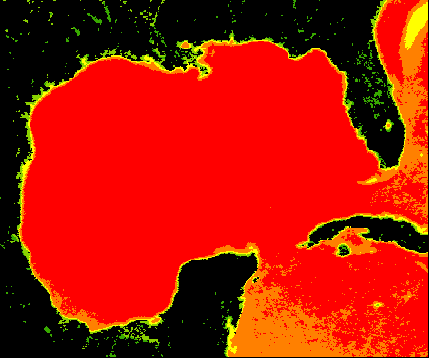
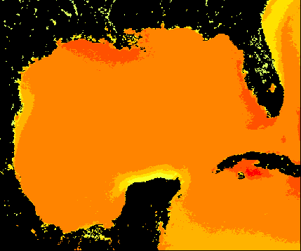
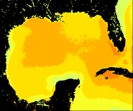
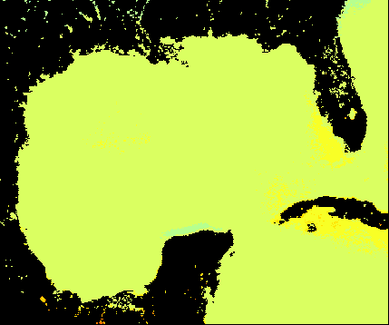
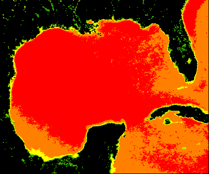
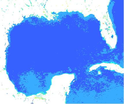
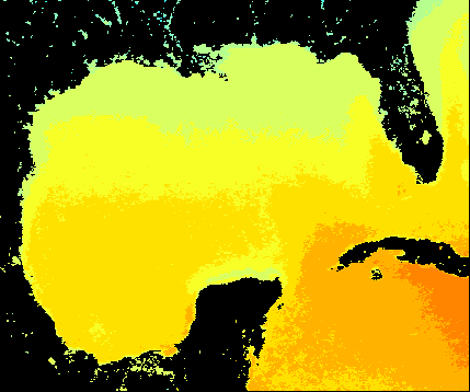
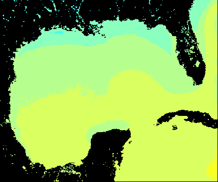
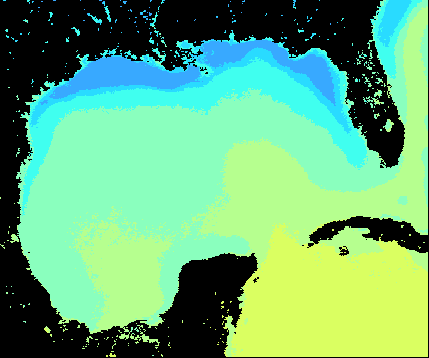
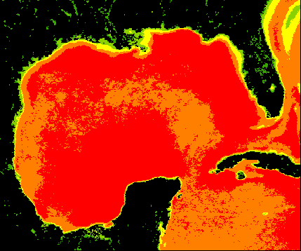
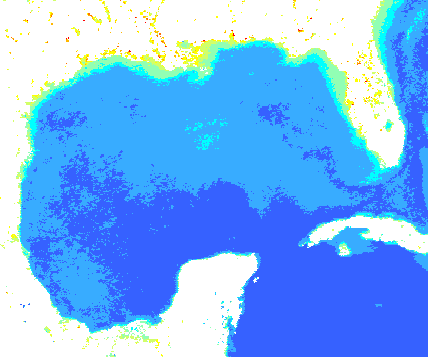
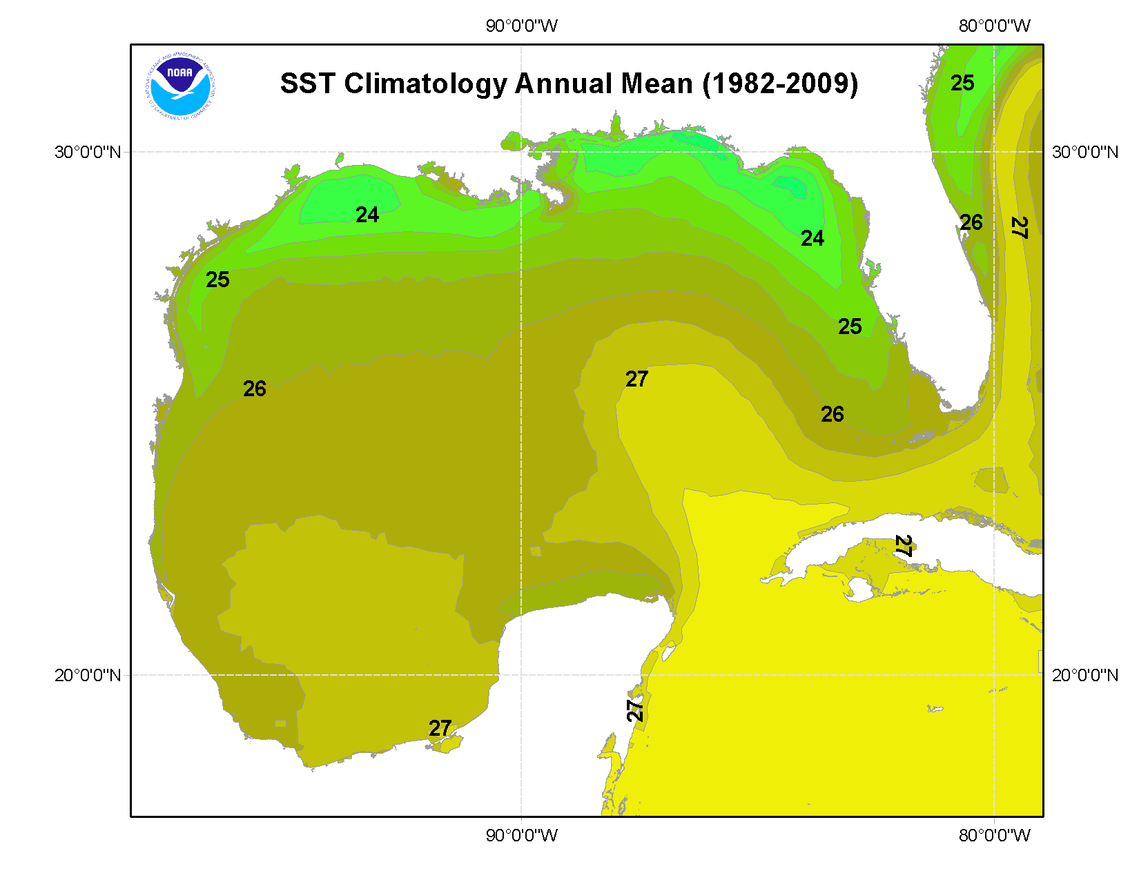
A separate land mask developed from the Global Self-Consistent High-Resolution Shoreline Database (GSHHS v 2.2.0, Wessel and Smith, 2011) is included with the data files. The color-classified versions of the climatologies were developed for use in visual online applications and are annual and seasonal means only.
Online Links:
| Range of values | |
|---|---|
| Minimum: | 17.03 |
| Maximum: | 31.97 |
| Units: | decimal degrees |
| Resolution: | 0.000000001 |
| Range of values | |
|---|---|
| Minimum: | -98.68 |
| Maximum: | -78.9 |
| Units: | decimal degrees |
| Resolution: | 0.0000000001 |
| Value | Definition |
|---|---|
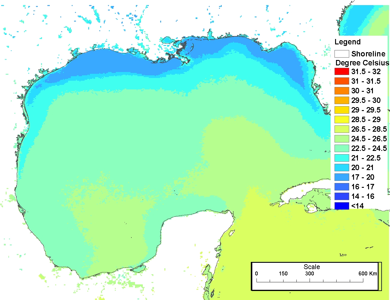
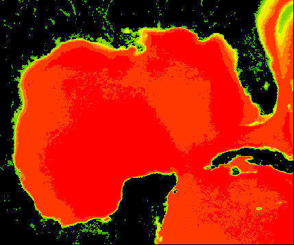
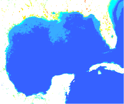
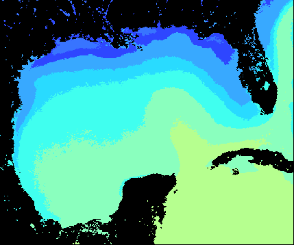
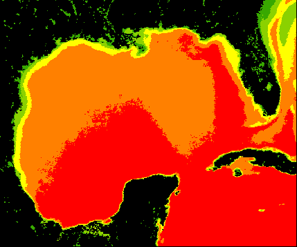
| sea surface temperature | The .HDF files are 16-bit files, and pixel values can range from 0 to 65535 (2 to the 16th power). However,realistic pixel values for SST will always be less than 600 or so. SST in degrees C = (0.075 *pixel value) - 3.0, so a pixel value of 600 equals 42 degrees C, a temperature which exceedsnormal SST limits. Temperatures are represented in 0.075 degree C increments |
Kenneth S. Casey, National Oceanographic Data Center (NODC), and Edward J. Kearns, Vicki Halliwell, and Robert Evans, University of Miami, Rosenstiel School of Marine and Atmospheric Science (RSMAS)
To provide high resolution climatologies of SST with high accuracy and spatial resolution for climate change and ecological studies.
Online Links:
To create the "cloud-screened" 5-day files used to create the seasonal and annual climatologies in this collection, original Pathfinder Version 5 day and night data of quality flags 4-7 were averaged to create global daily SST files, which were then averaged into 5day temporal bins. Version 5.1 data were used for 1982-1984, and Version 5.0 data were used for 1985-2009. The main difference between the 5.0 and 5.1 algorithms is that 5.1 uses a higher resolution data set, the Reynolds Optimum Interpolation 1/4-degree Daily SST Analysis Version 2, as both a first guess SST and in the quality control procedures. The primary effect of this change is to retain more data in the coastal and high gradient regions and in regions where meandering or feature advection is present.
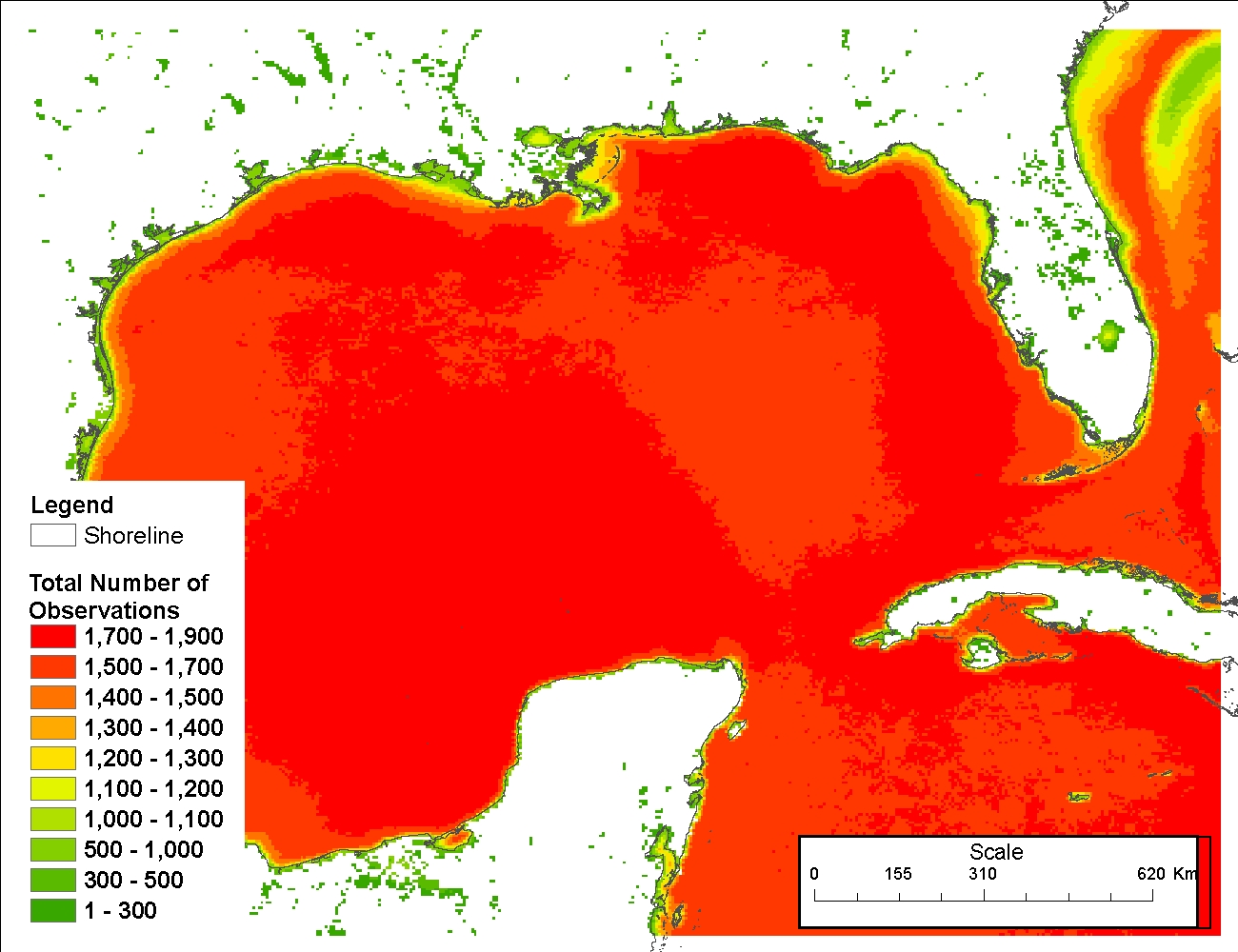
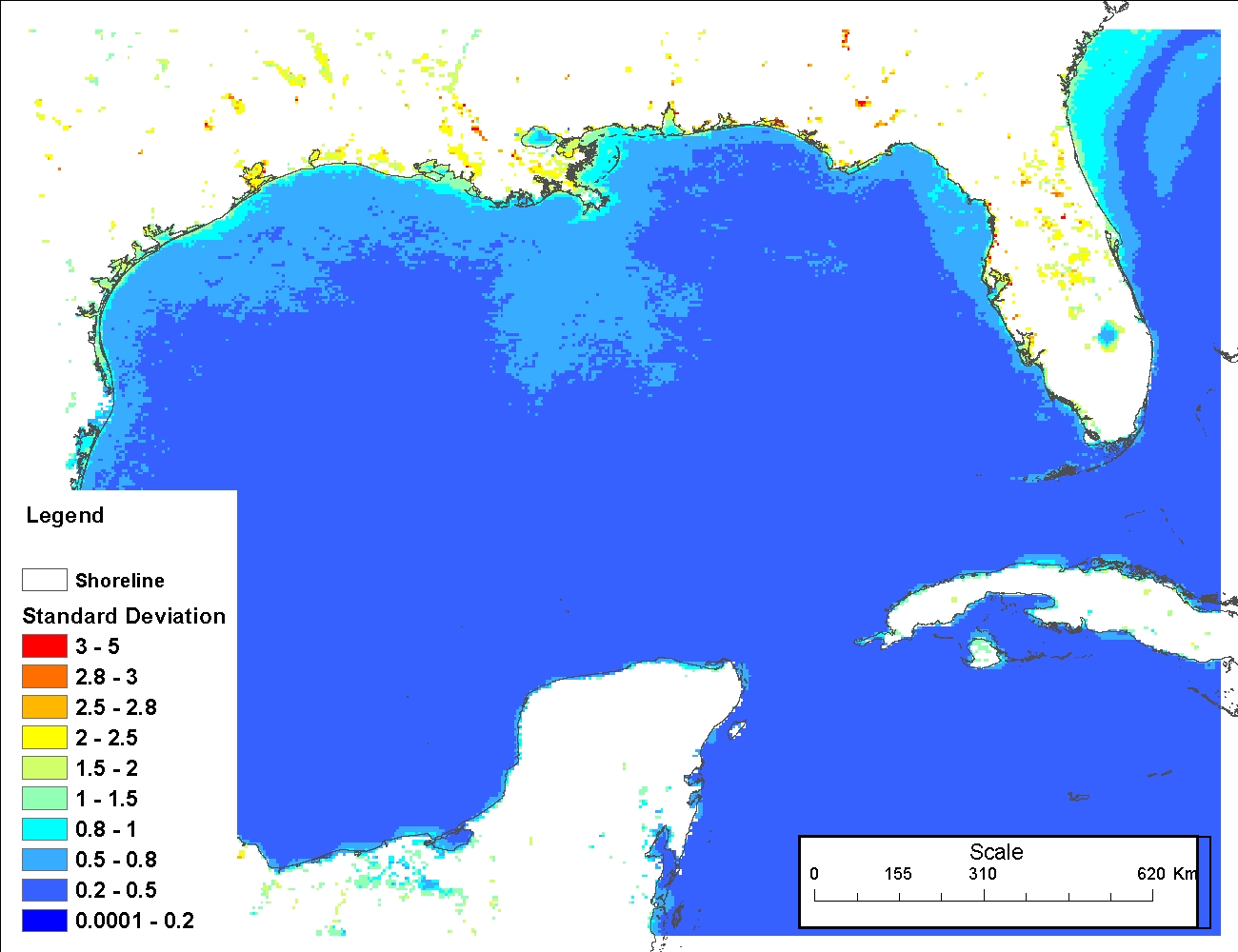
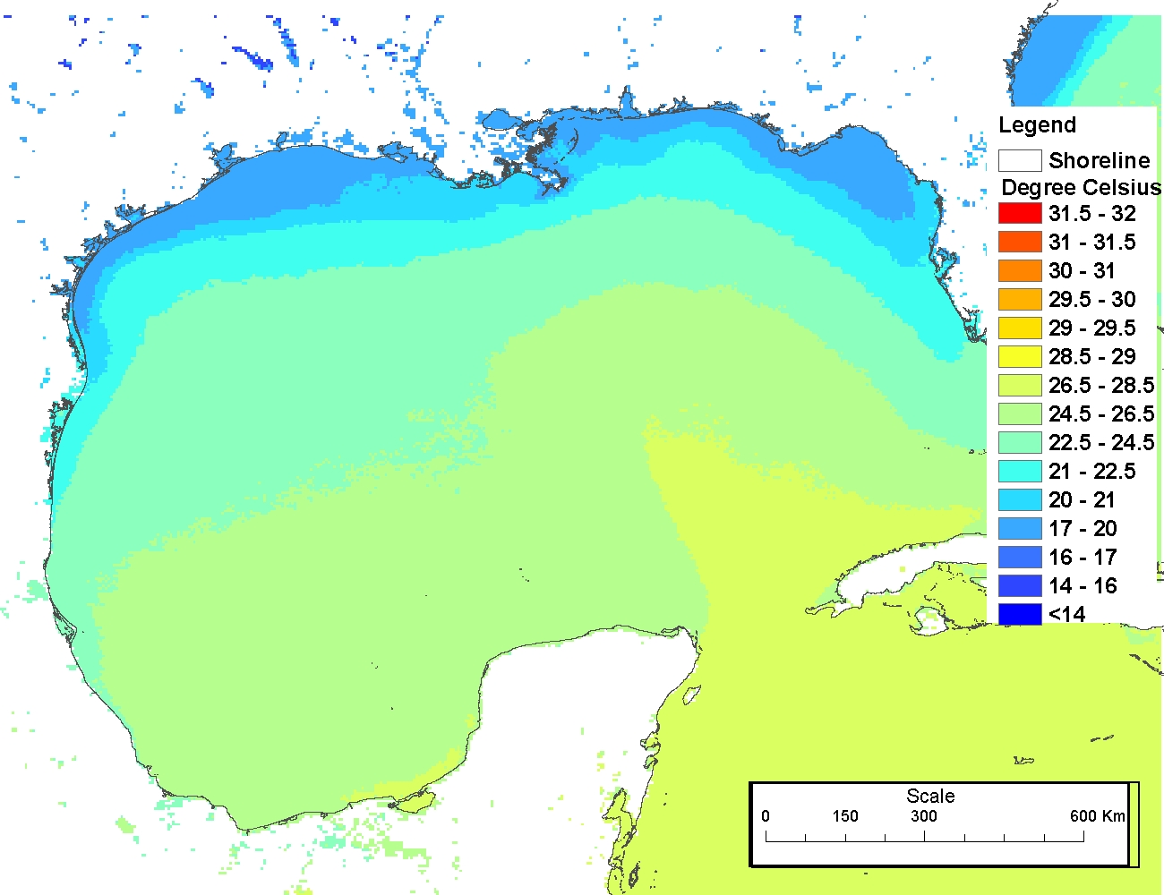
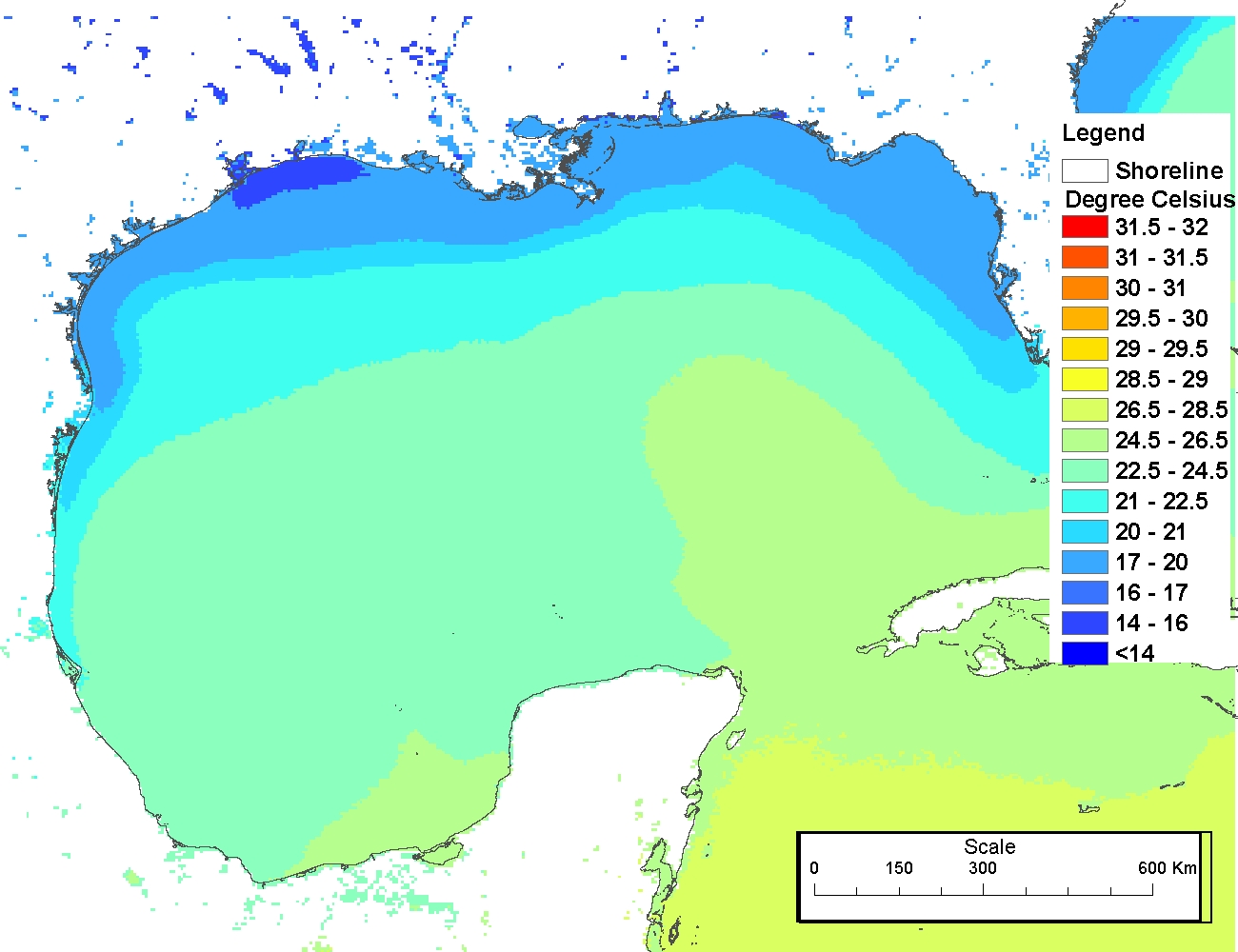
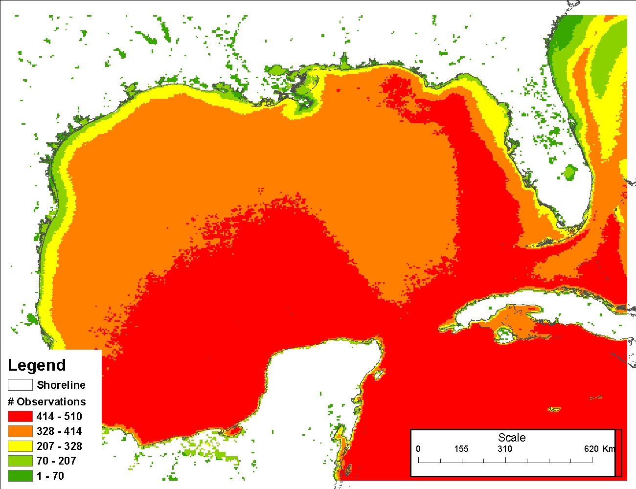
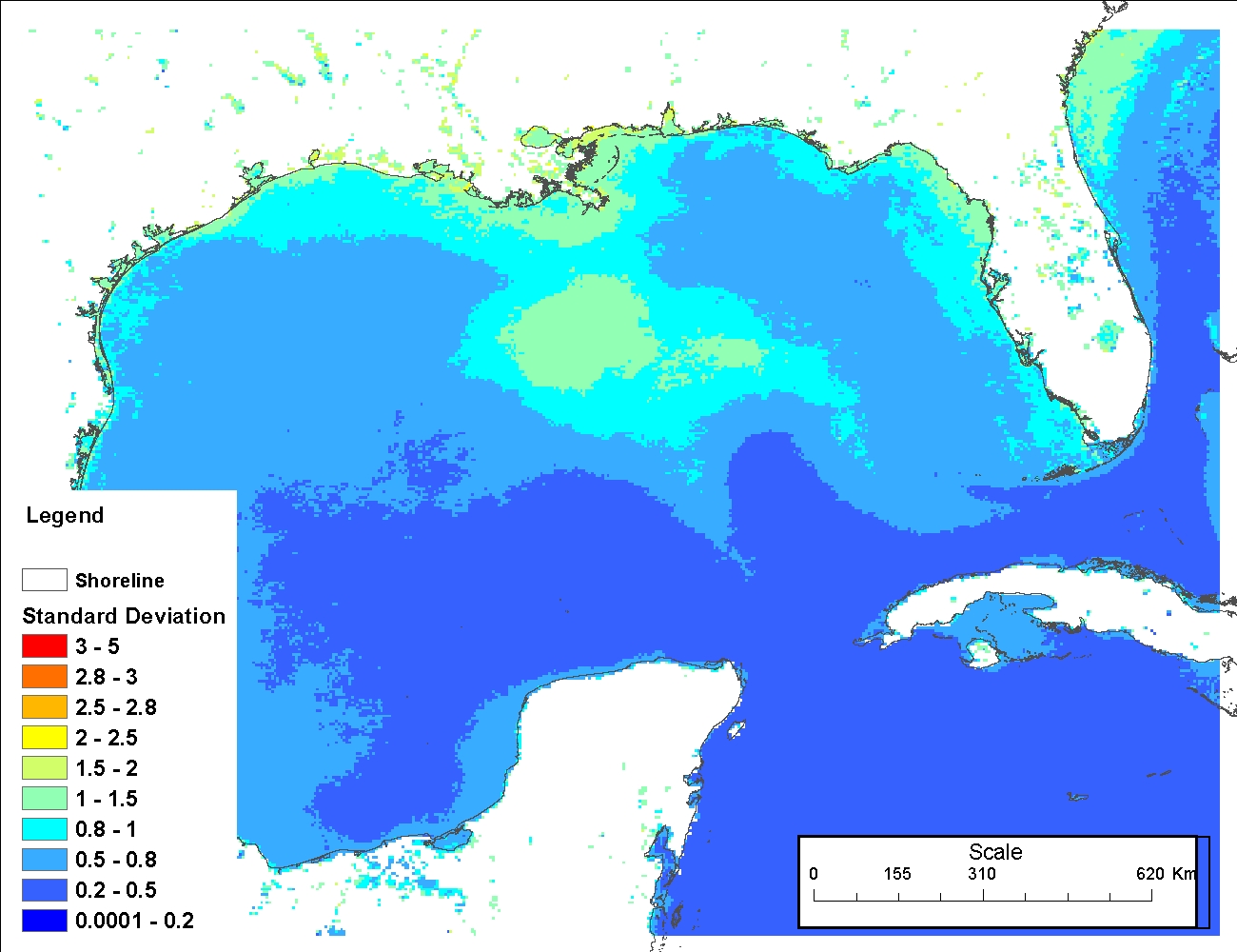
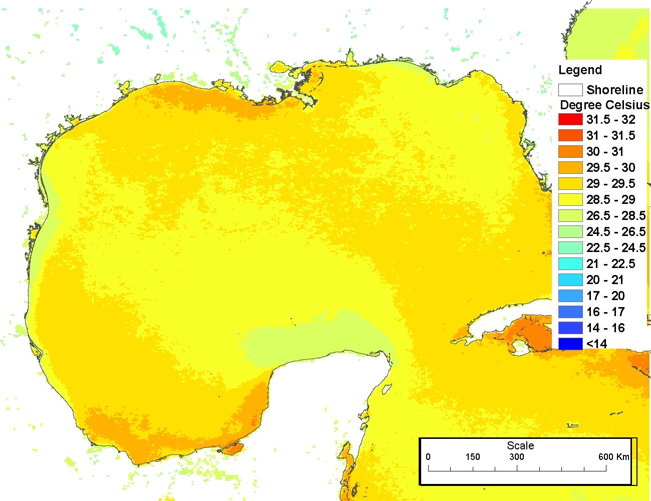
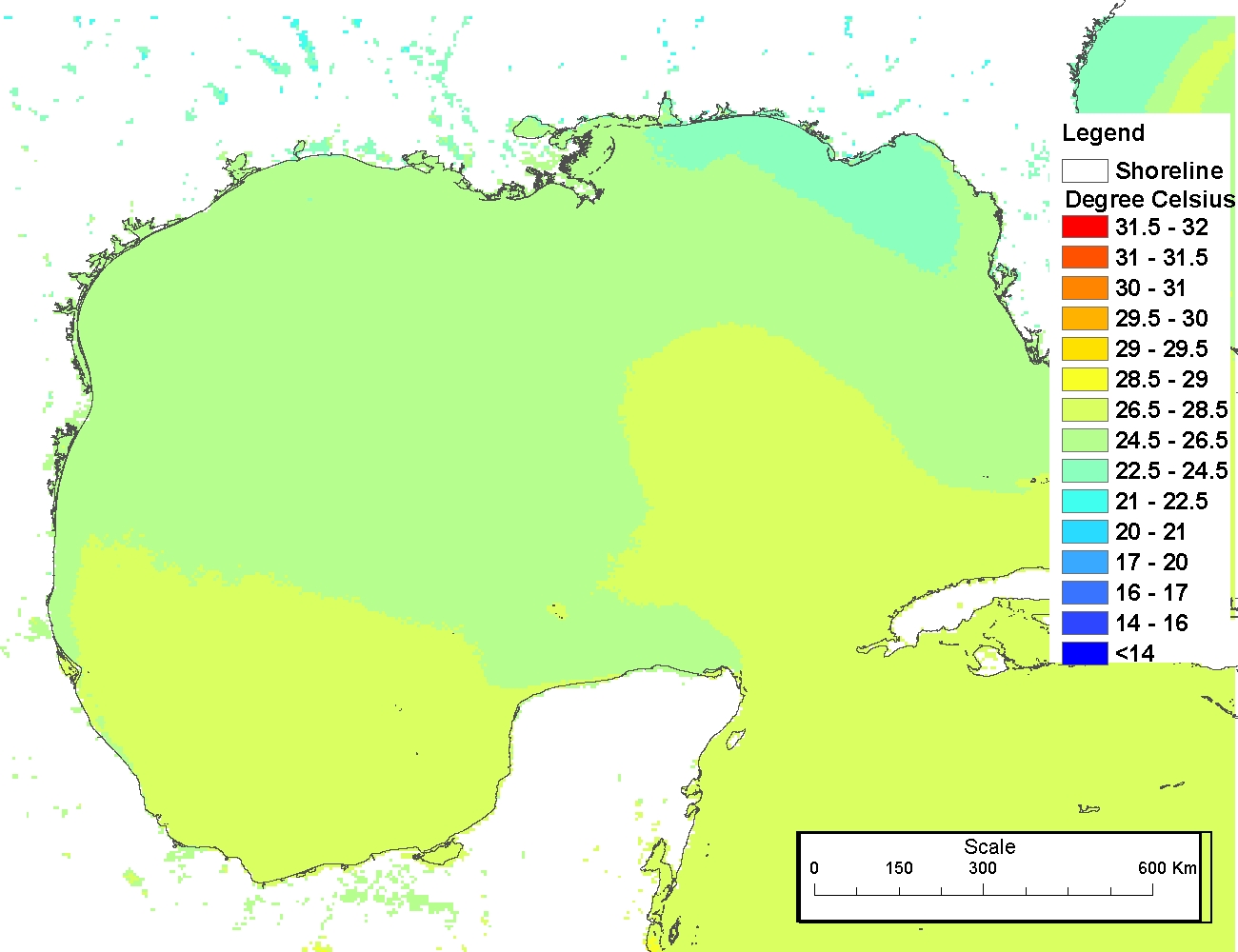
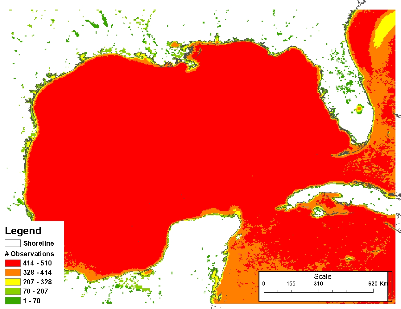
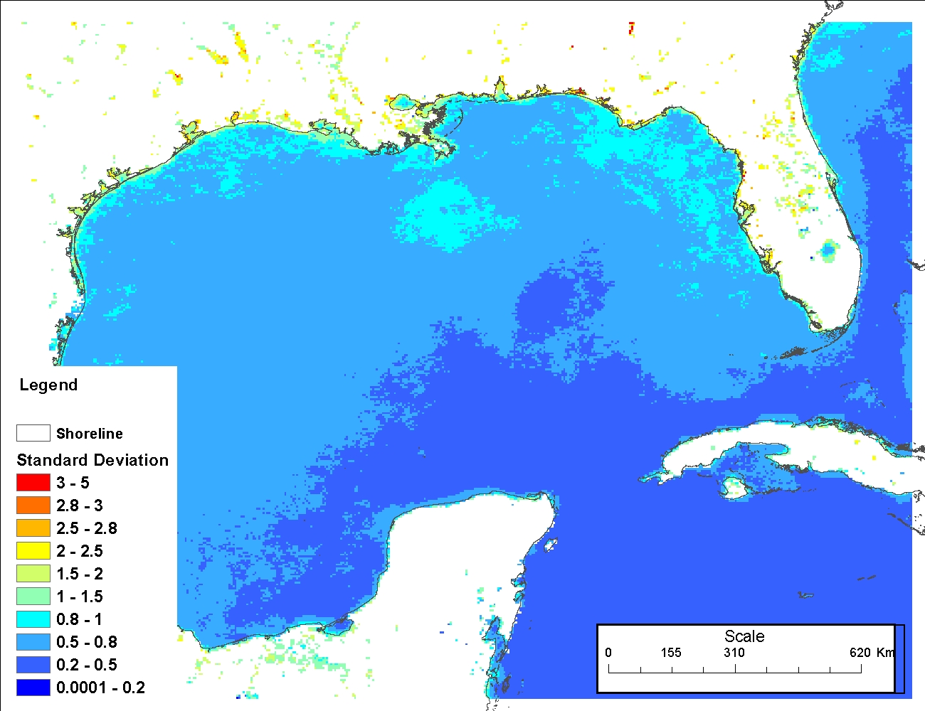
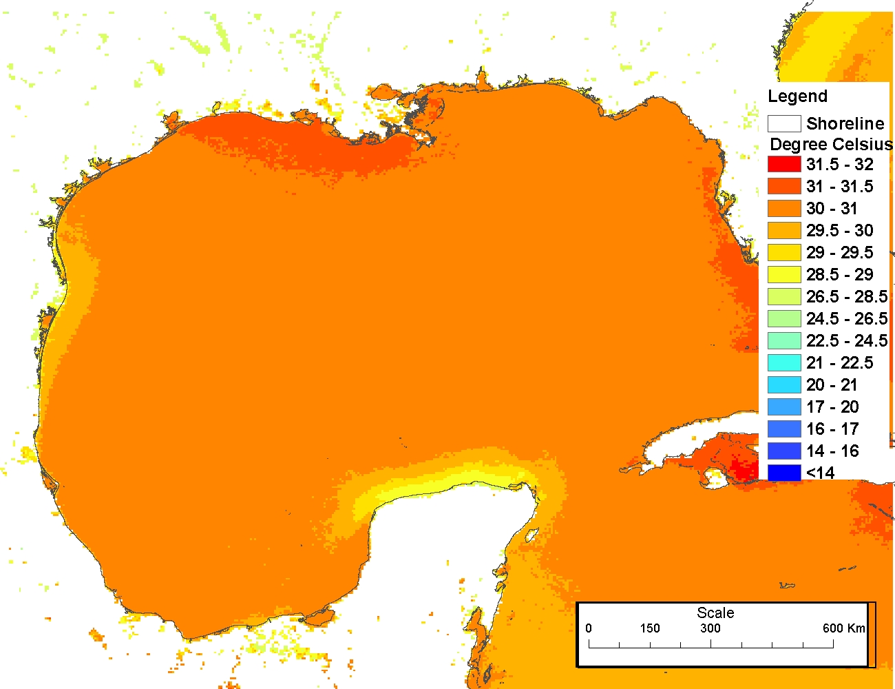
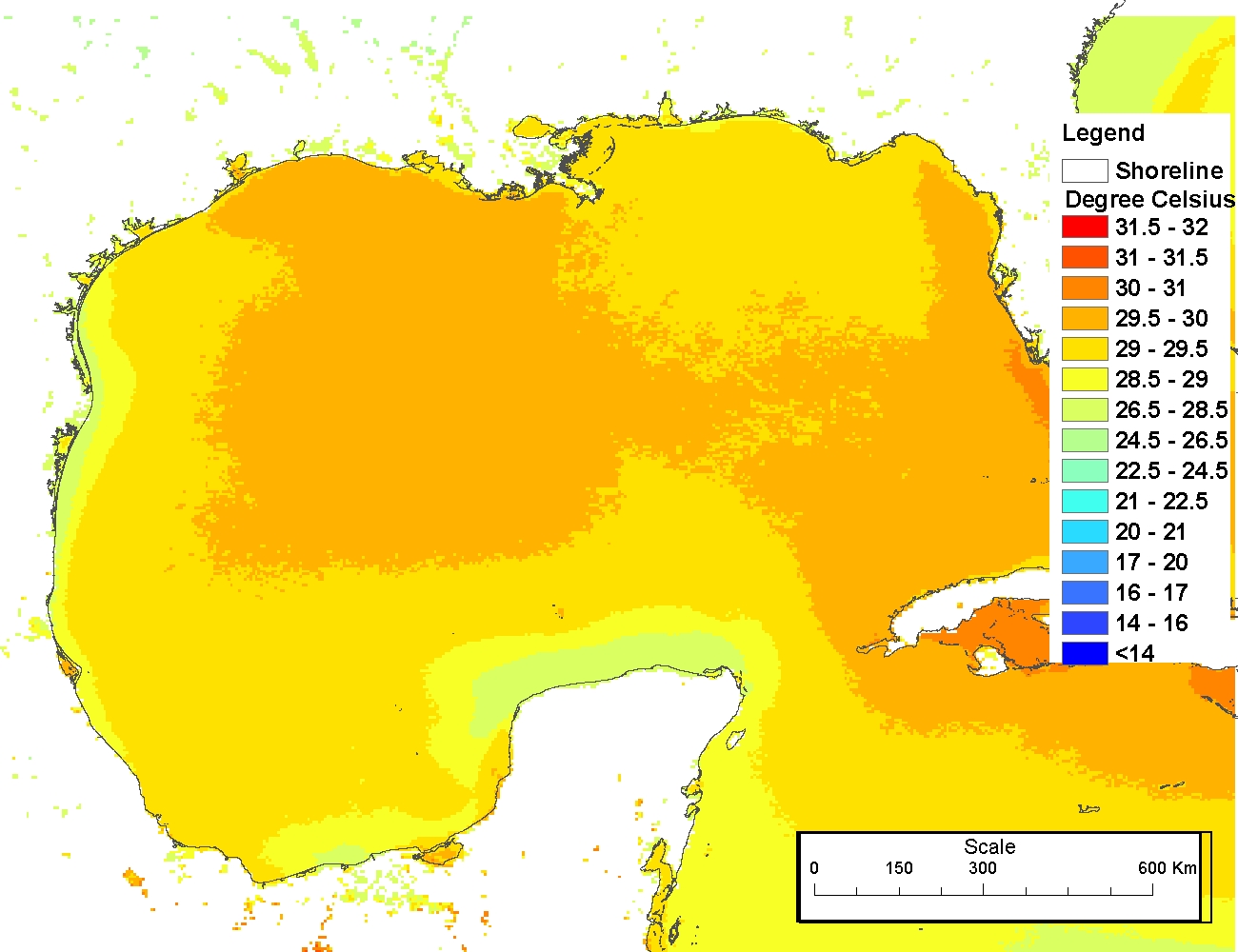
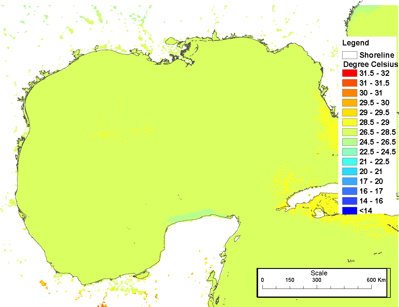
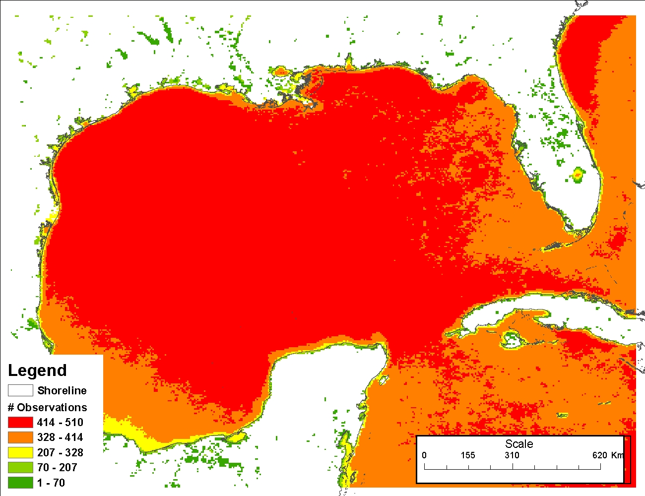
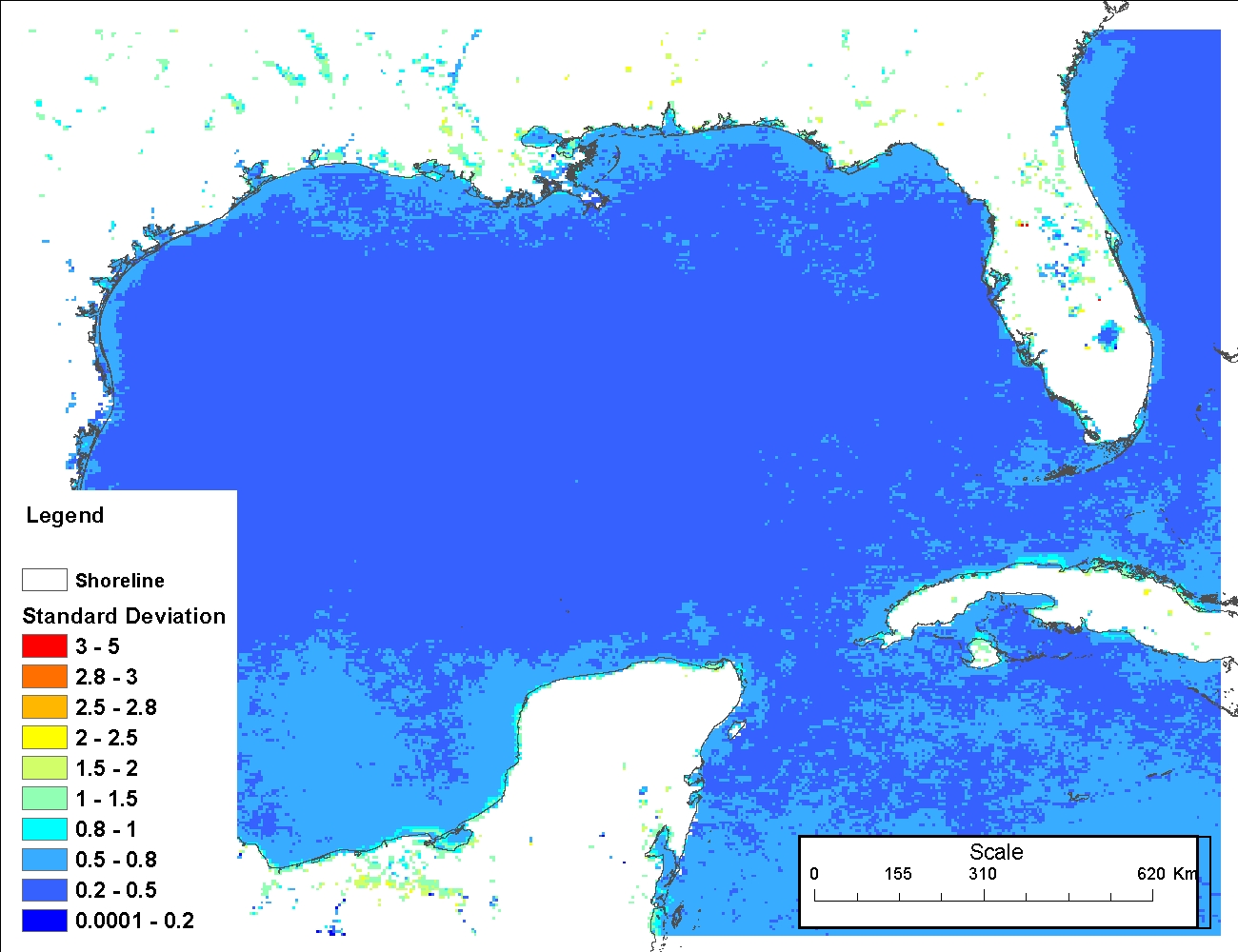
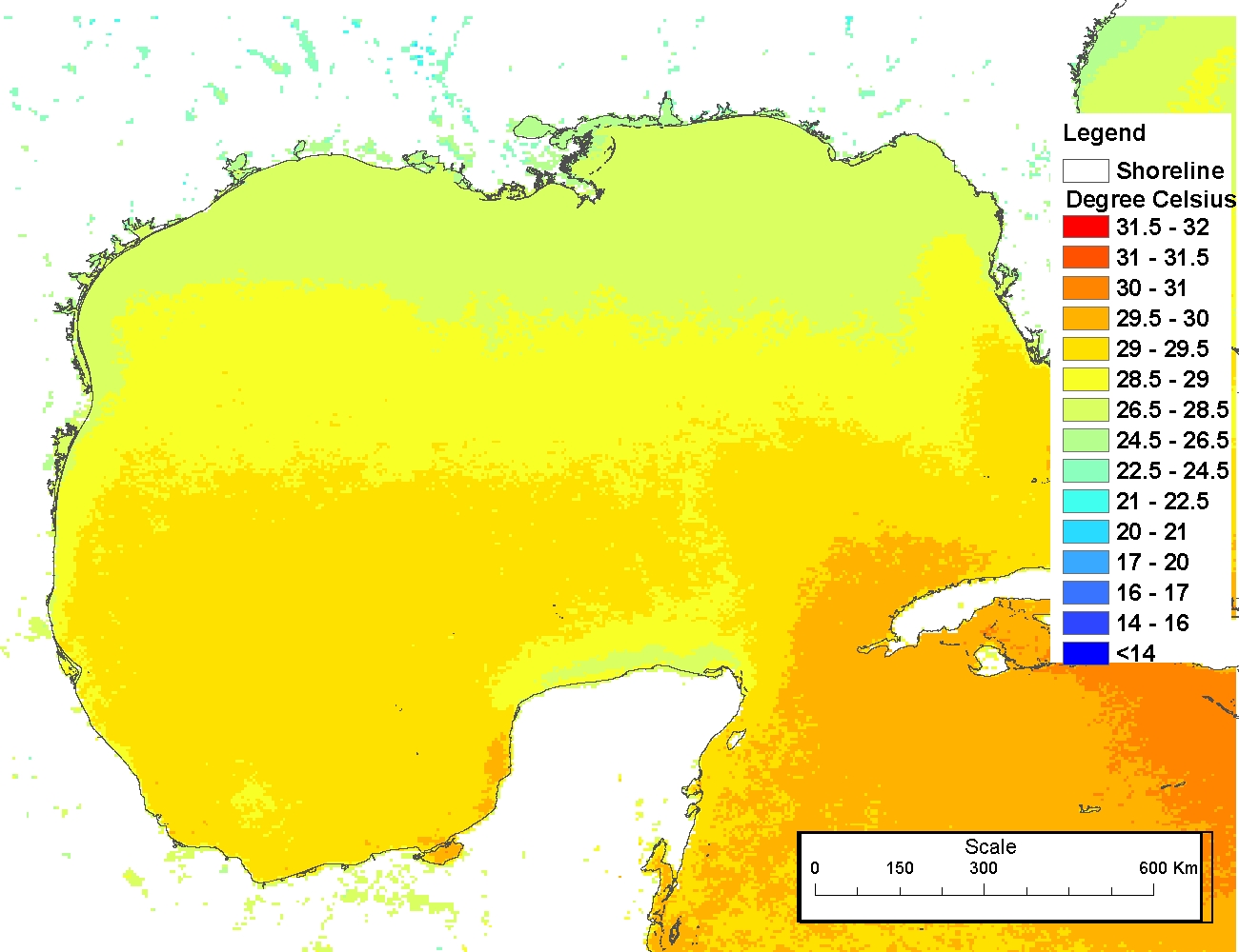
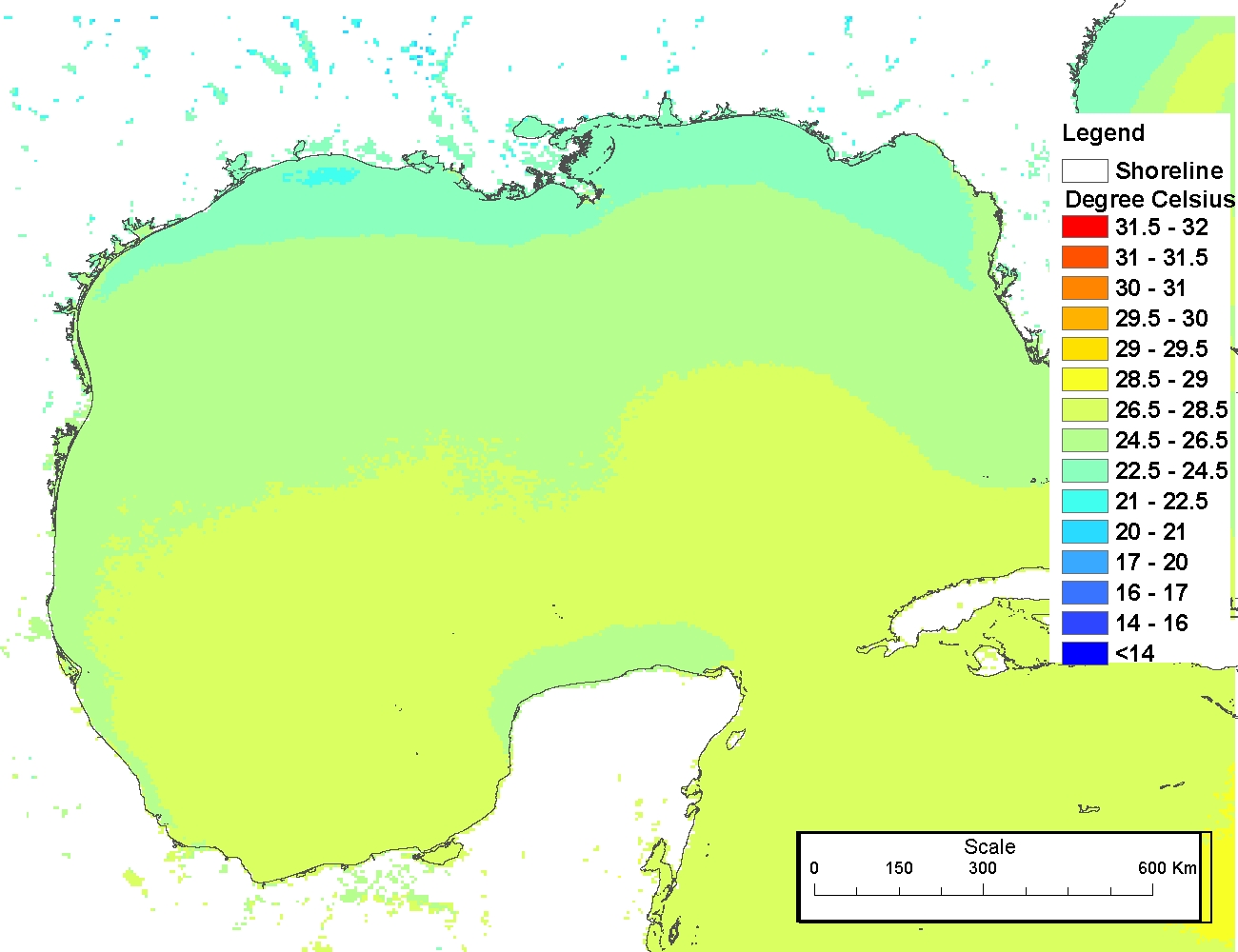
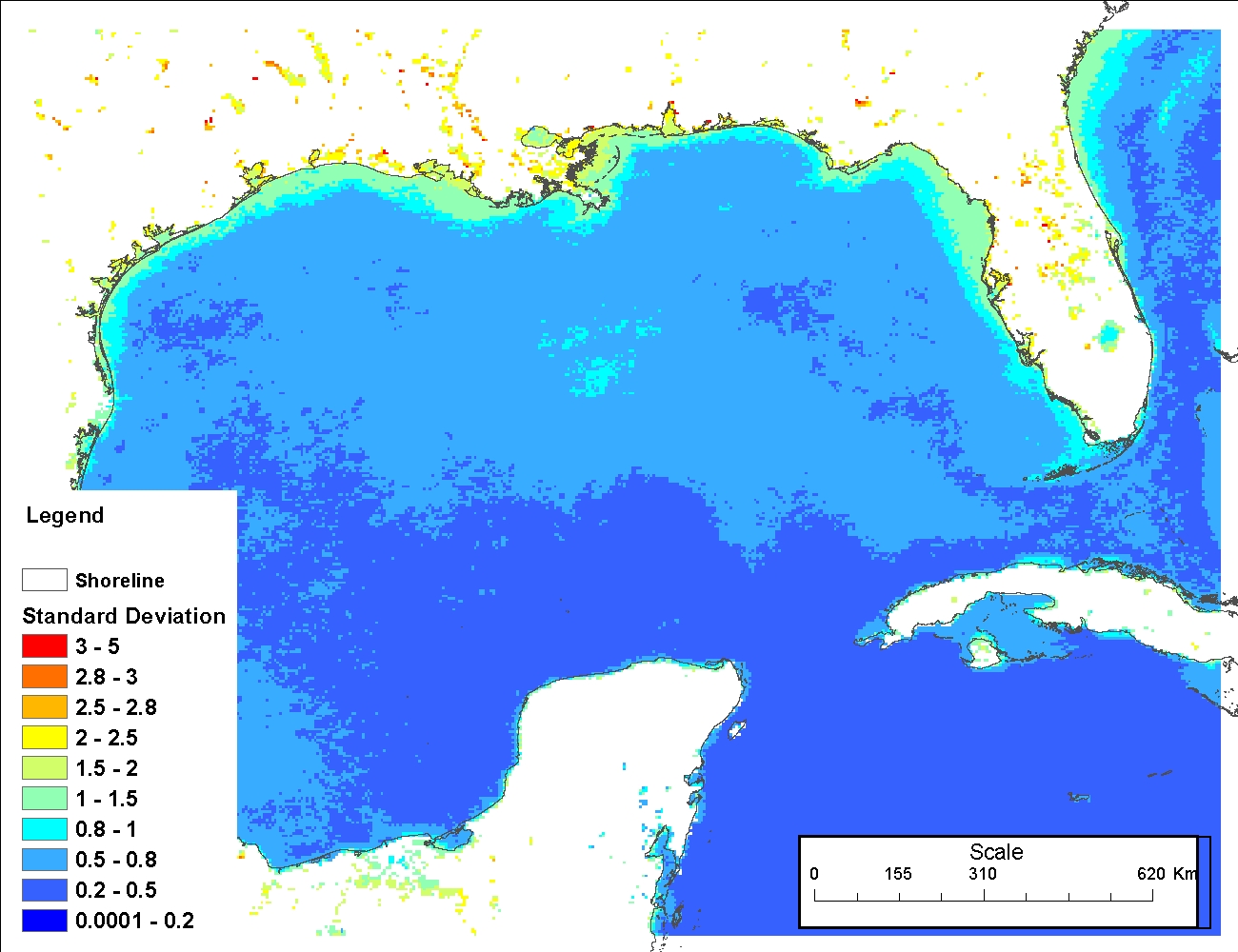
E. Additional processes required for SST climatologies: 1.The individual 5-day day-night cloudscreened files generated as part of the Version 5 Pathfinder Project for 1982-2009 were averaged into 3-month periods, or "seasons," to create a set of initial climatologies. For example, Season 1 of 1982, Season 1 of 1983, ...., Season 1 of 2009 were averaged to create a climatology for Season 1. In addition to the pre-screening of any data with a quality flag of less than 4, data with pixel values less than 16 were masked as NoData. This is because a pixel value translates to -1.8 degrees C, which is the coldest sea surface temperature possible. 2. Then, the temperature value was converted into degrees Celsius (Using the function New value = original value * 0.075 -3.0). 3. The time series maximum, minimum, average, number of observations and standard deviation were used for the final climatology data. 4. The final climatology maximum/minimum/average SST was the average of the time series maximum/minimum/average SST; the final climatology standard deviation was the standard deviation based on the seasonal average time series data; the final climatology number of observations was the total number of observations for all the seasonal time series data. Similar procedures were used for the annual climatology products.
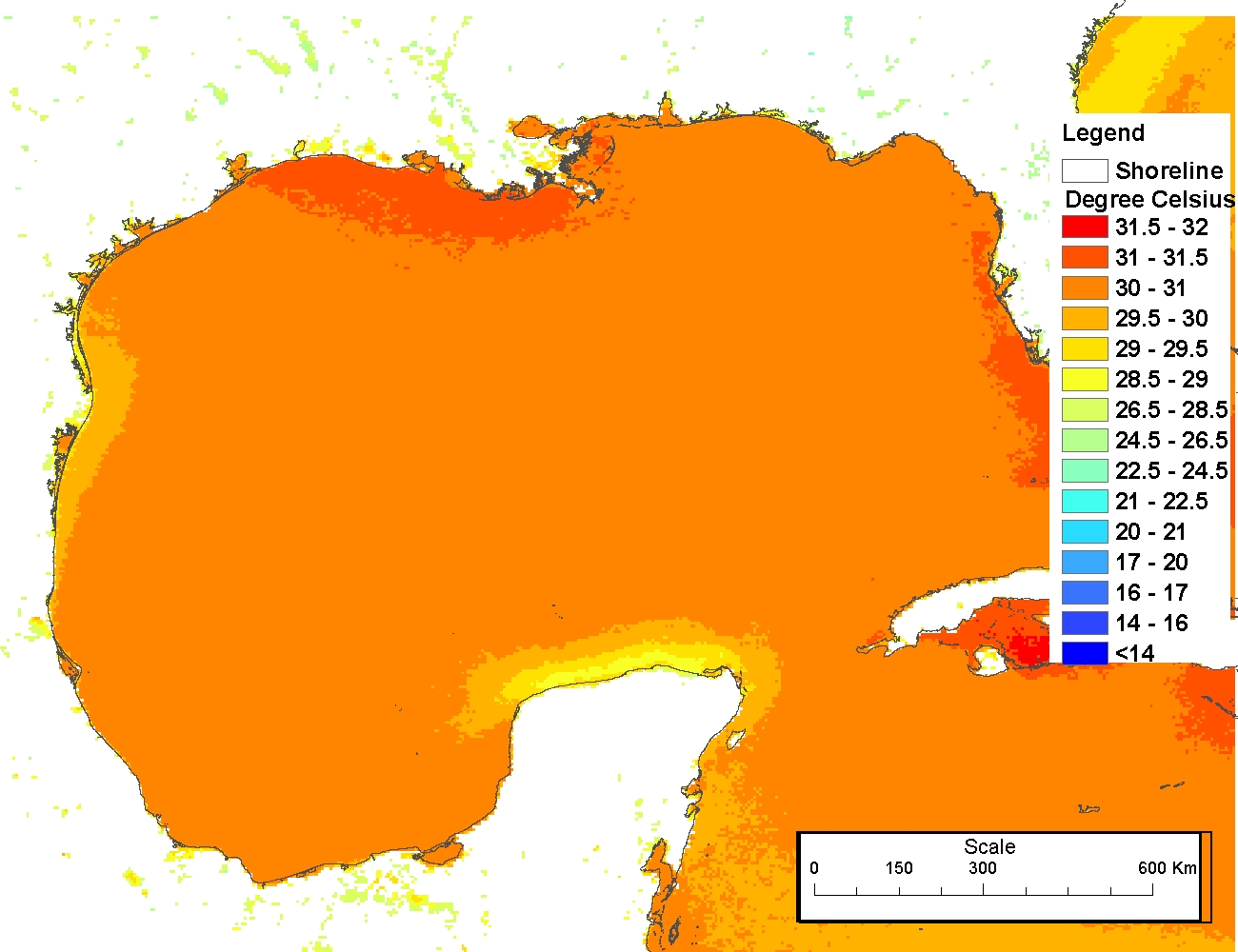
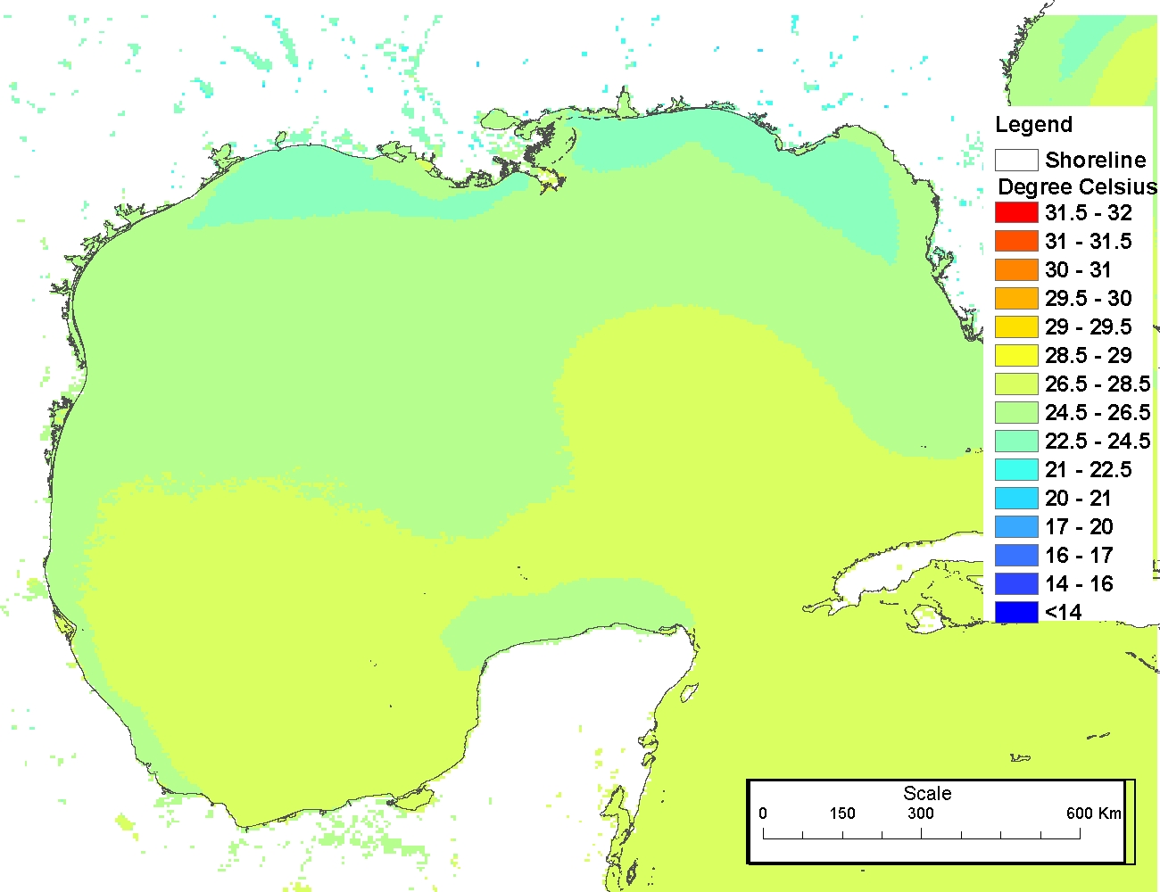
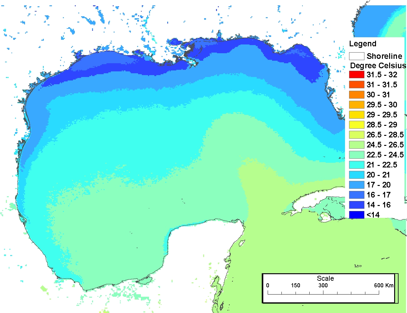
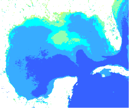
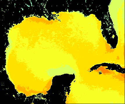
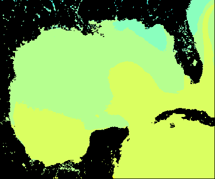
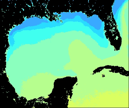
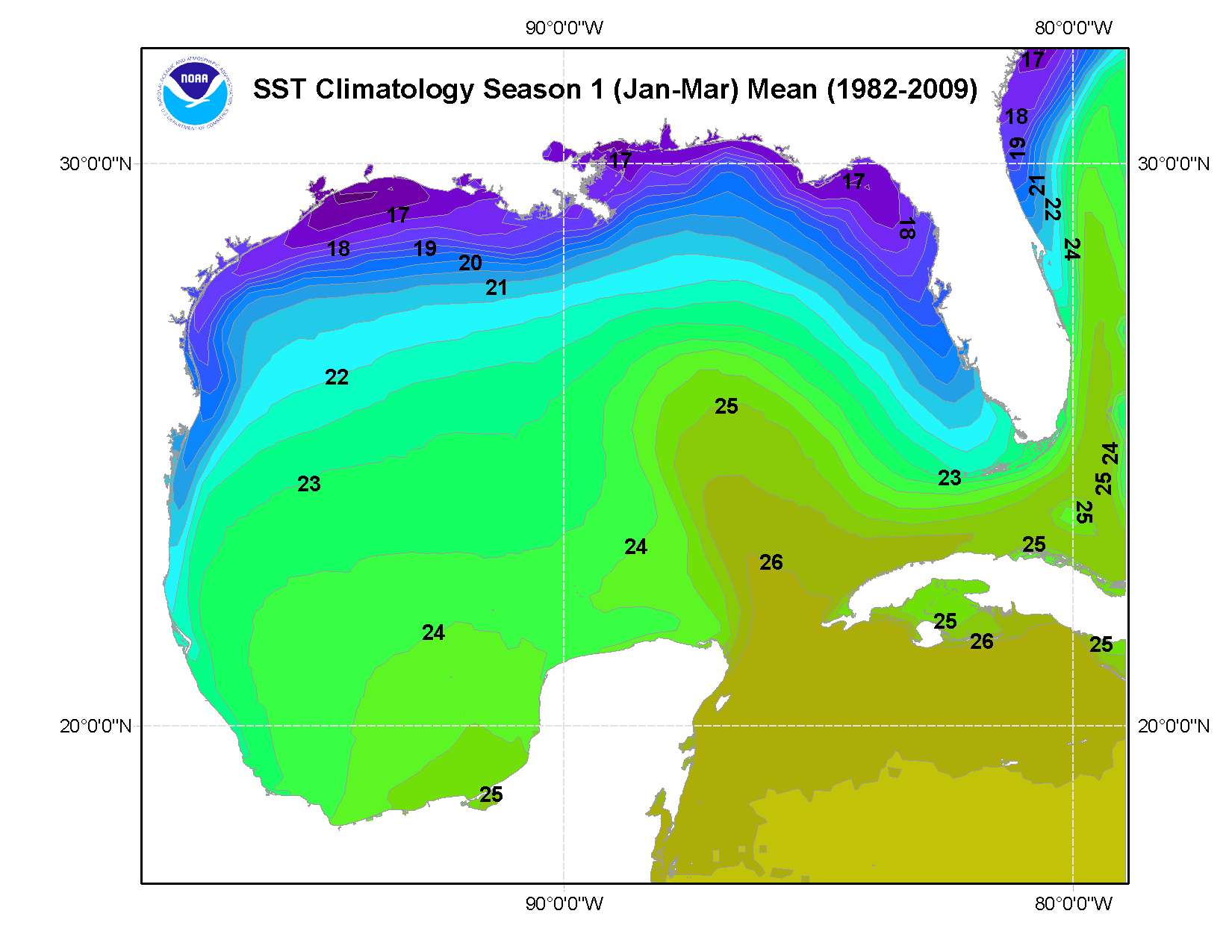
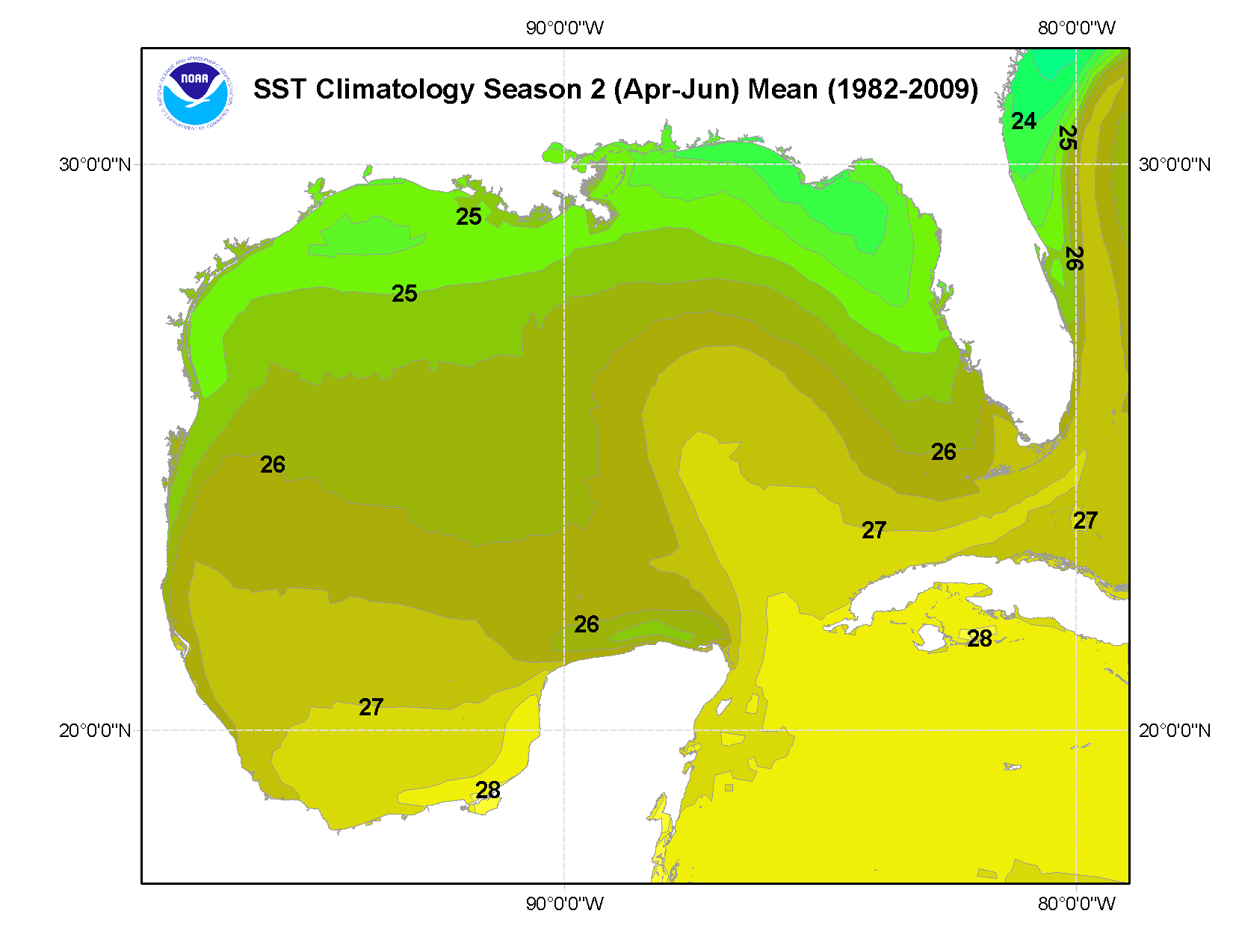
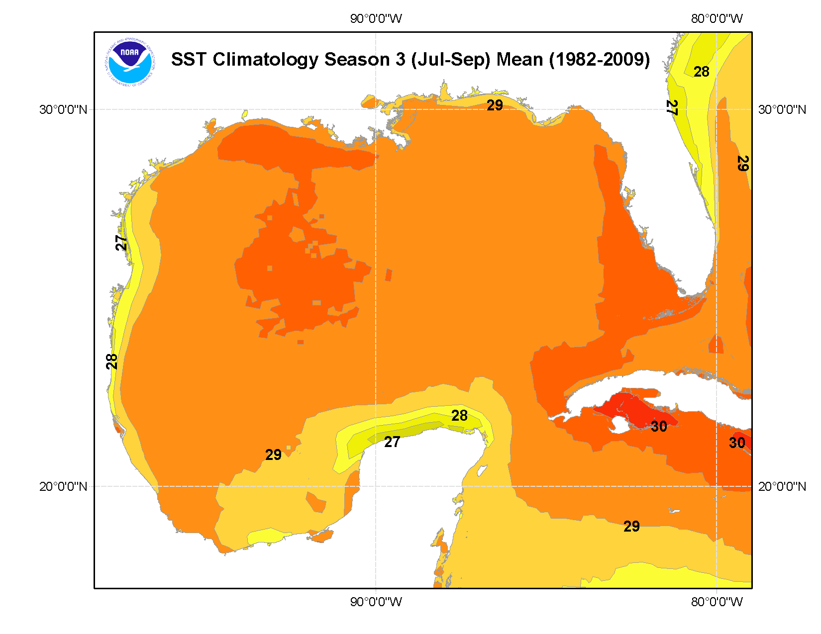
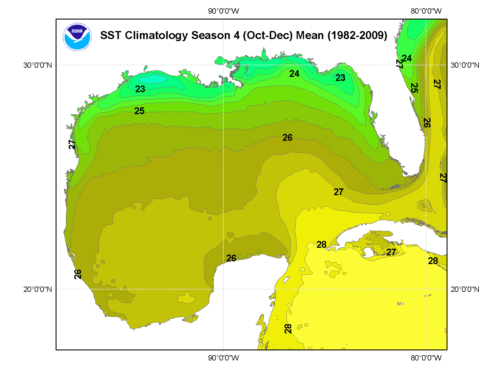
Color classified images were developed for use online. For the color classified .PNG images, 1) a land mask was applied, 2) a an ArcGIS filtering and smoothing filter was utilized, and 3) the classification was done with a 0.5 degree interval starting from 16 to 32 celsius.
Person who carried out this activity:
Online Links:
Online Links:
Online Links:
Online Links:
Online Links:
Online Links:
Online Links:
Online Links:
Online Links:
Online Links:
Online Links:
Online Links:
Online Links:
Online Links:
Online Links:
Online Links:
Online Links:
Online Links:
Online Links:
GSHHS is a high-resolution shoreline data set amalgamated from two databases in the public domain. The data have undergone extensive processing and are free of internal inconsistencies such as erratic points and crossing segments. The shorelines are constructed entirely from hierarchically arranged closed polygons. The data can be used to simplify data searches and data selections, or to study the statistical characteristics of shorelines and land-masses. It comes with access software and routines to facilitate decimation based on a standard line-reduction algorithm. See: Wessel, P., and W. H. F. Smith, A Global Self-consistent, Hierarchical, High-resolution Shoreline Database, J. Geophys. Res., 101, #B4, pp. 8741-8743, 1996
Are there legal restrictions on access or use of the data?
- Access_Constraints: None
- Use_Constraints:
- Please acknowledge the use of these data with - The Pathfinder Version 5 SST Data were provided by the NOAA/National Oceanographic Data Center at URL: http://pathfinder.nodc.noaa.gov
NOAA makes no warranty regarding these data, expressed or implied, nor does the fact of distribution constitute such a warranty. NOAA and NODC cannot assume liability for any damages caused by any errors or omissions in these data, nor as a result of the failure of these data to function on a particular system.
| Data format: | GeoTIFF files comprising climatologies 1982-2009 (seasons as defined by periods Jan-Mar, Apr-Jun, Jul-Sept, Oct-Dec). The data are represented using 32-bit in the .TIFF files. in format .TIF (version Tag Image File Format Version 2.4) GeoTIFF is a metadata format, which provides geographic information to associate with the image data. Size: 14.6 |
|---|---|
| Network links: |
https://accession.nodc.noaa.gov/0072888 https://gulfatlas.noaa.gov/ |
| Data format: | Arc Grid files comprising climatologies 1982-2009 (seasons as defined by periods Jan-Mar, Apr-Jun, Jul-Sept, Oct-Dec). Climatologies include annual and seasonal mean, maximum, minimum, standard deviation, and number of observations. Associated browse graphics in .png format are included with these data. in format ARCG Raster GIS file format (Arc grid) developed by ESRI Corporation Size: 30.0 |
|---|---|
| Network links: |
https://accession.nodc.noaa.gov/0072888 |
| Data format: | IN folder SST_means_GOM_color_classified_layers SSTlayers, an ArcGIS 10 (.mxd) file with associated shape files and matching .PNG browse graphics. This file displays SST data as color classified layers and was developed primarily for online displays. These files are of GOM SST annual and seasonal MEANS only. in format MXD (version 10.0) ArcGIS v10.0 Size: 18.6 |
|---|---|
| Network links: |
https://accession.nodc.noaa.gov/0072888 https://gulfatlas.noaa.gov/ |
Data may be directly downloaded through the NODC website at: http://www.nodc.noaa.gov/Archive/Search/. NODC can be contacted directly for custom orders. (When requesting data from the NODC, the desired data set may be referred to by the 7-digit number given in the RESOURCE DESCRIPTION field of this metadata record).
Within 24 hours if downloaded via the Internet
Contact the NODC User Services Group via phone/FAX/E-mail: nodc.services@noaa.gov
PC. Mac or other server (Unix, Linux), standard Internet browser. FTP capability