 Slope grid derived from gridded bathymetry of Baker Island,
Pacific Remote Island Areas, Central Pacific.
Slope grid derived from gridded bathymetry of Baker Island,
Pacific Remote Island Areas, Central Pacific.
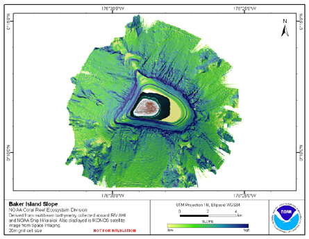 Slope is derived from gridded (20 m cell size) multibeam
bathymetry, collected aboard R/V AHI, and NOAA ship Hi'ialakai.
Cell values reflect the maximum rate of change (in degrees) in
elevation between neighboring cells derived with the ArcGIS
Spatial Ana...
Slope is derived from gridded (20 m cell size) multibeam
bathymetry, collected aboard R/V AHI, and NOAA ship Hi'ialakai.
Cell values reflect the maximum rate of change (in degrees) in
elevation between neighboring cells derived with the ArcGIS
Spatial Ana...