National Status and Trends: Bioeffects Program - St. Thomas East End Reserves (STEER) Database
The purpose of this effort was to characterize the extent and magnitude of chemical contamination in the St. Thomas East End Reserves or STEER, as part of a larger project to develop an integrated ecosystem assessment for the STEER. The STEER is a collect...
NCCOS National Status and Trends Bioeffects Assessment: Chemical contaminant data in the St. Thomas East End Reserves, U.S. Virgin Islands, from 2010-05-04 to 2012-06-22 (NCEI Accession 0146168)
This dataset provides valuable baseline data on sediment chemical contamination for the St. Thomas East End Reserve (STEER), U.S. Virgin Islands (USVI). From 2010-2012, NOAA scientists collected samples as part of a larger, long-term monitoring National S...
Collection of Coral and Conch Tissues within the St. Thomas East End Reserves (STEER), USVI
"The 2012 field mission in the STEER was in support of Year 2 for the project: Characterization of Land-Based Sources of Pollution and Effects in the St. Thomas East End Reserve (STEER). The overall goals of the field mission were to conduct a biological ...
Nutrients, sedimentation and total suspended solids in the St. Thomas East End Reserves in the Caribbean Sea from 2012-01-16 to 2013-11-25 (NCEI Accession 0139480)
This data set contains the results from monitoring in the St. Thomas East End Reserves (STEER) in St. Thomas, USVI, from January 2012 to November 2013. The monitoring was conducted by project partners at the University of the Virgin Islands, and was part ...
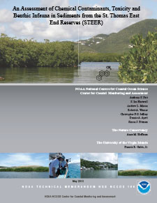
An assessment of chemical contaminants, toxicity and benthic infauna in sediments from the St. Thomas East End Reserves (STEER)
This report contains a chemical and biological characterization of sediments from the St. Thomas East End Reserves (STEER) in St. Thomas, U.S. Virgin Islands (USVI). The STEER Management Plan (published in 2011) identified chemical contaminants and habita...
Bathymetry (2011) of the St. Thomas East End Reserve
This image represents a LiDAR (Light Detection & Ranging) 0.3x0.3 meter resolution depth surface for the St. Thomas East End Reserve (STEER), St. Thomas in the U.S. Virgin Islands (USVI). The image's horizontal coordinate system is NAD83 UTM 20 North....
This guide was created to promote and manage the resources of the STEER (St. Thomas East End Reserves) coastal ecological system. Subjects include mangrove forests, seagrass beds, salt ponds, birds (sea and shore), coral reef communities, fisheries resour...
STEER: St. Thomas East End Reserves. Update on scientific research
"This report highlights a summary of what has been done, what is the current status and the benefits of the study for three research projects: (1) Characterization of Land-Based Sources of Pollution and Effects in the St. Thomas East End Reserves (STEER);...
"This management plan contains the roadmap for effectively conserving the coastal and marine natural and cultural resources of the southeast end of St. Thomas. It does not contain any new rule or regulation that does not already exist in Virgin Islands Co...
LiDAR Relative Reflectivity Surface (2011) for the St. Thomas East End Reserve, St. Thomas
This image represents a LiDAR (Light Detection & Ranging) 0.3x0.3 meter resolution relative seafloor reflectivity surface for the St. Thomas East End Reserve (STEER) in the U.S. Virgin Islands (USVI). The image's horizontal coordinate system is NAD83 ...
St. Thomas East End Reserves (STEER) activities guide
"The St. Thomas East End Reserves (STEER) is a territorial marine protected area which encompasses several existing protected areas (Cas Cay / Mangrove Lagoon, St James, and Compass Point Marine Reserves and Wildlife Sanctuaries) into one comprehensive ma...
Principal Component Surface (2011) for St. Thomas East End Reserve, St. Thomas
This image represents a 0.3x0.3 meter principal component analysis (PCA) surface for areas the St. Thomas East End Reserve (STEER) in the U.S. Virgin Islands (USVI). It was created by integrating eight topographic complexity surfaces (mean depth, standard...
St. Thomas East End Reserves watershed management plan
This management report provides watershed restoration recommendations for the lands surrounding the St. Thomas East End Reserves (STEER). STEER is a 3.7 sq. mile collection of marine reserves and wildlife sanctuaries that includes the last remaining mangr...
An integrated environmental assessment of the St. Thomas East End Reserves (STEER)
The St. Thomas East End Reserves, or STEER, is a collection of Marine Reserves and Wildlife Sanctuaries (MRWS) located on the southeastern end of the island of St. Thomas, U.S. Virgin Islands. With an area of approximately 9.6 km2 , the STEER contains ext...
An assessment of nutrients, sedimentation, and total suspended solids (TSS) in the St. Thomas East End Reserves (STEER)
This is the fifth report from a project to assess land-based sources of pollution (LSBPs) and their effects, and to characterize the biological community with the St. Thomas East End Reserves (Steer) in St. Thomas, USVI. Here we summarize the results of n...
St. Thomas East End Reserves: Implementation of management plan early action steps
"This project, St. Thomas East End Reserves: Implementation of Management Plan Early Action Steps,? successfully enabled two years of implementation of the St. Thomas East End Reserves (STEER) management plan; thereby meeting project objectives to increas...
Characterization of reef fish populations and benthic habitats within St. Thomas East End Reserve (STEER), USVI
"The 2012 field mission in the STEER was in support of Year 2 for the project: Characterization of Land-Based Sources of Pollution and Effects in the St. Thomas East End Reserve (STEER). The overall goals of the field mission were to conduct a biological ...
Characterization of fish communities and associated benthic habitats in the St. Thomas East End Reserves (STEER)
Located at the southeastern end of St. Thomas, U.S. Virgin Islands (USVI), the St. Thomas East End Reserves (STEER) is a collection of several existing protected areas, including Cas Cay/Mangrove Lagoon, St. James, and Compass Point Salt Pond Marine Reser...
Orthophoto Mosaic (2012) of the St. Thomas East End Reserve
This 0.3x0.3 meter imagery mosaic of the St. Thomas East End Reserve (STEER), St. Thomas in the U.S. Virgin Islands was created by the National Oceanic and Atmospheric Administration (NOAA) using a collection of orthophotos collected by the U.S. Army Corp...
An assessment of chemical contaminants detected in passive water samplers deployed in the St. Thomas east end reserves (STEER)
This report is the second in a series from a project to assess land-based sources of pollution (LBSP) and effects in the St. Thomas East End Reserves (STEER) in St. Thomas, USVI, and is the result of a collaborative effort between NOAA's National Centers ...
Benthic habitats of Fish Bay, Coral Bay and the St. Thomas East End Reserve
This report describes the development and assessment of shallow (0 d40 m) benthic habitat maps for Fish Bay, Coral Bay and the St. Thomas East End Reserve (STEER) in the U.S. Virgin Islands. The objective of this effort, conducted by NOAA's National Cente...
St. Thomas East End Reserves (STEER) accomplishments report
The management of the St. Croix East End Reserves (STEER) over the last two years has been a coordinated, informal co-management effort on the part of the community, Friends of Christmas Cove, Department of Planning and Natural Resources (DPNR), Universit...
Evaluating the efficacy of two MPAs in the USVI: St. Thomas East End Reserves and St. Croix East End Marine Park
PROJECT OBJECTIVESThe objectives of this MPA efficacy project are to: (1) evaluate sample size requirements for coral target reef fish species to obtain a desired level of survey precision (e.g. 15% CV) to compare MPAs and open areas; (2) develop an optim...
St. Thomas East End Reserves (STEER) Coastal Use Mapping Project ocean uses map book : results from participatory ocean use mapping workshops St. Thomas, USVI, May 22-23, 2012
This map book contains cartographic products derived from the St. Thomas East End Reserves (STEER) Coastal Use Mapping workshops conducted at the Bolongo Bay Beach Resort on May 22 and 23, 2012. This participatory mapping workshop was designed to gather s...
An assessment of contaminant body burdens in the coral (Porites astreoides) and Queen conch (Strombus gigas) from the St. Thomas East End Reserves (STEER)
As part of the joint effort between the US Virgin Islands Department of Planning and Natural Resources and the NOAA Centers for Coastal and Ocean Science (NCCOS), to conduct a Reserves-wide impact assessment of land-based sources of pollution and effects ...
 National Status and Trends: Bioeffects Program - St. Thomas East End Reserves (STEER) Database
 Collection of Coral and Conch Tissues within the St. Thomas East End Reserves (STEER), USVI
 This report contains a chemical and biological characterization of sediments from the St. Thomas East End Reserves (STEER) in St. Thomas, U.S. Virgin Islands (USVI). The STEER Management Plan (published in 2011) identified chemical contaminants and habita...
 This guide was created to promote and manage the resources of the STEER (St. Thomas East End Reserves) coastal ecological system. Subjects include mangrove forests, seagrass beds, salt ponds, birds (sea and shore), coral reef communities, fisheries resour...