 Water temperature data from reef sites off the upper Florida Keys from 2003-09-18 to 2022-12-11 (NCEI Accession 0126994)
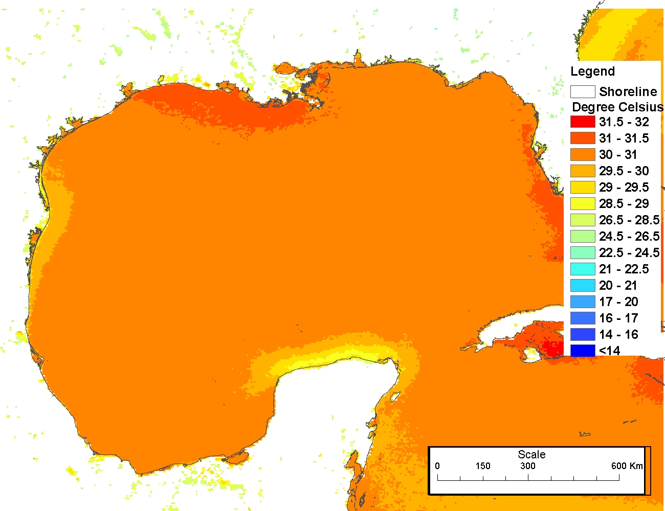
4 km AVHRR Pathfinder v5.0 Global Day-Night Sea Surface Temperature Averages, 1985-2009 (NODC Accession 0077816)
Water temperature data from reef sites off the upper Florida Keys from 2003-09-18 to 2022-12-11 (NCEI Accession 0126994)
Water temperature data from reef sites off the upper Florida Keys from 2003-09-18 to 2022-12-11 (NCEI Accession 0126994)
4 km AVHRR Pathfinder v5.0 Global Day-Night Sea Surface Temperature Averages, 1985-2009 (NODC Accession 0077816)
 This data set contains a set of monthly and yearly global day-night sea surface temperature averages, derived from the AVHRR Pathfinder Version 5 sea surface temperature cloudscreened data set (http://pathfinder.nodc.noaa.gov) in GeoTIFF format. The AVHRR...
4 km NODC/RSMAS AVHRR Pathfinder v5.0 and Interim v5.0 Sea Surface Temperature (SST) Data and v5.1 SST Data for 1981-2009
This data set contains a set of monthly and yearly global day-night sea surface temperature averages, derived from the AVHRR Pathfinder Version 5 sea surface temperature cloudscreened data set (http://pathfinder.nodc.noaa.gov) in GeoTIFF format. The AVHRR...
4 km NODC/RSMAS AVHRR Pathfinder v5.0 and Interim v5.0 Sea Surface Temperature (SST) Data and v5.1 SST Data for 1981-2009
 The 4 km Pathfinder effort at the National Oceanic and Atmospheric Administration (NOAA) National Oceanographic Data Center (NODC) and the University of Miami's Rosenstiel School of Marine and Atmospheric Science (RSMAS) is an extension of and improvement...
4 km NODC/RSMAS AVHRR Pathfinder Version 5 Seasonal and Annual Day-Night Sea Surface Temperature Climatologies for 1982-2009 for the Gulf of Mexico (NODC Accession 0072888)
The 4 km Pathfinder effort at the National Oceanic and Atmospheric Administration (NOAA) National Oceanographic Data Center (NODC) and the University of Miami's Rosenstiel School of Marine and Atmospheric Science (RSMAS) is an extension of and improvement...
4 km NODC/RSMAS AVHRR Pathfinder Version 5 Seasonal and Annual Day-Night Sea Surface Temperature Climatologies for 1982-2009 for the Gulf of Mexico (NODC Accession 0072888)
 The 4 km Pathfinder effort at the National Oceanic and Atmospheric Administration (NOAA) National Oceanographic Data Center (NODC) and the University of Miami's Rosenstiel School of Marine and Atmospheric Science (RSMAS) is an extension of and improvement...
Coastal Use Mapping Project - Northwest Hawai'i
The Coral Reef Temperature Anomaly Database (CoRTAD) Version 4 - Global, 4 km Sea Surface Temperature and Related Thermal Stress Metrics for 1981-10-31 to 2010-12-31 (NODC Accession 0087989)
Reef community structure, Sand Island, Oahu HI, (NODC Accession 0000177)
4 km NODC/RSMAS AVHRR Pathfinder v.5.0 Sea Surface Temperature (SST) Climatologies (1985-2001)
Hawaii Coral Reef Assessment and Monitoring Program (CRAMP): Benthic Data from 1999-2001 (NODC Accession 0000969)
2006 NOAA Bathymetric Lidar: Puerto Rico (Southwest)
The 4 km Pathfinder effort at the National Oceanic and Atmospheric Administration (NOAA) National Oceanographic Data Center (NODC) and the University of Miami's Rosenstiel School of Marine and Atmospheric Science (RSMAS) is an extension of and improvement...
Coastal Use Mapping Project - Northwest Hawai'i
The Coral Reef Temperature Anomaly Database (CoRTAD) Version 4 - Global, 4 km Sea Surface Temperature and Related Thermal Stress Metrics for 1981-10-31 to 2010-12-31 (NODC Accession 0087989)
Reef community structure, Sand Island, Oahu HI, (NODC Accession 0000177)
4 km NODC/RSMAS AVHRR Pathfinder v.5.0 Sea Surface Temperature (SST) Climatologies (1985-2001)
Hawaii Coral Reef Assessment and Monitoring Program (CRAMP): Benthic Data from 1999-2001 (NODC Accession 0000969)
2006 NOAA Bathymetric Lidar: Puerto Rico (Southwest)
 This data set (Project Number OPR-I305-KRL-06) depicts depth values (mean 5 meter gridded) collected using LiDAR
(Light Detection & Ranging) from the shoreline of southwestern Puerto Rico to the shelf edge. The Tenix LADS Corporation
(TLI) acquired bathym...
This data set (Project Number OPR-I305-KRL-06) depicts depth values (mean 5 meter gridded) collected using LiDAR
(Light Detection & Ranging) from the shoreline of southwestern Puerto Rico to the shelf edge. The Tenix LADS Corporation
(TLI) acquired bathym...