Water temperature data from reef sites off the upper Florida Keys from 2003-09-18 to 2022-12-11 (NCEI Accession 0126994)
Temperature loggers were deployed at various monitoring sites off the upper Florida Keys where other ecological studies were underway, most focused on aspects of Acropora spp. status or ecology. Hobo Tidbit® or Pendant® loggers were secured to the substra...
4 km AVHRR Pathfinder v5.0 Global Day-Night Sea Surface Temperature Averages, 1985-2009 (NODC Accession 0077816)
This data set contains a set of monthly and yearly global day-night sea surface temperature averages, derived from the AVHRR Pathfinder Version 5 sea surface temperature cloudscreened data set (http://pathfinder.nodc.noaa.gov) in GeoTIFF format. The AVHRR...
4 km NODC/RSMAS AVHRR Pathfinder v5.0 and Interim v5.0 Sea Surface Temperature (SST) Data and v5.1 SST Data for 1981-2009
The 4 km Pathfinder effort at the National Oceanic and Atmospheric Administration (NOAA) National Oceanographic Data Center (NODC) and the University of Miami's Rosenstiel School of Marine and Atmospheric Science (RSMAS) is an extension of and improvement...
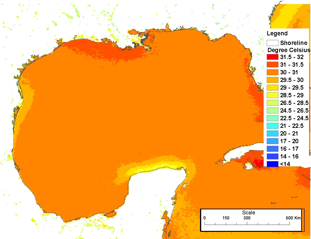
4 km NODC/RSMAS AVHRR Pathfinder Version 5 Seasonal and Annual Day-Night Sea Surface Temperature Climatologies for 1982-2009 for the Gulf of Mexico (NODC Accession 0072888)
The 4 km Pathfinder effort at the National Oceanic and Atmospheric Administration (NOAA) National Oceanographic Data Center (NODC) and the University of Miami's Rosenstiel School of Marine and Atmospheric Science (RSMAS) is an extension of and improvement...
Reef community structure, Sand Island, Oahu HI, (NODC Accession 0000177)
These reports provide the results of nine years (1990-98) of an annual quantitative monitoring of shallow marine communities inshore of the Sand Island Ocean Outfall, Oahu, Hawaii. This monitoring effort focuses on benthic and fish community structure and...
2007 MrSID Image of St. John Utilized to derive Benthic Habitat Maps (18064_c6_ne.sid)
This MrSID (.sid) file is an orthophoto mosaic from a collection of GeoTIFF format natural color and false color infrared orthophotos covering the islands of Puerto Rico, Culebra, Vieques, St. Thomas, St. John, and St. Croix (USVI). An orthophoto is remo...
2007 MrSID Image of St. John Utilized to derive Benthic Habitat Maps (18064_c6_nw.sid)
This MrSID (.sid) file is an orthophoto mosaic from a collection of GeoTIFF format natural color and false color infrared orthophotos covering the islands of Puerto Rico, Culebra, Vieques, St. Thomas, St. John, and St. Croix (USVI). An orthophoto is remo...
2007 MrSID Image of St. John Utilized to derive Benthic Habitat Maps (18064_c6_sw.sid)
This MrSID (.sid) file is an orthophoto mosaic from a collection of GeoTIFF format natural color and false color infrared orthophotos covering the islands of Puerto Rico, Culebra, Vieques, St. Thomas, St. John, and St. Croix (USVI). An orthophoto is remo...
2007 MrSID Image of St. John Utilized to derive Benthic Habitat Maps (18064_c7_ne.sid)
This MrSID (.sid) file is an orthophoto mosaic from a collection of GeoTIFF format natural color and false color infrared orthophotos covering the islands of Puerto Rico, Culebra, Vieques, St. Thomas, St. John, and St. Croix (USVI). An orthophoto is remo...
2007 MrSID Image of St. John Utilized to derive Benthic Habitat Maps (18064_c7_nw.sid)
This MrSID (.sid) file is an orthophoto mosaic from a collection of GeoTIFF format natural color and false color infrared orthophotos covering the islands of Puerto Rico, Culebra, Vieques, St. Thomas, St. John, and St. Croix (USVI). An orthophoto is remo...
 Water temperature data from reef sites off the upper Florida Keys from 2003-09-18 to 2022-12-11 (NCEI Accession 0126994)
 This data set contains a set of monthly and yearly global day-night sea surface temperature averages, derived from the AVHRR Pathfinder Version 5 sea surface temperature cloudscreened data set (http://pathfinder.nodc.noaa.gov) in GeoTIFF format. The AVHRR...
 The 4 km Pathfinder effort at the National Oceanic and Atmospheric Administration (NOAA) National Oceanographic Data Center (NODC) and the University of Miami's Rosenstiel School of Marine and Atmospheric Science (RSMAS) is an extension of and improvement...
 The 4 km Pathfinder effort at the National Oceanic and Atmospheric Administration (NOAA) National Oceanographic Data Center (NODC) and the University of Miami's Rosenstiel School of Marine and Atmospheric Science (RSMAS) is an extension of and improvement...