 Satellite-derived bathymetry for nearshore benthic habitats in the Pacific Remote Islands Marine National Monument
Bathymetric data derived from multispectral, high-resolution (2 m) satellite imagery acquired between 2011 and 2016 from Digital Globe’s WorldView-2 or WorldView-3 satellite to provide near complete coverage of nearshore terrain around several islands and...
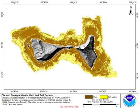 Hard and soft seafloor substrate map, derived from integrating
two existing map products: hard and soft seafloor substrate map
derived from an unsupervised classification of multibeam backscatter and
bathymetry derivatives, produced by NOAA Pacific Island...
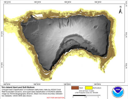
Hard and soft seafloor substrate map, derived from integrating
two existing map products: hard and soft seafloor substrate map
derived from an unsupervised classification of multibeam backscatter and
bathymetry derivatives, produced by NOAA Pacific Island...
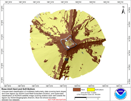
 Hard and soft seafloor substrate map, derived from integrating
two existing map products: hard and soft seafloor substrate map
derived from an unsupervised classification of multibeam backscatter and
bathymetry derivatives, produced by NOAA Pacific Island...
Hard and soft seafloor substrate map, derived from integrating
two existing map products: hard and soft seafloor substrate map
derived from an unsupervised classification of multibeam backscatter and
bathymetry derivatives, produced by NOAA Pacific Island...
 Hard and soft seafloor substrate map, derived from integrating two existing map
products: hard and soft substrate maps derived from an unsupervised classification of multibeam
backscatter and bathymetry derivatives, produced by NOAA Pacific Island Fisheri...
Hard and soft seafloor substrate map, derived from integrating two existing map
products: hard and soft substrate maps derived from an unsupervised classification of multibeam
backscatter and bathymetry derivatives, produced by NOAA Pacific Island Fisheri...
 Calcification accretion units, or CAUs, are used to assess the current effects of changes in seawater carbonate chemistry on calcification and accretion rates of calcareous and fleshy algae in the Hawaiian and Mariana Archipelagos, American Samoa, and the...
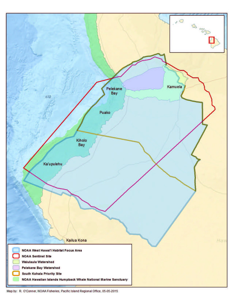 Hard and soft bottom seafloor substrate data and maps for the NOAA Habitat Blueprint West Hawaii Focus Area (WHFA) in the Main Hawaiian Islands. Cell values in the raster datasets reflect whether the seafloor is hard bottom or soft bottom based on an unsu...
 The Pacific Reef Assessment and Monitoring Program (Pacific RAMP), established by the Coral Reef Ecosystem Program (CREP) of the NOAA Pacific Islands Fisheries Science Center (PIFSC), is tasked with documenting and understanding the status and trends of c...