
Coastal Use Mapping Project - Northwest Hawai'i
The Hawaii Coastal Use Mapping Project is an innovative partnership between NOAA's National Marine Protected Areas Center, NOAA's Pacific Islands Fisheries Science Center, NOAA's Pacific Islands Regional Office, and the Hawaii Division of Aquatic Resource...
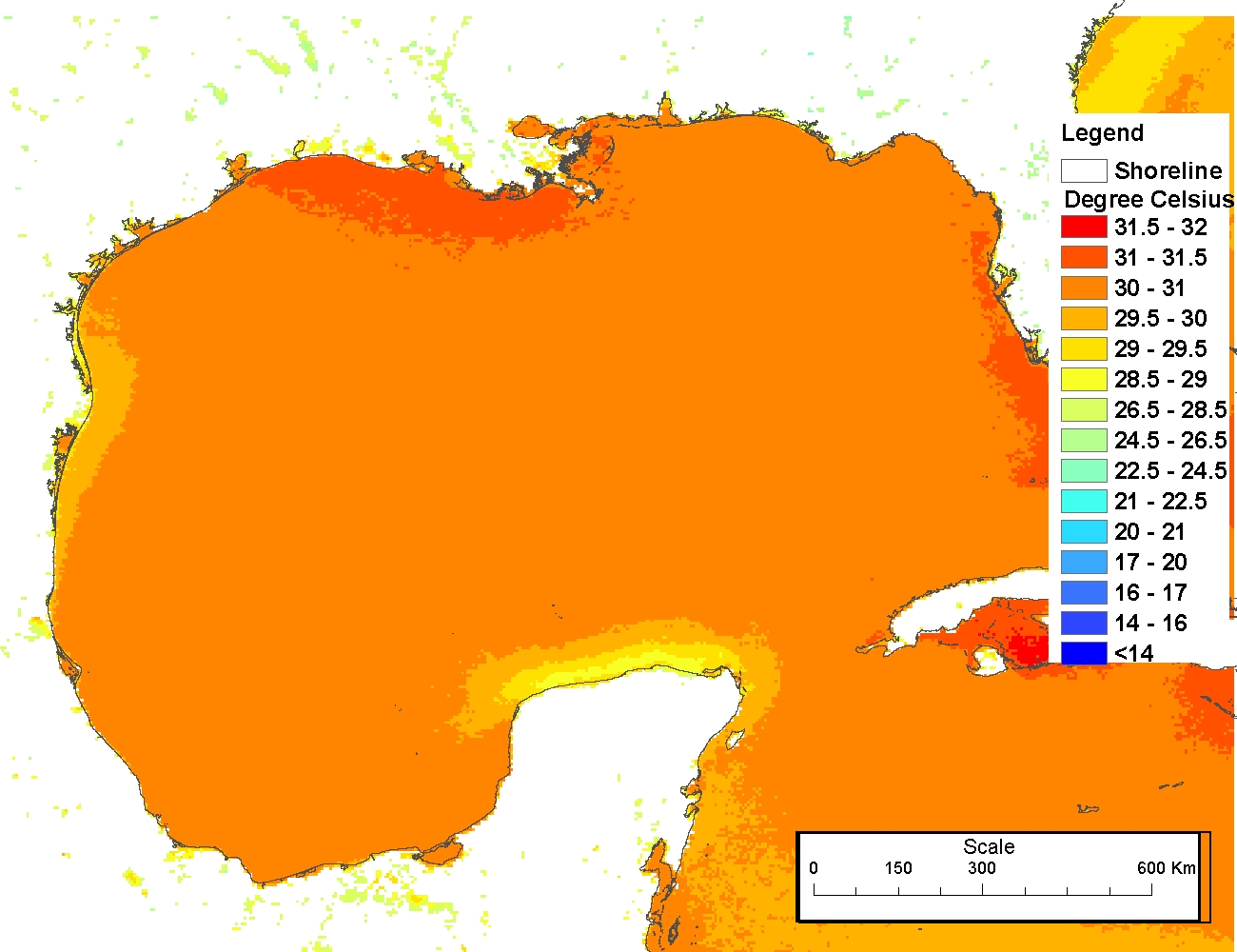
AVHRR Pathfinder Version 5.2 Level 3 Collated (L3C) Global 4km Sea Surface Temperature for 1981-2012
The AVHRR Pathfinder Version 5.2 Sea Surface Temperature data
set (PFV52) is a collection of global, twice-daily 4km sea surface temperature
data produced in a partnership by the NOAA National Oceanographic Data Cen...
 This data set (Project Number OPR-I305-KRL-06) depicts depth values (mean 5 meter gridded) collected using LiDAR
(Light Detection & Ranging) from the shoreline of southwestern Puerto Rico to the shelf edge. The Tenix LADS Corporation
(TLI) acquired bathym...
This data set (Project Number OPR-I305-KRL-06) depicts depth values (mean 5 meter gridded) collected using LiDAR
(Light Detection & Ranging) from the shoreline of southwestern Puerto Rico to the shelf edge. The Tenix LADS Corporation
(TLI) acquired bathym...
 The 4 km Pathfinder effort at the National Oceanic and Atmospheric Administration (NOAA) National Oceanographic Data Center (NODC) and the University of Miami's Rosenstiel School of Marine and Atmospheric Science (RSMAS) is an extension of and improvement...
 These files contain rasterized topobathy lidar elevations generated from data collected by the Coastal Zone Mapping and Imaging Lidar (CZMIL) system. CZMIL integrates a lidar sensor with simultaneous topographic and bathymetric capabilities, a digital cam...
 The 4 km Pathfinder effort at the National Oceanic and Atmospheric Administration (NOAA) National Oceanographic Data Center (NODC) and the University of Miami's Rosenstiel School of Marine and Atmospheric Science (RSMAS) is an extension of and improvement...
 This data set contains a set of monthly and yearly global day-night sea surface temperature averages, derived from the AVHRR Pathfinder Version 5 sea surface temperature cloudscreened data set (http://pathfinder.nodc.noaa.gov) in GeoTIFF format. The AVHRR...