
Coastal Use Mapping Project - Northwest Hawai'i
The Hawaii Coastal Use Mapping Project is an innovative partnership between NOAA's National Marine Protected Areas Center, NOAA's Pacific Islands Fisheries Science Center, NOAA's Pacific Islands Regional Office, and the Hawaii Division of Aquatic Resource...
2004 USACE Puerto Rico Lidar
This record describes Light Detection and Ranging (Lidar) data acquired for the island of Puerto Rico. The data were acquired for
USACE, St. Louis District by 3001, Inc., between January 10 and February 8, 2004. The mission was flown at a density sufficie...
 This data set (Project Number OPR-I305-KRL-06) depicts depth values (mean 5 meter gridded) collected using LiDAR
(Light Detection & Ranging) from the shoreline of southwestern Puerto Rico to the shelf edge. The Tenix LADS Corporation
(TLI) acquired bathym...
This data set (Project Number OPR-I305-KRL-06) depicts depth values (mean 5 meter gridded) collected using LiDAR
(Light Detection & Ranging) from the shoreline of southwestern Puerto Rico to the shelf edge. The Tenix LADS Corporation
(TLI) acquired bathym...
 The 4 km Pathfinder effort at the National Oceanic and Atmospheric Administration (NOAA) National Oceanographic Data Center (NODC) and the University of Miami's Rosenstiel School of Marine and Atmospheric Science (RSMAS) is an extension of and improvement...
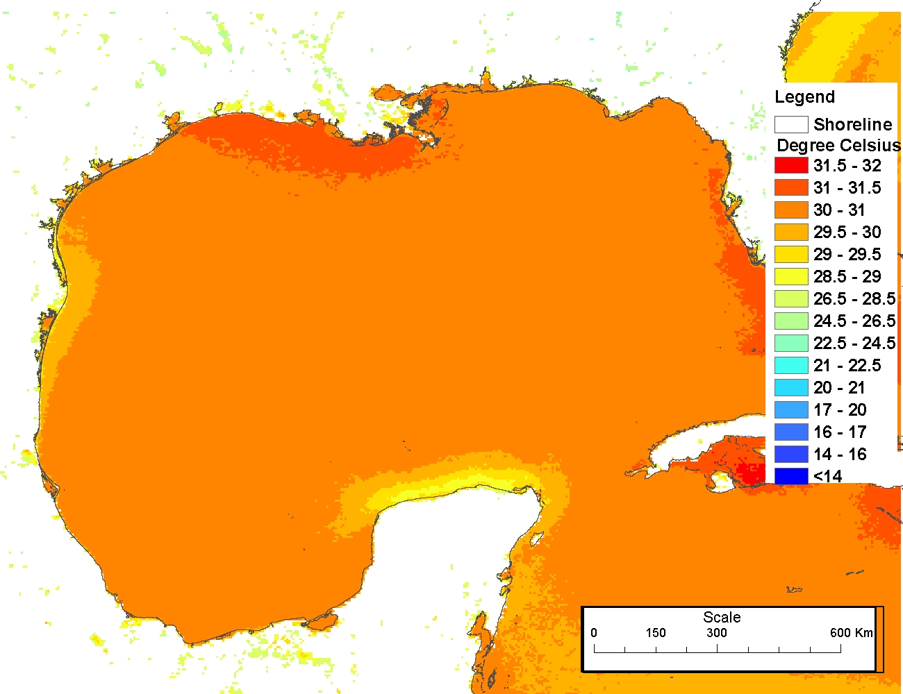 The 4 km Pathfinder effort at the National Oceanic and Atmospheric Administration (NOAA) National Oceanographic Data Center (NODC) and the University of Miami's Rosenstiel School of Marine and Atmospheric Science (RSMAS) is an extension of and improvement...
 Product: Processed, classified lidar point cloud data tiles in LAS 1.4 format.
Geographic Extent: Approximately 4,028 square miles encompassing the Big Island of Hawaii.
Dataset Description: The HI Hawaii Island Lidar NOAA 2017 B17 lidar project called fo...
Product: Processed, classified lidar point cloud data tiles in LAS 1.4 format.
Geographic Extent: Approximately 4,028 square miles encompassing the Big Island of Hawaii.
Dataset Description: The HI Hawaii Island Lidar NOAA 2017 B17 lidar project called fo...
 These files contain classified topo/bathy lidar data. Data are classified as 1 (valid non-ground topographic data), 2 (valid ground topographic data), and 29 (valid bathymetric data). Classes 1 and 2 are defined in accordance with the American Society for...