 2006 NOAA Bathymetric Lidar: Puerto Rico (Southwest)
 This data set (Project Number OPR-I305-KRL-06) depicts depth values (mean 5 meter gridded) collected using LiDAR
(Light Detection & Ranging) from the shoreline of southwestern Puerto Rico to the shelf edge. The Tenix LADS Corporation
(TLI) acquired bathym...
This data set (Project Number OPR-I305-KRL-06) depicts depth values (mean 5 meter gridded) collected using LiDAR
(Light Detection & Ranging) from the shoreline of southwestern Puerto Rico to the shelf edge. The Tenix LADS Corporation
(TLI) acquired bathym...
 The 4 km Pathfinder effort at the National Oceanic and Atmospheric Administration (NOAA) National Oceanographic Data Center (NODC) and the University of Miami's Rosenstiel School of Marine and Atmospheric Science (RSMAS) is an extension of and improvement...
 Product: Processed, classified lidar point cloud data tiles in LAS 1.4 format.
Geographic Extent: Approximately 4,028 square miles encompassing the Big Island of Hawaii.
Dataset Description: The HI Hawaii Island Lidar NOAA 2017 B17 lidar project called fo...
Product: Processed, classified lidar point cloud data tiles in LAS 1.4 format.
Geographic Extent: Approximately 4,028 square miles encompassing the Big Island of Hawaii.
Dataset Description: The HI Hawaii Island Lidar NOAA 2017 B17 lidar project called fo...
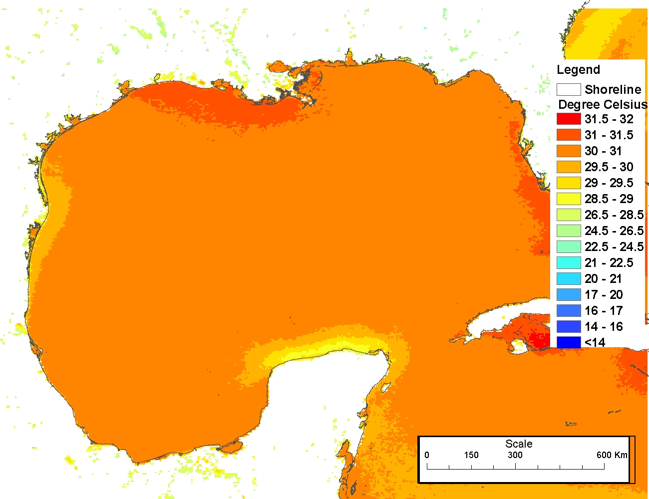 The 4 km Pathfinder effort at the National Oceanic and Atmospheric Administration (NOAA) National Oceanographic Data Center (NODC) and the University of Miami's Rosenstiel School of Marine and Atmospheric Science (RSMAS) is an extension of and improvement...
 Leading Edge Geomatics (LEG) collected 3451 square miles in Puerto Rico. The nominal pulse spacing for this project was 1 point every 0.7 meters. Dewberry used proprietary procedures to classify the LAS according to project specifications: 0-Never Class...
 This data set contains a set of monthly and yearly global day-night sea surface temperature averages, derived from the AVHRR Pathfinder Version 5 sea surface temperature cloudscreened data set (http://pathfinder.nodc.noaa.gov) in GeoTIFF format. The AVHRR...