
NCCOS Mapping: Geospatial products of water depth, acoustic backscatter, and ROV data collected from NOAA Ship Nancy Foster in the Northeast Caribbean Sea in the off the coast of Guanica and Ponce, Puerto Rico from 2018-06-29 to 2018-06-07 (NCEI Accession 0276935)
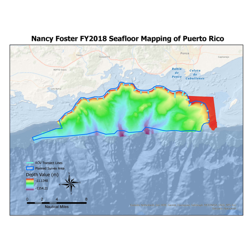
Multibeam and acoustic backscatter data collected from NOAA Ship Nancy Foster from 2018-06-29 to 2018-07-06. The majority of data were collected using a Kongsberg EM710, with the most northern inshore portion collected using a Kongsberg EM2040. Bathyme...