Downloadable DataDepth soundings from a single beam echo sounder collected around the nearshore areas of Timor-Leste in 2012 and 2013
Metadata Thumbnail 
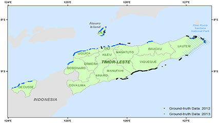
This dataset contains singlebeam bathymetry data acquired during small-boat surveys conducted from October 20-26, 2012 and June 4-27, 2013 in Timor-Leste by the NOAA Coral Reef Ecosystem Program (CREP). Data was acquired with a HydroLite-TM Echosounder Ki...
Downloadable DataBenthic percent cover derived from analysis of benthic images collected at coral reef sites in Timor-Leste in 2013 and 2014 (NCEI Accession 0168620)
Metadata Thumbnail The benthic cover data described here result from benthic photo-quadrat surveys conducted by the NOAA Coral Reef Ecosystem Program (CREP) in hard bottom shallow water (< 15 m) habitats in Timor-Leste during reef fish surveys surveys at 150 sites that were...
Downloadable DataBenthic images collected at coral reef sites in Timor-Leste from 2012-10-15 to 2014-10-09 (NCEI Accession 0166378)
Metadata Thumbnail Photographs of the seafloor were collected during benthic photo-quadrat surveys conducted by the NOAA Coral Reef Ecosystem Program (CREP) in hard bottom shallow water (< 15 m) habitats in Timor-Leste. Photographs were collected along transects at fixed cl...
Downloadable DataSatellite-derived bathymetry for nearshore benthic habitats in Timor-Leste from 2010-02-09 to 2013-10-02 (NCEI Accession 0169504)
Metadata Thumbnail Bathymetric data derived from multispectral, high-resolution (2 m) satellite imagery from DigitalGlobe's WorldView-2 satellite to provide near complete coverage of nearshore terrain along the northern coastline of Timor-Leste, including the district of Oe...
Downloadable DataCoral reef fish biomass and benthic cover data from Timor-Leste in June 2013 (NCEI Accession 0165354)
Metadata Thumbnail Coral reef fish and benthos were surveyed at 150 shallow-water coral reef sites across the north coast of Timor-Leste and around Atauro Island in June 2013 during a 21-day survey mission. This project was conducted by the National Oceanic and Atmospheric ...
Downloadable DataNearshore benthic habitats of Timor-Leste derived from WorldView-2 satellite imagery from 2010-02-09 to 2013-12-14 (NCEI Accession 0168914)
Metadata Thumbnail Benthic habitat classes were derived for nearshore waters (< 20 m depths) around Timor-Leste from DigitalGlobe WorldView-2 satellite imagery, acquired from Jan 26 2010 to Aug 10, 2014, by the NOAA Coral Reef Ecosystem Program (CREP). Habitat classes inclu...
Downloadable DataWater temperature data from subsurface temperature recorders (STRs) deployed at coral reef sites in Timor-Leste from 2012-10-15 to 2014-10-09 (NCEI Accession 0168931)
Metadata Thumbnail Water temperature data were collected by the NOAA Coral Reef Ecosystem Program (CREP) using subsurface temperature recorders (STRs) deployed at fixed climate survey sites located on hard bottom shallow water (< 30 m) habitats in Timor-Leste. Climate sites...
Downloadable DataCalcification rates of crustose coralline algae (CCA) derived from calcification accretion units (CAUs) deployed at coral reef sites in Timor-Leste from 2012-10-15 to 2014-10-09 (NCEI Accession 0170031)
Metadata Thumbnail The calcification rate data described here were collected by the NOAA Coral Reef Ecosystem Program (CREP) from calcification accretion units, or CAUs, moored for two years at fixed climate survey sites and located on hard bottom shallow water (< 15 m) hab...
Downloadable DataAssessing cryptic reef diversity of colonizing marine invertebrates using autonomous reef monitoring structures (ARMS) deployed at coral reef sites in Timor-Leste from 2012-10-15 to 2014-10-09 (NCEI Accession 0169338)
Metadata Thumbnail The data described here, including photographs, genetic sequences, and specimen information, were collected by the NOAA Coral Reef Ecosystem Program (CREP) from Autonomous Reef Monitoring Structures, or ARMS, moored for two years at fixed climate survey s...
ResourceInterdisciplinary baseline ecosystem assessment surveys to Inform ecosystem-based management planning in Timor-Leste : final report
This document is the final report on the activities performed by the United States National Oceanic and Atmospheric Administration (NOAA) from 2012 to 2016, through a partnership agreement with the United States Agency for International Development (USAID...