
Advancing model-based essential fish habitat descriptions for North Pacific species in the Gulf of Alaska
Councils and NMFS are required to review the essential fish habitat (EFH) components of Fishery Management Plans (FMPs) and revise or amend these components based on available information at least every five years (50 CFR 600.815(a)(10)) in an EFH 5-year ...
Exploring Alaska's Seamounts, June 22-July 15, 2002 [electronic resource] / [U.S. Dept. of Commerce, National Oceanic and Atmospheric Administration, Office of Ocean Exploration].
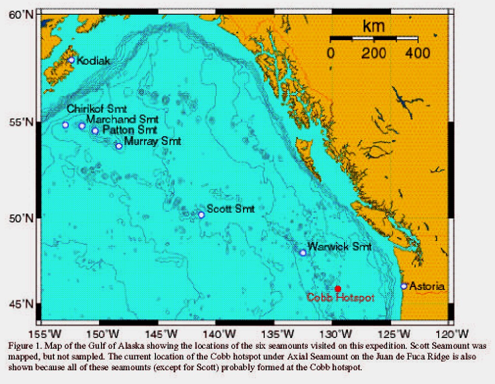
"The Gulf of Alaska is a Pacific water body that is bordered by the southern coast of Alaska and the western coast of Canada. This glorious region is home to some of the largest glaciers on earth, and the cold, nutrient-rich waters of the Gulf support a d...

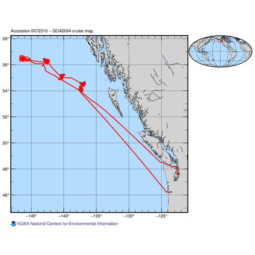
Oceanographic data collected during the Gulf of Alaska 2004 Expedition (alaska2004) on RV Atlantis in Gulf of Alaska from July 30, 2004 - August 23, 2004 (NODC Accession 0072310)
The 2004 Gulf of Alaska Seamount Expedition will use the deep submergence vehicle (DSV) Alvin to explore five large seamounts. Giacomini, Pratt, Welker, Denson, and Dickens seamounts stretch over a 400-nautical-mile section of the northeast Pacific, calle...
Expedition Report : EX2306, Seascape Alaska 5: Gulf of Alaska Remotely Operated Vehicle Exploration and Mapping
From August 23rd - September 14th, 2023 (Kodiak, Alaska to Seward, Alaska), NOAA Ocean Exploration conducted Seascape Alaska 5: Gulf of Alaska Remotely Operated Vehicle Exploration and Mapping (EX2306), a remotely operated vehicle (ROV) and mapping expedi...
Niskin bottle data of the Hawaii Ocean Time-series (HOT) program in the North Pacific 100 miles north of Oahu, Hawaii for cruises HOT239-248 during 2012 (NCEI Accession 0119430)
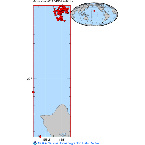
The HOT program makes repeated observations of the physics, biology and chemistry at a site approximately 100 km north of Oahu, Hawaii. Two stations are visited about once a month: Kahe Point (Station 1: 21.34N, 158.27W) and Station ALOHA (Station 2: 22....
Assessing the ecological importance of red tree coral thickets in the eastern Gulf of Alaska
"Red tree corals (Primnoa pacifica), the largest structure-forming gorgonians in the North Pacific Ocean, form dense thickets in some areas. These thickets are a dominant benthic habitat feature in the Gulf of Alaska (GOA), yet little is known about the e...
CTD data of the Hawaii Ocean Time-series (HOT) program in the North Pacific 100 miles north of Oahu, Hawaii for cruises HOT239-248 during 2012 (NODC Accession 0119895)

The HOT program makes repeated observations of the physics, biology and chemistry at a site approximately 100 km north of Oahu, Hawaii. Two stations are visited about once a month: Kahe Point (Station 1: 21.34N, 158.27W) and Station ALOHA (Station 2: 22.7...
 Predictive models of the abundance and distribution of deep-sea corals and sponges in the Gulf of Alaska (NCEI Accession 0289894)