 2018 USACE FEMA Topobathy Lidar DEM: Main Island, Culebra, and Vieques, Puerto Rico
 These bare earth Digital Elevation Model (DEM) files along the Puerto Rico coast, contain rasterized topobathy lidar elevations at a 1 meter grid size, generated from data collected by the Coastal Zone Mapping and Imaging Lidar (CZMIL) system. CZMIL integ...
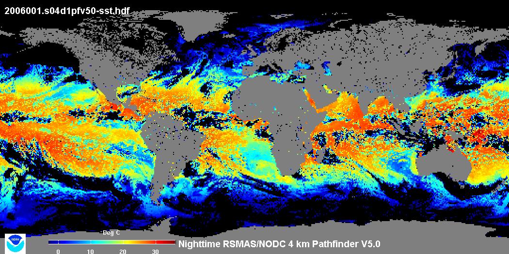
 This data set contains a set of monthly and yearly global day-night sea surface temperature averages, derived from the AVHRR Pathfinder Version 5 sea surface temperature cloudscreened data set (http://pathfinder.nodc.noaa.gov) in GeoTIFF format. The AVHRR...
 Product: These lidar data are processed Classified LAS 1.4 files, formatted to 301 individual 1500 m x 1500 m tiles; used to create intensity images, 3D breaklines and hydro-flattened DEMs as necessary.
Geographic Extent: St. Croix, US Virgin Isla...
 This data set was retrieved from the USGS rockyftp website and processed to NOAA/OCM's Digital Coast.
Product: These lidar data are processed Classified LAS 1.4 files, formatted to 4,376 individual 1500 m x 1500 m tiles; used to create intensity images,...
 The 4 km Pathfinder effort at the National Oceanic and Atmospheric Administration (NOAA) National Oceanographic Data Center (NODC) and the University of Miami's Rosenstiel School of Marine and Atmospheric Science (RSMAS) is an extension of and improvement...
 These files contain classified topo/bathy lidar data. Data are classified as 1 (valid non-ground topographic data), 2 (valid ground topographic data), and 29 (valid bathymetric data). Classes 1 and 2 are defined in accordance with the American Society for...
 These files contain classified topo/bathy lidar data. Data are classified as 1 (valid non-ground topographic data), 2 (valid ground topographic data), and 29 (valid bathymetric data). Classes 1 and 2 are defined in accordance with the American Society for...