Depth soundings from a single beam echo sounder collected around the nearshore areas of Timor-Leste in 2012 and 2013
This dataset contains singlebeam bathymetry data acquired during small-boat surveys conducted from October 20-26, 2012 and June 4-27, 2013 in Timor-Leste by the NOAA Coral Reef Ecosystem Program (CREP). Data was acquired with a HydroLite-TM Echosounder Ki...
NCCOS mapping: seafloor mapping products for the Florida Keys National Marine Sanctuary from 2004-01-01 to 2019-09-22 (NCEI Accession 0170215)
This dataset is an inventory of seafloor mapping data from hydrographic multibeam sonar surveys and georeferenced benthic photographs and video clips, all collected in and around the Florida Keys National Marine Sanctuary (FKNMS). The multibeam data sets ...
NCCOS Mapping: Geospatial products of water depth, acoustic backscatter, and ROV data collected from NOAA Ship Nancy Foster in the Dry Tortugas, Florida Keys National Marine Sanctuary from 2021-03-18 to 2021-04-10 (NCEI Accession 0290189)
Multibeam and acoustic backscatter data collected from NOAA Ship Nancy Foster from 2021-03-18 to 2021-04-10. Data was collected using a Kongsberg EM2040. Bathymetry grids were created using CARIS HIPS and SIPS software, and corrected to Mean Lower Low Wat...
Principal Components Analysis (PCA) Image used to characterize the complexity of the seafloor around St. John, USVI
Eight complexity surfaces (mean depth, standard deviation of depth, curvature, plan curvature, profile curvature, rugosity, slope, and slope of slope) were stacked and exported to create one image with several different bands (each band representing a spe...
NCCOS Mapping: Geospatial products of water depth, acoustic backscatter, and ROV data collected from NOAA Ship Nancy Foster in the Northeast Caribbean Sea surrounding St. Croix and St. Thomas, US. Virgin Islands from 2019-07-02 to 2019-07-12 (NCEI Accession 0276772)
Multibeam and acoustic backscatter data collected from NOAA Ship Nancy Foster from 2019-07-02 to 2019-07-12. The majority of these data were collected using a Kongsberg EM710, with the most inshore portion collected using a Kongsberg EM2040. Bathymetry gr...
NOAA TIFF Image - 1 m Backscatter Mosaic of Abrir La Sierra Bank, PR (2007) collected using a Kongsberg EM 1002 (95 kHz) multibeam echosounder (NCEI Accession 0131853)
This image represents a 1 meter resolution backscatter mosaic of the Abrir La Sierra Bank off the coast of western Puerto Rico, collected using a Kongsberg EM 1002 (95 kHz) multibeam echosounder.
NOAA's NOS/NCCOS/CCMA Biogeography Team, in collaboration ...
NOAA TIFF Image - 1 m Backscatter Mosaic of Abrir La Sierra Bank, PR (2007) collected using a SeaBat Reson 8124 (200 kHz) multibeam echosounder (NCEI Accession 0131853)
This image represents a 1 meter resolution backscatter mosaic of the Abrir La Sierra Bank off the coast of western Puerto Rico, collected using a SeaBat Reson 8124 (200 kHz) multibeam echosounder.
NOAA's NOS/NCCOS/CCMA Biogeography Team, in collaboration...
Curvature Derivative Surface used to characterize the complexity of the seafloor around St. John, USVI
Curvature was calculated from the bathymetry surface for each raster cell using the ArcGIS 3D Analyst "Curvature" Tool. Curvature describes the rate of change of curvature (in 1/100 z units) within a square 3x3 cell window. A negative value denotes concav...
Plan Curvature Derivative Surface used to characterize the complexity of the seafloor around St. John, USVI
Plan curvature was calculated from the bathymetry surface for each raster cell using the ArcGIS 3D Analyst "Curvature" Tool. Plan curvature describes the rate of change of curvature (perpendicular to the slope direction) within a square 3x3 cell neighborh...
Profile Curvature Derivative Surface used to characterize the complexity of the seafloor around St. John, USVI
Profile curvature was calculated from the bathymetry surface for each raster cell using the ArcGIS 3D Analyst "Curvature" Tool. Profile curvature describes the rate of change of curvature (parallel to the slope direction) within a square 3x3 cell neighbor...
 Depth soundings from a single beam echo sounder collected around the nearshore areas of Timor-Leste in 2012 and 2013
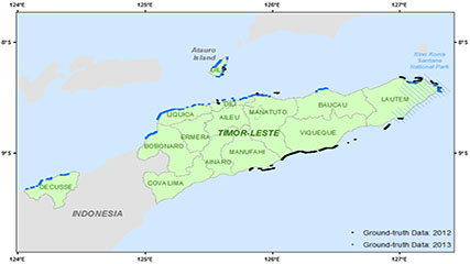 This dataset contains singlebeam bathymetry data acquired during small-boat surveys conducted from October 20-26, 2012 and June 4-27, 2013 in Timor-Leste by the NOAA Coral Reef Ecosystem Program (CREP). Data was acquired with a HydroLite-TM Echosounder Ki...