 Seafloor substrate (hard and soft bottom) maps at select islands/atolls in American Samoa, Mariana Archipelago, and the Pacific Remote Island Areas
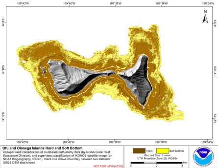
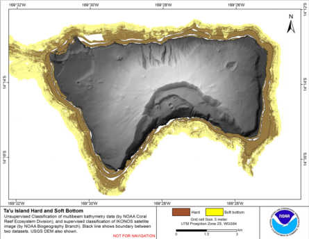
 Seafloor substrate (i.e., hard vs. soft bottom) from 0 to up to 50 m depths around islands/atolls in American Samoa, Mariana Archipelago, and Pacific Remote Island Areas produced by the NOAA Ecosystem Sciences Division (ESD). The islands/atolls include Tu...
 Hard and soft seafloor substrate map, derived from integrating two existing map
products: hard and soft substrate maps derived from an unsupervised classification of multibeam
backscatter and bathymetry derivatives, produced by NOAA Pacific Island Fisheri...
Hard and soft seafloor substrate map, derived from integrating two existing map
products: hard and soft substrate maps derived from an unsupervised classification of multibeam
backscatter and bathymetry derivatives, produced by NOAA Pacific Island Fisheri...
 Hard and soft seafloor substrate map, derived from integrating
two existing map products: hard and soft seafloor substrate map
derived from an unsupervised classification of multibeam backscatter and
bathymetry derivatives, produced by NOAA Pacific Island...
Hard and soft seafloor substrate map, derived from integrating
two existing map products: hard and soft seafloor substrate map
derived from an unsupervised classification of multibeam backscatter and
bathymetry derivatives, produced by NOAA Pacific Island...
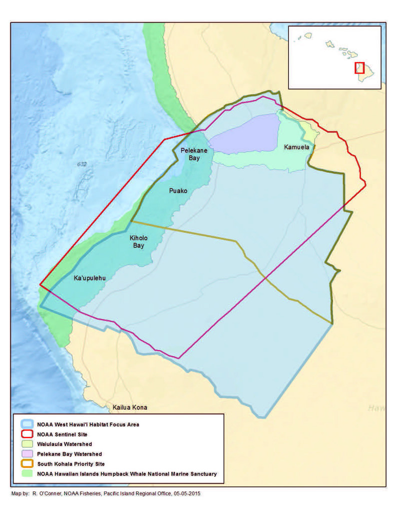 Benthic habitat maps depict dominant substrate type and biological cover in depths between 0 and ~150 m for two priority sites in the Main Hawaiian Islands; the NOAA Habitat Blueprint West Hawaii Focus Area (WHFA) and the Hawaii Division of Aquatic Resour...
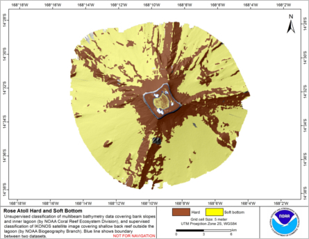
 Preliminary hard and soft seafloor substrate map derived
from an unsupervised classification of multibeam backscatter and
bathymetry derivatives at Rose Atoll, Territory of American Samoa, USA.
The dataset was created from gridded (40 m cell size) multibe...
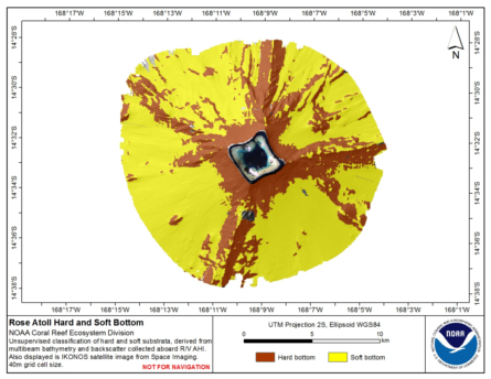
Preliminary hard and soft seafloor substrate map derived
from an unsupervised classification of multibeam backscatter and
bathymetry derivatives at Rose Atoll, Territory of American Samoa, USA.
The dataset was created from gridded (40 m cell size) multibe...
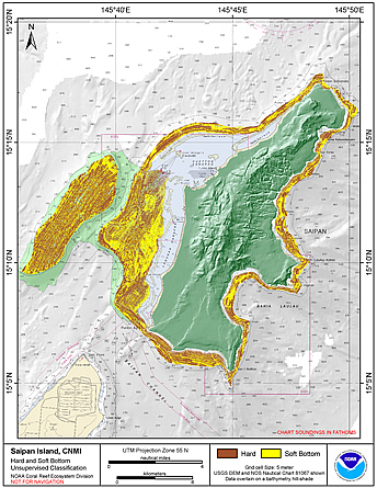 Preliminary hard and soft seafloor substrate map derived
from an unsupervised classification of multibeam backscatter and
bathymety derivatives at Saipan Island, Commonwealth of the Northern
Mariana Islands (CNMI). The dataset was derived using Reson
8101...
Preliminary hard and soft seafloor substrate map derived
from an unsupervised classification of multibeam backscatter and
bathymety derivatives at Saipan Island, Commonwealth of the Northern
Mariana Islands (CNMI). The dataset was derived using Reson
8101...
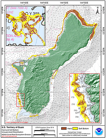 Preliminary hard and soft seafloor substrate map derived
from an unsupervised classification of multibeam backscatter and
bathymety derivatives at the U.S. Territory of Guam. The
dataset was derived using Reson 8101 backscatter data, bathymetric
variance ...
Preliminary hard and soft seafloor substrate map derived
from an unsupervised classification of multibeam backscatter and
bathymety derivatives at the U.S. Territory of Guam. The
dataset was derived using Reson 8101 backscatter data, bathymetric
variance ...