
Sampling grids to support the collection and analysis of survey data for the National Coral Reef Monitoring Program in American Samoa, Pacific Remote Islands Areas, Main Hawaiian Islands
The sampling grids are identified as essential components for the stratified random sampling design of the National Coral Reef Monitoring Program (NCRMP). The benthic habitat map layers including bathymetry, hard and soft substrates, reef zones and sector...
Coral reef ecosystem marine protected area monitoring in Fagamalo, American Samoa: benthic images collected during belt transect surveys in 2015
In 2010 the village of Fagamalo, Tutuila, American Samoa, designated a no-take Marine Protected Area that sees the protection of 2.25 square kilometers of ocean. Because little is known regarding the status of living marine communities in the area, and at...
Benthic Habitat Maps for Rose Atoll Marine National Monument in American Samoa from 2004 to 2010
Benthic habitat maps for Rose Atoll, American Samoa were derived from high resolution, multispectral satellite imagery for 2004, 2006, and 2010. The benthic habitat maps for 2004 were previously generated by NOAA's NCCOS's BioGeography Branch before this ...
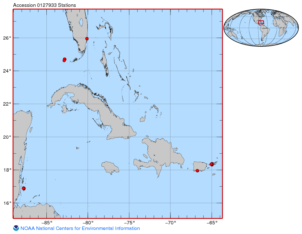 This project was funded for two years by CRCP (FY13-14) and built upon one year of pilot work conducted in FY12 funded by NMFS-SEFSC and SERO as an NRC postdoctoral research fellowship (Huntington). The goals of the project were to characterize natural, r...
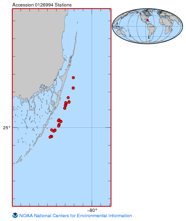 Temperature loggers were deployed at various monitoring sites off the upper Florida Keys where other ecological studies were underway, most focused on aspects of Acropora spp. status or ecology. Hobo Pendant loggers were secured to the substrate at a site...
 Disease Resistance of Acropora spp. in Florida Nursery Stocks
 Gridded bathymetry at 40m resolution surrounding Baker Island, within the Pacific Remote Island Areas - Central Pacific Ocean. Bottom coverage was achieved in depths between 8 and 4700 meters. The Arc ASCII grids and floating point geotifs include multibe...
 Gridded bathymetry at 60m resolution surrounding Guam Island, Guam U.S. Territory. Bottom coverage was achieved in depths between 0 and ~3500 meters. The Arc ASCII grids and floating point geotifs include multibeam bathymetry data acquired over multiple s...
 Gridded bathymetry at 40m resolution surrounding Howland Island, within the Pacific Remote Island Areas - Central Pacific Ocean. Bottom coverage was achieved in depths between 8 and 3800 meters. The Arc ASCII grids and floating point geotifs include multi...
 The focus of the Wahikuli-Honokowai Watershed Management Plan is the land use practices and alterations affected in the agricultural and urban districts that have upset the natural drainage patterns and ecohydrologic balance and services the watersheds pr...