
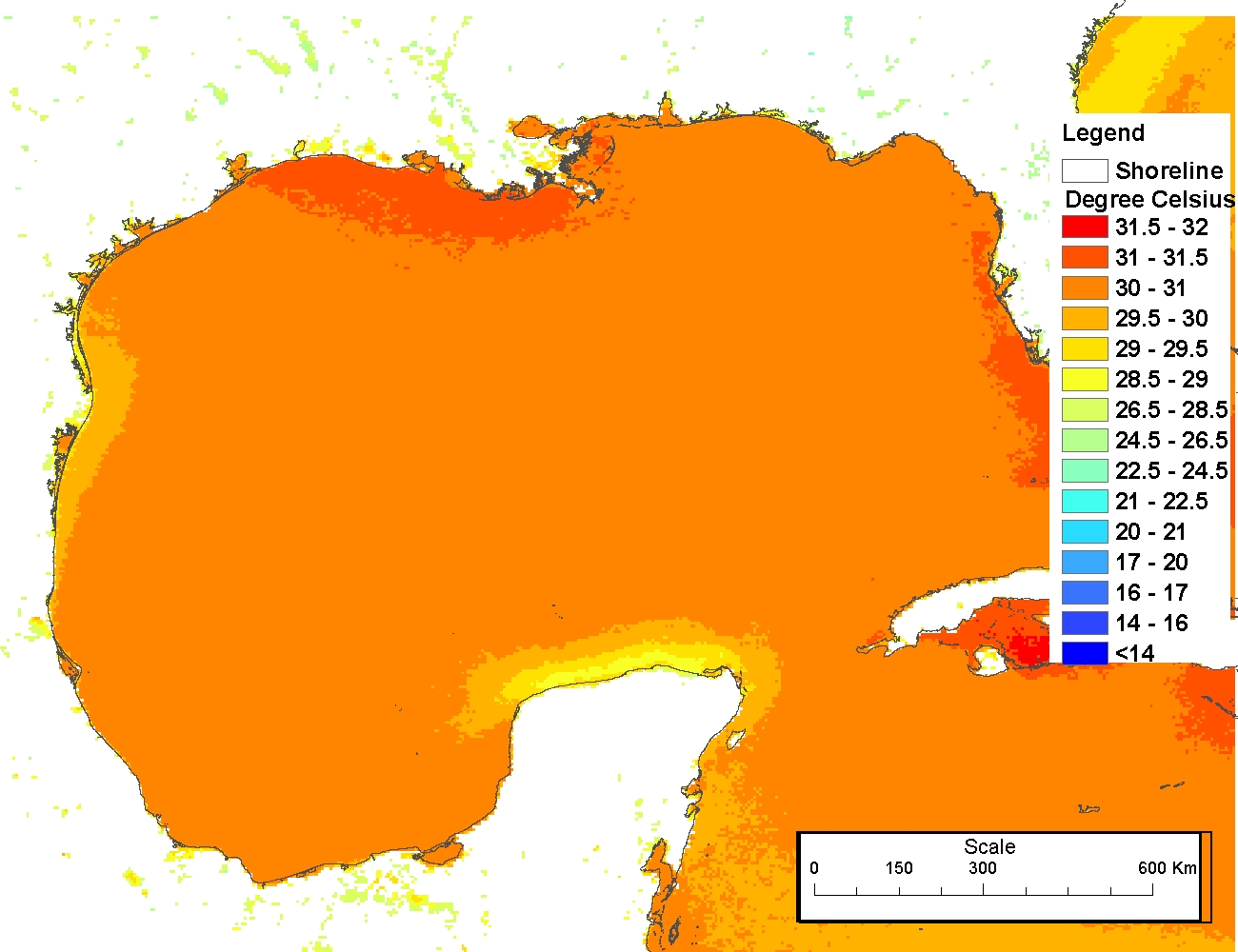
Sea surface temperatures from AVHRR
The production of these AVHRR L2P data is a NEODAAS activity in collaboration with the UK National Centre for Ocean Forecasting (NCOF). NEODAAS-Dundee acquires approx. 15 AVHRR HRPT passes per day over NW Europe and Arctic, each approx. 15 minutes duratio...

Landsat 7 ETM/1G satellite imagery - Hawaiian Islands cloud-free mosaics
Cloud-free Landsat satellite imagery mosaics of the islands of the main 8 Hawaiian Islands (Hawaii, Maui, Kahoolawe, Lanai, Molokai, Oahu, Kauai and Niihau). Landsat 7 ETM (enhanced thematic mapper) is a polar orbiting 8 band
multispectral satellite-borne...
Wetlands of the U.S. Virgin Islands 2010 edition
"This report provides an overview of the types and current status of wetlands in the U.S. Virgin Islands, the benefits provided by wetlands, the threats to wetlands, the current management framework, and summary information on selected sites. The 25 site ...
 This data set contains a set of monthly and yearly global day-night sea surface temperature averages, derived from the AVHRR Pathfinder Version 5 sea surface temperature cloudscreened data set (http://pathfinder.nodc.noaa.gov) in GeoTIFF format. The AVHRR...
 The 4 km Pathfinder effort at the National Oceanic and Atmospheric Administration (NOAA) National Oceanographic Data Center (NODC) and the University of Miami's Rosenstiel School of Marine and Atmospheric Science (RSMAS) is an extension of and improvement...
 The 4 km Pathfinder effort at the National Oceanic and Atmospheric Administration (NOAA) National Oceanographic Data Center (NODC) and the University of Miami's Rosenstiel School of Marine and Atmospheric Science (RSMAS) is an extension of and improvement...
 The Coral Reef Temperature Anomaly Database (CoRTAD) is a collection of sea
surface temperature (SST) and related thermal stress metrics, developed specifically
for coral reef ecosystem applications but relevant to other ec...
The Coral Reef Temperature Anomaly Database (CoRTAD) is a collection of sea
surface temperature (SST) and related thermal stress metrics, developed specifically
for coral reef ecosystem applications but relevant to other ec...