
2018 USGS/NRCS Lidar DEM: Southeast Florida
Product: These are Digital Elevation Model (DEM) data for Florida counties of Broward, Collier, Hendry, Miami-Dade, Monroe, and Palm Beach, as part of the required deliverables for the Florida Southeast 2018 Lidar project. Class 2 (ground) lidar points in...
Coral and artificial reef shape files, Broward County, Florida, (NODC Accession 0000244)
Coral reef and artificial reef location shape files and accompanying table files for reefs located off shore of Broward County, Florida. Accompanying "attribute" tables provide information on artificial reef type, date of creation, and associated informa...
 This data set contains a set of monthly and yearly global day-night sea surface temperature averages, derived from the AVHRR Pathfinder Version 5 sea surface temperature cloudscreened data set (http://pathfinder.nodc.noaa.gov) in GeoTIFF format. The AVHRR...
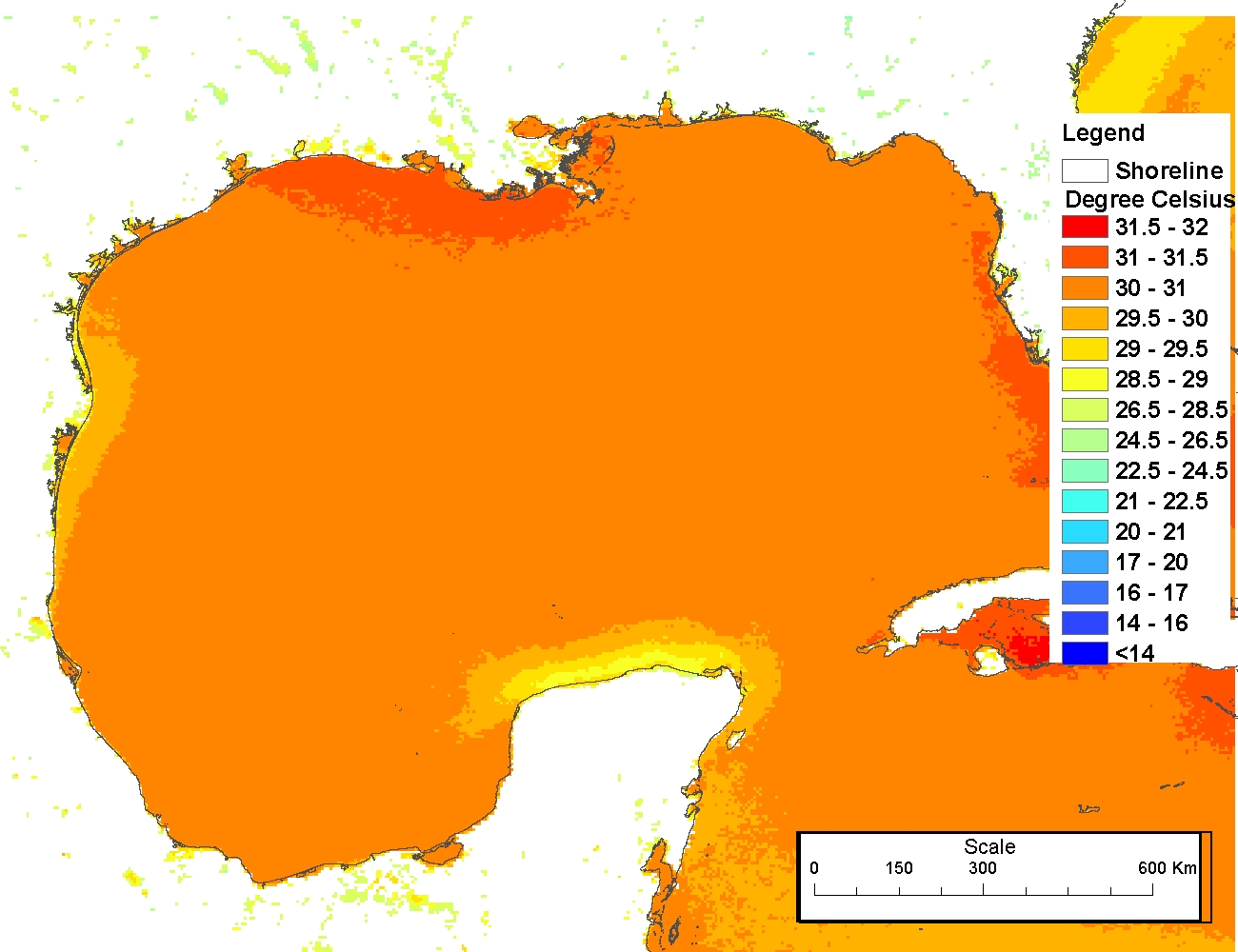 The 4 km Pathfinder effort at the National Oceanic and Atmospheric Administration (NOAA) National Oceanographic Data Center (NODC) and the University of Miami's Rosenstiel School of Marine and Atmospheric Science (RSMAS) is an extension of and improvement...
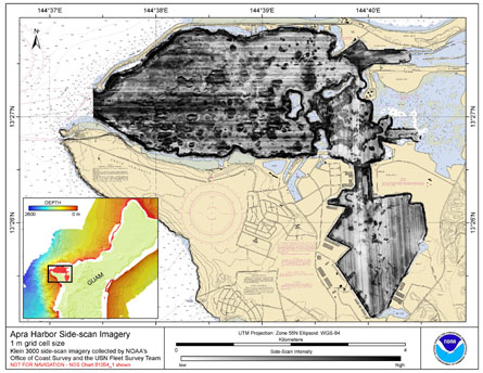 Gridded side-scan imagery collected in Apra Harbor, Guam U.S. Territory, USA. The GeoTIFF and
Arc ASCII file includes data that were collected using a Klein 3000 high-resolution side-scan sonar system
with dual operating frequencies of 100 and 500 kHz. Th...
Gridded side-scan imagery collected in Apra Harbor, Guam U.S. Territory, USA. The GeoTIFF and
Arc ASCII file includes data that were collected using a Klein 3000 high-resolution side-scan sonar system
with dual operating frequencies of 100 and 500 kHz. Th...
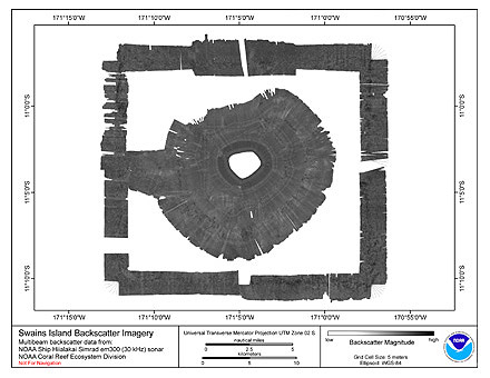 Multibeam backscatter imagery extracted from gridded bathymetry of Swains Island, American Samoa.
These data provide coverage between 50 and 5000 meters. The backscatter dataset includes data collected using the Simrad EM300
multibeam sonar. The sonars fr...
Multibeam backscatter imagery extracted from gridded bathymetry of Swains Island, American Samoa.
These data provide coverage between 50 and 5000 meters. The backscatter dataset includes data collected using the Simrad EM300
multibeam sonar. The sonars fr...