
Baseline Marine Biological Survey ROI-NAMUR Outfall United States Army Kwajalein Atoll, Republic of the Marshall Islands, 1997(NODC Accession 0000630)
Roi-Namur is located at the northernmost tip of Kwajalein Atoll, approximately 64 kilometers north of the U.S. Army Kwajalein Atoll(USAKA) central command post on Kwajalein Islet. Roi-Namur has a single sewage outfall, which is located at the northwestern...
Marine Biological Survey ROI-NAMUR Outfall, United States Army Kwajalein Atoll, Republic of the Marshall Islands, May 2000 (NODC Accession 0000653)
Roi-Namur is located at the northernmost tip of Kwajalein Atoll,approximately 64 kilometers north of the U.S. Army Kwajalein Atoll(USAKA) central command post on Kwajalein Islet. Roi-Namur has a single sewage outfall, which is located at the northwestern ...

News from NOAA in the North Atlantic, Fall 2014
"In this newsletter, you will find stories about NOAA collaborating on citizen science at Stellwagen, ecological forecasting, and regional collaboration activities planned for FY15."
Hawaii Coral Bleaching Collaborative: surveys for percent of bleached coral cover across the Hawaiian Archipelago from October 02 to November 18, 2015 (NCEI Accession 0246373)
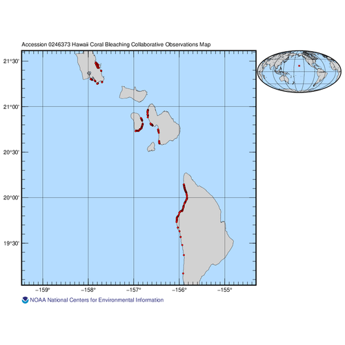
The data described here result from coral bleaching surveys across the Hawaiian Archipelago from October 02 to November 18, 2015. The data provide survey-level information on percent live coral cover and the percentages of coral unbleached, partially, and...
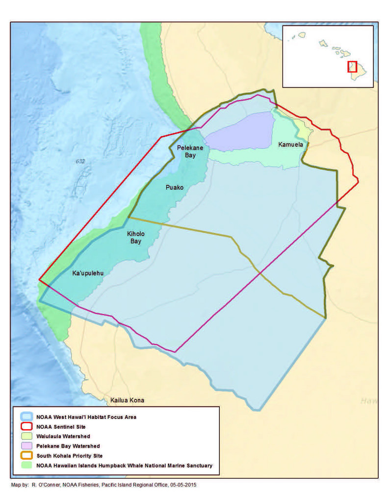 Hard and soft bottom seafloor substrate data and maps for the NOAA Habitat Blueprint West Hawaii Focus Area (WHFA) in the Main Hawaiian Islands. Cell values in the raster datasets reflect whether the seafloor is hard bottom or soft bottom based on an unsu...
 The Oahu, Hawaii Elevation Data Task Order involves collecting and delivering topographic elevation point data derived from multiple return light detection and ranging (LiDAR) measurements on the island of Oahu in Hawaii. The Statement of Work (SOW) for ...