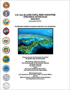
U.S. All Islands Coral Reef Committee Strategic Action Plan 2008-2013 (updated 2010). A collaborative initiative to conserve coral reefs in U.S. jurisdictions
"The U.S. All Islands Coral Reef Committee (AIC) is a made up of marine resource managers from state, commonwealth, territorial agencies and freely associated states working collaboratively with federal agencies to conserve and protect coral reefs in the ...
Scientists within the ACCRETE (Acidification, Climate, and Coral Reef Ecosystems Team) Lab of AOML_s Ocean Chemistry and Ecosystems Division (OCED) have constructed a tool to monitor ocean acidification over the wider Caribbean and Gulf of Mexico. This to...
Leading Edge Geomatics (LEG) collected 3451 square miles in Puerto Rico. The nominal pulse spacing for this project was 1 point every 0.7 meters. Dewberry used proprietary procedures to classify the LAS according to project specifications: 0-Never Class...
West Hawaii Aquarium Project 1999-2004, Fish and Substrate Data (NODC Accession 0002288)
In response to declines in reef fishes, the Hawaii state legislature
created the West Hawaii Regional Fishery Management Area in 1998 to
improve fishery resources (Act 306). The West Hawaii Aquarium Project
(WHAP) was funded by the Hawaii Coral Reef Init...
2013 USACE Topographic Lidar: Rio Puerto Nuevo (PR)
This data set is an LAZ (compressed LAS) format file containing LIDAR point cloud data. The NAD83/2011 geodetic products were delivered as individual LAS files representing the geographic extent of each uniquely identified and acquired flight line or lift...
4 km NODC/RSMAS AVHRR Pathfinder v5.0 and Interim v5.0 Sea Surface Temperature (SST) Data and v5.1 SST Data for 1981-2009
The 4 km Pathfinder effort at the National Oceanic and Atmospheric Administration (NOAA) National Oceanographic Data Center (NODC) and the University of Miami's Rosenstiel School of Marine and Atmospheric Science (RSMAS) is an extension of and improvement...
West Hawaii Aquarium Project 1999-2003 Fish and Substrate Data (NODC Accession 0001467)
In response to declines in reef fishes, the Hawaii state legislature
created the West Hawaii Regional Fishery Management Area in 1998 to
improve fishery resources (Act 306). The West Hawaii Aquarium Project
(WHAP) was funded by the Hawaii Coral Reef Init...
Axis Geospatial, LLC collected 1,994 square miles in Palm Beach County, Florida. The nominal pulse spacing for this project was 1 point every 0.7 meters. Dewberry used proprietary procedures to classify the LAS according to project specifications: 1-Pro...
West Hawaii Aquarium Project 1999-2002 Fish and Substrate Data (NODC Accession 0000938)
In response to declines in reef fishes, the Hawaii state legislature
created the West Hawaii Regional Fishery Management Area in 1998 to
improve fishery resources (Act 306). The West Hawaii Aquarium Project
(WHAP) was funded by the Hawaii Coral Reef Init...
State of Hawaii, Department of Health, Clean Water Branch State-wide Water Quality Sampling Dataset 1999-2006 (NODC Accession 0013723)
The Monitoring Section of the State of Hawaii, Department of Health,
Clean Water Branch collects water quality data at over 300 coastal
locations state-wide using well-established instruments and methodologies.
This dataset spans 1999-2006.
 U.S. All Islands Coral Reef Committee Strategic Action Plan 2008-2013 (updated 2010). A collaborative initiative to conserve coral reefs in U.S. jurisdictions
 "The U.S. All Islands Coral Reef Committee (AIC) is a made up of marine resource managers from state, commonwealth, territorial agencies and freely associated states working collaboratively with federal agencies to conserve and protect coral reefs in the ...
 Ocean Acidification Product Suite
 Leading Edge Geomatics (LEG) collected 3451 square miles in Puerto Rico. The nominal pulse spacing for this project was 1 point every 0.7 meters. Dewberry used proprietary procedures to classify the LAS according to project specifications: 0-Never Class...
 This data set is an LAZ (compressed LAS) format file containing LIDAR point cloud data. The NAD83/2011 geodetic products were delivered as individual LAS files representing the geographic extent of each uniquely identified and acquired flight line or lift...
 The 4 km Pathfinder effort at the National Oceanic and Atmospheric Administration (NOAA) National Oceanographic Data Center (NODC) and the University of Miami's Rosenstiel School of Marine and Atmospheric Science (RSMAS) is an extension of and improvement...