 Estimated Depth Maps of the Northwestern Hawaiian Islands Derived from High Resolution IKONOS Satellite Imagery (Draft)
Estimated shallow-water, depth maps were produced using rule-based, semi-automated image analysis of high-resolution satellite imagery for nine locations in the Northwestern Hawaiian Islands. This project is a cooperative effort between the National Ocean...
 This map displays fish biomass observation locations overlaid on bathymetry.
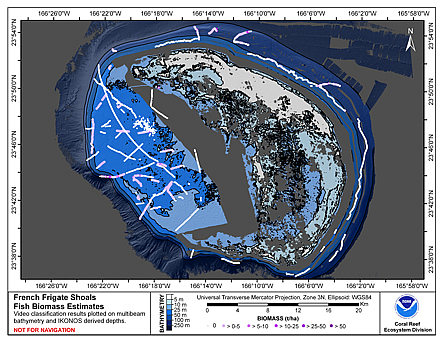 This map displays fish biomass observation locations overlaid on bathymetry
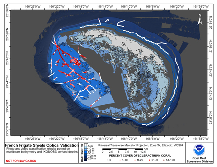 This map displays optical validation observation locations and percent coverage of scleractinian coral overlaid on bathymetry.
 This map displays optical validation observation locations and percent coverage of scleractinian coral overlaid on bathymetry.
 Cruise report, NOAA Ship Hi`ialakai, Cruise HA-10-07, 4 September - 29 September 2010, Northwestern Hawaiian Islands (NWHI), French Frigate Shoals, Pearl and Hermes Atoll, Kure Atoll, and Lisianski Island and Neva Shoal, main Hawaiian Islands, Five fathom pinnacle
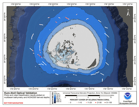 This map displays optical validation observation locations and percent coverage of scleractinian coral
overlaid on bathymetry.
This map displays optical validation observation locations and percent coverage of scleractinian coral
overlaid on bathymetry.