
Sea surface temperatures from AVHRR
The production of these AVHRR L2P data is a NEODAAS activity in collaboration with the UK National Centre for Ocean Forecasting (NCOF). NEODAAS-Dundee acquires approx. 15 AVHRR HRPT passes per day over NW Europe and Arctic, each approx. 15 minutes duratio...

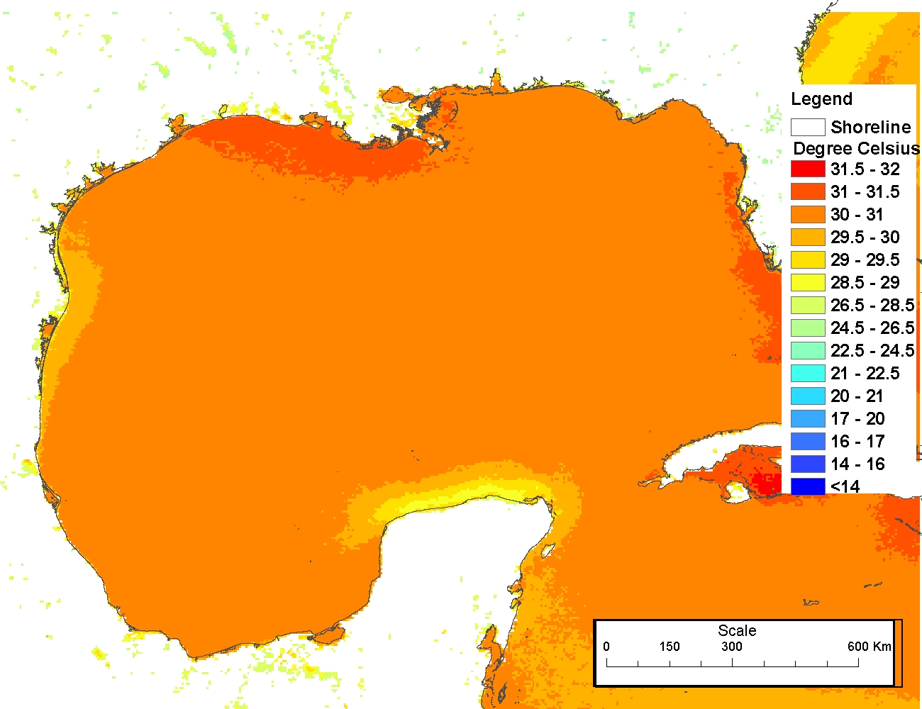
AVHRR Pathfinder Version 5.2 Level 3 Collated (L3C) Global 4km Sea Surface Temperature for 1981-2012
The AVHRR Pathfinder Version 5.2 Sea Surface Temperature data
set (PFV52) is a collection of global, twice-daily 4km sea surface temperature
data produced in a partnership by the NOAA National Oceanographic Data Cen...
 The 4 km Pathfinder effort at the National Oceanic and Atmospheric Administration (NOAA) National Oceanographic Data Center (NODC) and the University of Miami's Rosenstiel School of Marine and Atmospheric Science (RSMAS) is an extension of and improvement...
 The Coral Reef Temperature Anomaly Database (CoRTAD) is a collection of sea surface temperature (SST) and related thermal stress metrics, developed specifically for coral reef ecosystem applications but relevant to other ecosystems as well. The CoRTAD Ve...
 Leading Edge Geomatics (LEG) collected 3451 square miles in Puerto Rico. The nominal pulse spacing for this project was 1 point every 0.7 meters. Dewberry used proprietary procedures to classify the LAS according to project specifications: 0-Never Class...
 The 4 km Pathfinder effort at the National Oceanic and Atmospheric Administration (NOAA) National Oceanographic Data Center (NODC) and the University of Miami's Rosenstiel School of Marine and Atmospheric Science (RSMAS) is an extension of and improvement...
 This data set contains a set of monthly and yearly global day-night sea surface temperature averages, derived from the AVHRR Pathfinder Version 5 sea surface temperature cloudscreened data set (http://pathfinder.nodc.noaa.gov) in GeoTIFF format. The AVHRR...