ResourceIdentification guide to the deep-sea cartilaginous fishes of the Indian Ocean / Ebert, D.A. and Mostarda, E.
Metadata Thumbnail 
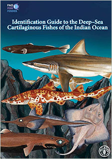
"This fully illustrated guide is designed to assist with the identification of a selection of deep-sea cartilaginous fishes of the Indian Ocean that are of major, moderate or minor importance to fisheries. [...] This guide is intended to help fishery work...
ResourceIdentification guide to the deep-sea cartilaginous fishes of the Indian Ocean
Metadata Thumbnail "This guide covers the deep-sea Indian Ocean, primarily FAO Fishing Areas 51 and 57, and that part of Area 47 that extends from Cape Point, South Africa to the east, e.g. the extreme southwestern Indian Ocean. It includes a selection of species of major, ...
ResourceEvaluating the Effects of a Deep-Water Marine Protected Area a Decade After Closure: A Multifaceted Approach Reveals Equivocal Benefits to Reef Fish Populations
Marine protected areas (MPAs) are increasingly used to rebuild fish populations. In 2009, eight MPAs were designated off the southeast United States with the goal of rebuilding populations of long-lived deep-water reef fishes. We tested whether reef fish ...
Downloadable DataFish Density of El Seco, Puerto Rico from 2009-03-31 to 2009-04-02, Project NF-09-01-USVI, 2009, WGS84 (NCEI Accession 0137091)
Metadata Thumbnail This data contains densities of fishes detected using mobile fisheries sonar on board NOAA Ship Nancy Foster. The data were acquired in concert with a multibeam bathymetry survey off the coast of Vieques Island, Puerto Rico in 2009. Fish densities are pre...
ResourceData Report: Comprehensive Inventory of Seafloor Mapping, Ground-truthing, and Predictive Habitat Modeling Datasets to Support Deepwater Horizon Mesophotic and Deep Benthic Communities
A comprehensive inventory of seafloor mapping, ground-truthing, and predictive habitat modeling data was compiled for a large part of the northern GOM for years 1980-2021 to meet the DWH restoration goals and support restoration activities. Thorough and r...
Downloadable DataNCCOS mapping: seafloor mapping products for the Florida Keys National Marine Sanctuary from 2004-01-01 to 2019-09-22 (NCEI Accession 0170215)
Metadata Thumbnail This dataset is an inventory of seafloor mapping data from hydrographic multibeam sonar surveys and georeferenced benthic photographs and video clips, all collected in and around the Florida Keys National Marine Sanctuary (FKNMS). The multibeam data sets ...
Geographic ServicesNCCOS Assessment: Benthic Habitat Map for the Insular Shelf South of St. Thomas and St. John, U.S. Virgin Islands (NCEI Accession 0170098)
Metadata Thumbnail The dataset describes the spatial distribution of benthic habitats on the insular shelf south of St. Thomas and St. John, U.S. Virgin Islands. These benthic habitats include: (1) Coral Reef Colonized with Live Coral, (2) Pavement Colonized with Live Coral...
Downloadable DataNCCOS Caribbean Fishery Acoustic Assessment: Fish Density Data Collection from NOAA Ship Nancy Foster, from 2008-03-26 to 2014-05-31 (NCEI Accession 0156395)
Metadata Thumbnail These data sets show acoustically detected fish densities throughout the Caribbean ocean. NOAA/NCCOS collected these data sets to help characterize broad-scale fish abundance, biomass, and understand temporal behavior. Acoustic data was collected aboard ...
Downloadable DataNCCOS Assessment: Underwater Video for Ground Validation and Accuracy Assessment of Benthic Habitat Maps of the Insular Shelf South of St. Thomas and St. John, U.S. Virgin Islands, 2010-03-20 to 2017-02-10
The presence and absence of the four substrate and four biological cover types were documented at 1,353 locations on the insular shelf south of St. Thomas and St. John. At each location, an underwater camera system was used to collect high definition (HD)...