
AVHRR Pathfinder Version 5.2 Level 3 Collated (L3C) Global 4km Sea Surface Temperature for 1981-2012
The AVHRR Pathfinder Version 5.2 Sea Surface Temperature data
set (PFV52) is a collection of global, twice-daily 4km sea surface temperature
data produced in a partnership by the NOAA National Oceanographic Data Cen...
National Coral Reef Monitoring Program: Dissolved inorganic carbon, total alkalinity, pH and other variables collected from surface discrete observations using infrared dissolved inorganic carbon analyzer, alkalinity titrator and other instruments from the North Atlantic Ocean near Key West, Florida (Class III climate monitoring sites) from 2012-03-23 to 2014-12-11 (NCEI Accession 0132022)
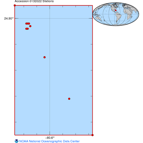
This archival package contains data collected to monitor changes to coral reef carbonate chemistry over time, at US affiliated coral reef sites, through quantifying key chemical parameters that are expected to be impacted by ocean acidification. This effo...

NOAA/NESDIS Coral Reef Team Workshop Report
NESDIS performs a variety of coral reef activities including monitoring, mapping, data distribution, paleoclimatology, and technology transfer. The purpose of the NESDIS team is to bring all NESDIS coral reef activities under a focused, coordinated NESDIS...
Computing applications for satellite temperature datasets : a performance evaluation of Graphics Processing Units
The Coral Reef Watch program of NOAA develops and provides remote sensing tools for the conservation of coral reef ecosystems. Reef managers and other stakeholders have expressed a desire for higher resolution monitoring tools than those currently availab...
 The mapped data derived from AVHRR is divided into files for CoastWatch regions of interest. Each file contains multiple data variables stored using the HDF-4 Scientific Data Sets (SDS) model. The product contents are channel 1 albedo, channel 2 albedo, c...
 Product shows local sea surface temperatures (degrees C). It is a composite gridded-image derived from 8-km resolution SST Observations. It is generated every 48 hours for North America. SST is defined as the skin temperature of the ocean surface water.