Downloadable DataU.S. Coastal Relief Model - Hawaii
Metadata Thumbnail NGDC's U.S. Coastal Relief Model (CRM) provides the first comprehensive view of the U.S. coastal zone integrating offshore bathymetry with land topography into a seamless representation of the coast. The CRM spans the U.S. East and West Coasts, the northe...
Downloadable DataU.S. Coastal Relief Model - Puerto Rico
Metadata Thumbnail NGDC's U.S. Coastal Relief Model (CRM) provides the first comprehensive view of the U.S. coastal zone integrating offshore bathymetry with land topography into a seamless representation of the coast. The CRM spans the U.S. East and West Coasts, the northe...
Downloadable DataNational Coral Reef Monitoring Program: Carbonate Budget data of Bird Key Reef in the Dry Tortugas from 2015-09-01 to 2015-09-03 (NCEI Accession 0159176)
Metadata Thumbnail This data set includes census based carbonate budget data that was collected in coral reef habitats located within the Dry Tortugas National Park (DTNP). Surveys (based on Perry et al 2012) were collected over one week at Bird Key Reef in the Dry Tortugas...
Downloadable DataNational Coral Reef Monitoring Program: Dissolved inorganic carbon, total alkalinity, pH and other variables collected from surface discrete observations using infrared dissolved inorganic carbon analyzer, alkalinity titrator and other instruments from the North Atlantic Ocean near Key West, Florida (Class III climate monitoring sites) from 2012-03-23 to 2014-12-11 (NCEI Accession 0132022)
Metadata Thumbnail 
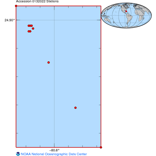
This archival package contains data collected to monitor changes to coral reef carbonate chemistry over time, at US affiliated coral reef sites, through quantifying key chemical parameters that are expected to be impacted by ocean acidification. This effo...
Downloadable DataAVHRR Pathfinder Version 5.2 Level 3 Collated (L3C) Global 4km Sea Surface Temperature for 1981-2012
The AVHRR Pathfinder Version 5.2 Sea Surface Temperature data set (PFV52) is a collection of global, twice-daily 4km sea surface temperature data produced in a partnership by the NOAA National Oceanographic Data Cen...
Downloadable DataALGAL SPECIES and Other Data from VARIOUS SMALL VESSELS from 19940825 to 19950522 (NODC Accession 9800169)
Downloadable DataSt. Croix, U.S. Virgin Islands Coastal Digital Elevation Model
Metadata Thumbnail NOAA's National Geophysical Data Center (NGDC) is building high-resolution digital elevation models (DEMs) for select U.S. coastal regions. These integrated bathymetric-topographic DEMs are used to support tsunami forecasting and warning efforts at the NO...
Downloadable DataWATER DEPTH - AVERAGE and Reflectance- Intensity collected from LADS Mk II Airborne System in Caribbean Sea and Puerto Rico from 2006-04-07 to 2006-05-15 (NCEI Accession 0153360)
Metadata Thumbnail These images represent LiDAR (Light Detection & Ranging) data collected by NOAA from the shoreline of southwestern Puerto Rico to about 50 meters in depth. Reflectivity was calculated for each sounding as the ratio of returned energy to transmitted energy...
Downloadable DataU.S. Virgin Islands National Park Coral Transplant Study, St. John, 1999-2009 (NODC Accession 0112724)
In a pilot project in the Caribbean (Virgin Islands National Park, St. John, U.S. Virgin Islands), storm-produced fragments of Acropora palmata, Acropora cervicornis, and Porites porites were collected from donor reefs and transplanted to nearby degraded ...
Downloadable DataOceanographic data collected during the Atlantic Deep-Water Canyons: Pathways to the Abyss 2011 on NOAA Ship Nancy Foster in the North Atlantic Ocean from 2011-06-04 to 2011-06-17 (NODC Accession 0082240)
Submarine canyons are dominant features of the outer continental shelf and slope of the US East coast from Cape Hatteras to the Gulf of Maine. They are important conduits of anthropogenic pollutants, organic carbon, and sediments from shallow to deeper wa...