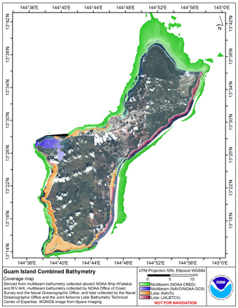
 Coverage map of gridded multibeam and lidar bathymetry of the US Territory of Guam
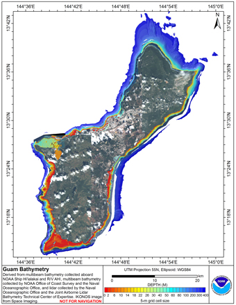
 Gridded multibeam bathymetry is integrated with gridded lidar bathymetry.
Gridded (5 m cell size) multibeam bathymetry were collected aboard NOAA Ship
Hiialaka'i and R/V AHI and by the Naval Oceanographic Office and NOAA
Office of Coast Survey in Apra Har...
Gridded multibeam bathymetry is integrated with gridded lidar bathymetry.
Gridded (5 m cell size) multibeam bathymetry were collected aboard NOAA Ship
Hiialaka'i and R/V AHI and by the Naval Oceanographic Office and NOAA
Office of Coast Survey in Apra Har...