 5 m Gridded bathymetry of the lagoon and slope environments of Rose
Atoll, American Samoa (Arc ASCII format)
5 m Gridded bathymetry of the lagoon and slope environments of Rose
Atoll, American Samoa (Arc ASCII format)
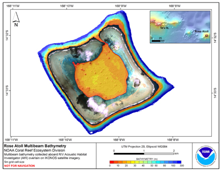 Gridded bathymetry (5 m cell size) of the inner lagoon and slope environments of Rose
Atoll, American Samoa. This survey provides coverage between <10 and 300 meters.
The multibeam data are from the Reson 8101ER system aboard the R/V AHI and were
collect...
Gridded bathymetry (5 m cell size) of the inner lagoon and slope environments of Rose
Atoll, American Samoa. This survey provides coverage between <10 and 300 meters.
The multibeam data are from the Reson 8101ER system aboard the R/V AHI and were
collect...
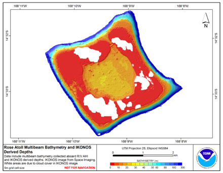 Gridded multibeam bathymetry is integrated with bathymetry derived from
multispectral IKONOS satellite data. Gridded (5 m cell size) multibeam bathymetry
were collected aboard the R/V AHI (Acoustic Habitat Investigator). Bathymetry values
shallower than 2...
Gridded multibeam bathymetry is integrated with bathymetry derived from
multispectral IKONOS satellite data. Gridded (5 m cell size) multibeam bathymetry
were collected aboard the R/V AHI (Acoustic Habitat Investigator). Bathymetry values
shallower than 2...
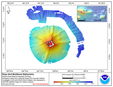 Gridded (40 m cell size) bathymetry of the slope environment
of Rose Atoll, American Samoa, South Pacific.
Almost complete bottom coverage was achieved in depths between
10 and 3000 meters. The bathymetry dataset includes Simrad EM300,
EM3002D, and Reson ...
Gridded (40 m cell size) bathymetry of the slope environment
of Rose Atoll, American Samoa, South Pacific.
Almost complete bottom coverage was achieved in depths between
10 and 3000 meters. The bathymetry dataset includes Simrad EM300,
EM3002D, and Reson ...