 10m Gridded bathymetry of Swains Island, American Samoa, South Pacific (netCDF format)
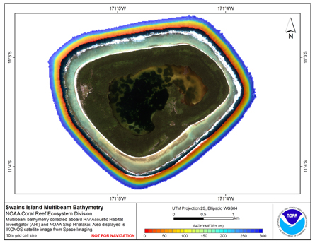 Gridded (10 m cell size) bathymetry of the slope environment of
Swains Island, American Samoa, South Pacific.
Almost complete bottom coverage was achieved in depths between
7 and 4800 meters (10 m grid includes data to 300 m). The bathymetry dataset
inclu...
Gridded (10 m cell size) bathymetry of the slope environment of
Swains Island, American Samoa, South Pacific.
Almost complete bottom coverage was achieved in depths between
7 and 4800 meters (10 m grid includes data to 300 m). The bathymetry dataset
inclu...
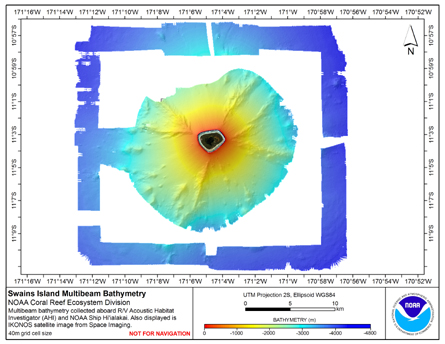 Gridded bathymetry (40 m cell size) of the slope environment of
Swains Island, American Samoa. Almost complete bottom coverage was achieved
in depths between 7 and 4800 m. The multibeam data are from the Simrad EM300
system aboard the NOAA Ship Hi'ialakai...
Gridded bathymetry (40 m cell size) of the slope environment of
Swains Island, American Samoa. Almost complete bottom coverage was achieved
in depths between 7 and 4800 m. The multibeam data are from the Simrad EM300
system aboard the NOAA Ship Hi'ialakai...