 Gridded bathymetry of the banktop and slope environments of Ta'u
Island of the Manu'a Island group, American Samoa (Arc ASCII format)
Gridded bathymetry of the banktop and slope environments of Ta'u
Island of the Manu'a Island group, American Samoa (Arc ASCII format)
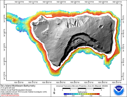 Gridded bathymetry of the banktop and slope environments of Ta'u
Island of the Manu'a Island group, American Samoa. This
survey provides almost complete coverage between 20 and 350 meters.
The multibeam data are from Reson 8101ER system aboard the R/V AH...
Gridded bathymetry of the banktop and slope environments of Ta'u
Island of the Manu'a Island group, American Samoa. This
survey provides almost complete coverage between 20 and 350 meters.
The multibeam data are from Reson 8101ER system aboard the R/V AH...
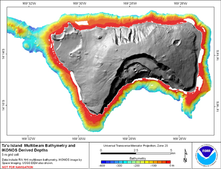 Gridded multibeam bathymetry is integrated with bathymetry
derived from multispectral IKONOS satellite data. Gridded (10 m cell
size) multibeam bathymetry collected aboard NOAA Ship Hiialaka'i and
R/V AHI. Bathymetry values shallower than 15 m were derive...
Gridded multibeam bathymetry is integrated with bathymetry
derived from multispectral IKONOS satellite data. Gridded (10 m cell
size) multibeam bathymetry collected aboard NOAA Ship Hiialaka'i and
R/V AHI. Bathymetry values shallower than 15 m were derive...