Towards a new and integrated approach to submarine canyon research
"Submarine canyons, steep-walled valleys that cut across virtually every continental margin around the world, are considered major sediment transport pathways between continental shelves and the deep sea. Owing to their steep topography and high terrain h...
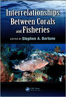
"This book is the result of NOAA CRCP's sponsored workshop held by the Gulf of Mexico Fishery Management Council in Tampa, Florida, 20-22 May 2013, where world authorities came together to discuss the current and emerging threats as well as challenges and...
Benthic foraminiferal thanatocoenoses from the Cap-Ferret Canyon area (NE Atlantic): A complex interplay between hydro-sedimentary and biological processes
"Benthic foraminiferal thanatocoenoses from the Cap-Ferret Canyon area were studied in the greater than150 micrometers fraction of 4-5 cm deep sediment levels, at 13 stations. The shallowest station (151 m depth) is located at the shelf break, close to th...
Main Hawaiian Island lobsters: Commercial catch and dealer data analysis (1984-2004)
This study analyzes 21 years (1984-2004) of data from fisherman catch and dealer sales reports to provide a current assessment of the lobster resources of the main Hawaiian Islands (MHI) and its associated commercial fishery. The current study was conduct...
Benthic foraminifera from Capbreton Canyon revisited; faunal evolution after repetitive sediment disturbance
"At a 650 m deep site in the axis of Capbreton Canyon an 18-cm-thick turbidite was deposited in December 1999. During subsequent campaigns, an almost monospecific fauna of the benthic foraminifer Technitella melo, considered as a pioneer species, was foun...
Recent sediment transport and deposition in the Cap-Ferret Canyon, South-East margin of Bay of Biscay
"The Cap-Ferret Canyon (CFC), a major morphologic feature of the eastern margin of the Bay of Biscay, occupies a deep structural depression that opens about 60 km southwest of the Gironde Estuary. Detailed depth profiles of the particle-reactive radionucl...
Ecopath with Ecosim: Methods, capabilities and limitations
"The Ecopath with Ecosim (EwE) modeling approach combines software for ecosystem trophic mass balance analysis (Ecopath), with a dynamic modeling capability (Ecosim) for exploring past and future impacts of fishing and environmental disturbances as well a...
"Although known since antiquity, corals in deep, cold waters remained largely unappreciated and overlooked by the scientific community until the 1990s. The last two decades have seen a dramatic increase in our understanding of these diverse ecosystems alo...
The utility of museum records for documenting distributions of deep-sea corals off the southeastern United States
Museum records can enhance distribution maps of deep-sea corals (DSC), but museum data usually acquired from online internet catalogues may be of uncertain quality. Also, many museum records are unavailable through online sources. Holdings of four structu...
Physical processes affecting circulation and hydrography in the Sable Gully of Nova Scotia
"The Sable Gully is the largest submarine canyon along the shelf break off the east coast of North America. The circulation and hydrography in the Gully have significant temporal and spatial variability. This paper presents a numerical study of the three-...
 Towards a new and integrated approach to submarine canyon research
 "This book is the result of NOAA CRCP's sponsored workshop held by the Gulf of Mexico Fishery Management Council in Tampa, Florida, 20-22 May 2013, where world authorities came together to discuss the current and emerging threats as well as challenges and...