
Pacific Reef Assessment and Monitoring Program: Stratified random surveys (StRS) of reef fish at coral reef sites across the Northwestern Hawaiian Islands from 2007-09-21 to 2012-08-19, including benthic estimate data from 2011 to 2012 (NCEI Accession 0178974)
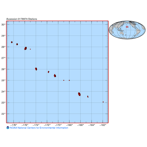
Reef fish data provided in this dataset were collected during stationary point count (SPC) surveys as part of Papahānaumokuākea Marine National Monument funded research cruises to the Northwestern Hawaiian Islands in 2007, 2009, 2011, and 2012. Benthic es...
National Coral Reef Monitoring Program: Assessing and monitoring cryptic reef diversity of colonizing marine invertebrates using autonomous reef monitoring structures (ARMS) deployed at coral reef sites across Guam, Saipan, Pagan and Maug of the Mariana Archipelago from 2014-03-25 to 2017-06-19 (NCEI Accession 0176414)
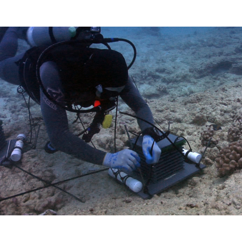
Autonomous Reef Monitoring Structures (ARMS) are used by the Ecosystem Sciences Division (ESD) at the NOAA Pacific Islands Fisheries Science Center (PIFSC) to assess and monitor cryptic reef diversity of colonizing marine invertebrates. The 2-mm fraction ...
National Coral Reef Monitoring Program: Benthic Cover Derived from Analysis of Benthic Images Collected during Stratified Random Surveys (StRS) across the Pacific Remote Island Areas from 2017-04-02 to 2017-04-23 (NCEI Accession 0176575)
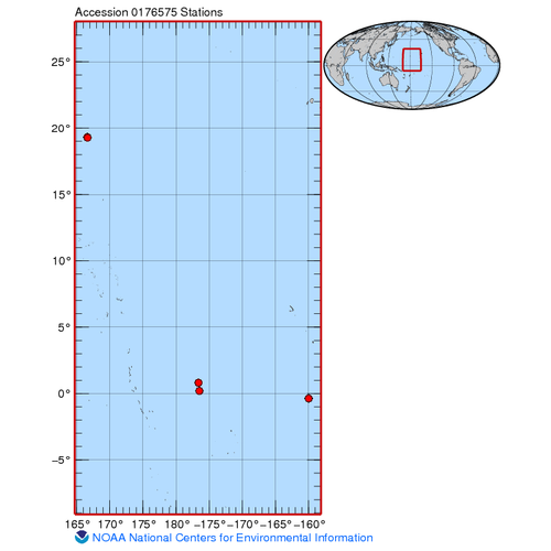
The data described here resulted from benthic photo-quadrat surveys conducted along transects at stratified random sites across the Pacific Remote Island Areas, including Baker, Howland, and Jarvis Islands, and Wake Atoll in April 2017 as a part of Rapid ...
National Coral Reef Monitoring Program: Stratified random surveys (StRS) of reef fish, including benthic estimate data from French Frigate Shoals, Lisianski Island, and Midway Atoll of the Northwestern Hawaiian Islands from 2014-08-14 to 2014-08-26 (NCEI Accession 0181481)
The stationary point count (SPC) method is used to conduct reef fish surveys in the Hawaiian and Mariana Archipelagos, American Samoa, and the Pacific Remote Island Areas as part of the NOAA National Coral Reef Monitoring Program (NCRMP). The SPC method c...
National Coral Reef Monitoring Program: Stratified random surveys (StRS) of reef fish, including benthic estimate data of the Northwestern Hawaiian Islands from 2015-07-30 to 2015-08-21 (NCEI Accession 0181482)
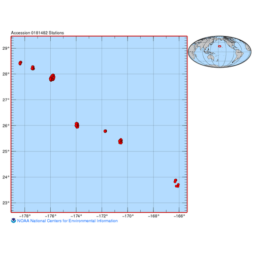
The stationary point count (SPC) method is used to conduct reef fish surveys in the Hawaiian and Mariana Archipelagos, American Samoa, and the Pacific Remote Island Areas as part of the NOAA National Coral Reef Monitoring Program (NCRMP). The SPC method c...
National Coral Reef Monitoring Program: Stratified random surveys (StRS) of reef fish, including benthic estimate data across American Samoa from 2018-06-19 to 2018-07-18 (NCEI Accession 0183543)
The stationary point count (SPC) method is used by the NOAA Pacific Islands Fisheries Science Center (PIFSC), Ecosystem Sciences Division (ESD, formerly the Coral Reef Ecosystem Division) to conduct reef fish surveys in the Hawaiian and Mariana Archipelag...