Downloadable DataEndangered Species and Wildlife Resources Inventory Kwajalein Atoll, U.S. Army , Republic of the Marshall Islands 1996 (NODC Accession 0000251)
This report summarizes the results of the first Environmental Standards and Procedures (UES) inventory of endangered species and wildlife resources at United States Army Kwajalein Atoll (USAKA), which was conducted in 1996. The primary objective of the in...
Downloadable DataNCCOS Assessment: Juvenile fish trap data from Salt River Bay, St. Croix, U.S. Virgin Islands, from 2018-05-16 to 2019-06-26 (NCEI Accession 0207791)
Metadata Thumbnail 
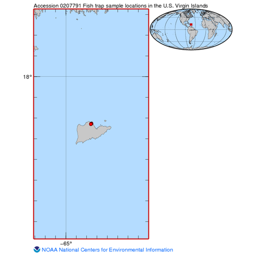
This tabular dataset provides all catch records for a fish trapping study conducted in Salt River Bay National Historical Park and Ecological Preserve, St. Croix, U.S. Virgin Islands (USVI). From May 2018 to June 2019 fish traps were deployed along the ma...
Downloadable DataBenthic cover derived from structure from motion images collected during marine debris surveys at coral reef sites entangled with derelict fishing nets at Pearl and Hermes Atoll in the Northwestern Hawaiian Islands from 2018/09/24 to 2018/10/03 (NCEI Accession 0209247)
Metadata Thumbnail The benthic cover and fishing-net related data described in this dataset are derived from the GIS analysis of benthic orthophotos. The source imagery was collected using a Structure from Motion (SfM) approach during in-water marine debris swim surveys con...
Offline DataStructure from motion images collected during marine debris surveys at coral reef sites entangled with fishing nets at Pearl and Hermes Atoll in the Northwestern Hawaiian Islands from 2018/09/24 to 2018/10/03
Metadata Thumbnail The photographs described in this dataset were collected using a Structure from Motion (SfM) approach during in-water marine debris swim surveys conducted by snorkelers in search of derelict fishing nets. Surveys were conducted by the NOAA Fisheries, Ecos...
Downloadable DataBenthic cover derived from structure from motion images collected during marine debris surveys at coral reef sites entangled with derelict fishing nets at Pearl and Hermes Atoll in the Northwestern Hawaiian Islands from 2021-09-13 to 2021-09-14 (NCEI Accession 0253462)
Metadata Thumbnail The benthic cover and fishing-net related data described in this dataset are derived from the GIS analysis of benthic orthophotos. Source imagery was collected by snorkelers using a Structure from Motion (SfM) approach from at Pearl and Hermes Atoll in t...
Downloadable DataStructure from motion images collected at control sites during marine debris surveys at coral reef sites entangled with derelict fishing nets at Pearl and Hermes Atoll in the Northwestern Hawaiian Islands from 2021-09-13 to 2021-09-14 (NCEI Accession 0253649)
Metadata Thumbnail The "control" site photographs described in this dataset were collected using a Structure from Motion (SfM) approach during in-water marine debris swim surveys conducted by snorkelers in search of derelict fishing nets. Surveys were conducted by the NOAA ...
Downloadable DataShoreline surveys and removal of marine debris at Midway Atoll, Northwestern Hawaiian Islands from 2013 to 2016 (NCEI Accession 0189571)
Metadata Thumbnail The marine debris data included in this dataset are from annual shoreline surveys conducted from 2013 to 2016 at the islands of Midway Atoll (Eastern, Spit, and Sand Islands) in the Northwestern Hawaiian Islands (NWHI) by the NOAA Pacific Islands Fisherie...
Downloadable DataMarine Debris Survey and Removal Efforts in the Northwestern Hawaiian Islands from 1999 to 2021 (NCEI Accession 0190879)
Metadata Thumbnail The marine debris data included in this dataset are from annual in-water surveys conducted from 1999 to 2021 at the reefs, atolls and islands in the Northwestern Hawaiian Islands (NWHI) by the NOAA Pacific Islands Fisheries Science Center (PIFSC), Ecosyst...