 Rugosity 60 m grid derived from gridded bathymetry of Guam Island,
Mariana Islands, USA
Rugosity 60 m grid derived from gridded bathymetry of Guam Island,
Mariana Islands, USA
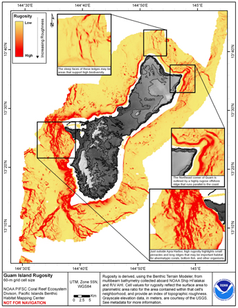 Rugosity is derived from gridded (60 m cell size)
multibeam bathymetry, collected aboard NOAA Ship Hiialaka'i and
R/V AHI, using the Benthic Terrain Modeler with rugosity methods by
Jeff Jenness (2003). Cell values reflect the surface area to planimetric
...
Rugosity is derived from gridded (60 m cell size)
multibeam bathymetry, collected aboard NOAA Ship Hiialaka'i and
R/V AHI, using the Benthic Terrain Modeler with rugosity methods by
Jeff Jenness (2003). Cell values reflect the surface area to planimetric
...