Surveys of Selected Coral and Fish Assemblages Adjacent to the Waianae
Ocean Outfall, Oahu, Hawaii, 2003-2010 (NODC Accession 0084515)
Since 1990, biota of the coral reef ecosystems have been annualy monitored at
stations located at and in the vicinity of the Waianae Ocean Sewage Outfall.
NODC Accession 0000794 contains surveys of 1990-1998. This new update
includes surveys from years...
Reef community structure, Sand Island, Oahu HI, (NODC Accession 0000177)
These reports provide the results of nine years (1990-98) of an annual quantitative monitoring of shallow marine communities inshore of the Sand Island Ocean Outfall, Oahu, Hawaii. This monitoring effort focuses on benthic and fish community structure and...
The Coastal Use Mapping Project is designed to collect critical information on human activities in and near the St. Thomas East End Reserves (STEER). The project purpose is to improve understanding of the spatial range and intensity of key human activitie...
The Hawaii Coastal Use Mapping Project is an innovative partnership between NOAA's National Marine Protected Areas Center, NOAA's Pacific Islands Fisheries Science Center, NOAA's Pacific Islands Regional Office, and the Hawaii Division of Aquatic Resource...
Barbers Point Sewage Outfall Fish Census from Annual Surveys 1991-2010 (NODC Accession 0073346)
The Honouliuli Wastewater Treatment Plant (WWTP) located in Ewa,
Oahu, Hawaii, near Barbers Point (Kalaeloa) has been in operation
since 1982. It releases approximately 22 mgd (0.96 m3/s) of primary
treated sewage through a 2,670-m pipe at a depth of 6...
A Survey of Selected Coral and Fish Assemblages Near
the Waianae Ocean Outfall, Oahu, Hawaii, 1990-1999 (NODC Accession 0000794)
During 1990-1999, coral growth and fish abundance were monitored at stations located at and
in the vicinity of the Waianae Ocean Outfall. Comparisons of results with fish surveys
showed no significant differences in the species composition or relative abu...
Coastal activities in American Samoa in 2012 for use in coastal management
The American Samoa Coastal use Participatory Mapping Project was developed through a partnership between the American Samoa Government's Department of Commerce Coastal Management Program (ASCMP), Department of Marine and Wildlife Resources (DMWR), NOAA's ...
4 km AVHRR Pathfinder v5.0 Global Day-Night Sea Surface Temperature Averages, 1985-2009 (NODC Accession 0077816)
This data set contains a set of monthly and yearly global day-night sea surface temperature averages, derived from the AVHRR Pathfinder Version 5 sea surface temperature cloudscreened data set (http://pathfinder.nodc.noaa.gov) in GeoTIFF format. The AVHRR...
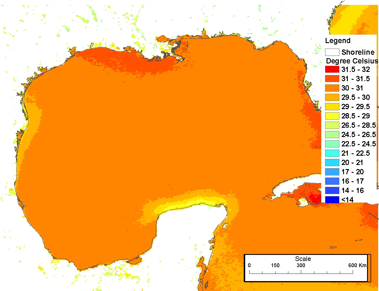
4 km NODC/RSMAS AVHRR Pathfinder Version 5 Seasonal and Annual Day-Night Sea Surface Temperature Climatologies for 1982-2009 for the Gulf of Mexico (NODC Accession 0072888)
The 4 km Pathfinder effort at the National Oceanic and Atmospheric Administration (NOAA) National Oceanographic Data Center (NODC) and the University of Miami's Rosenstiel School of Marine and Atmospheric Science (RSMAS) is an extension of and improvement...
Data from the Roi Removal Project, West Hawaii, 2010-2011 (NODC Accession 0082197
In situ observations of the introduced predatory grouper roi (Cephalopholis
argus) were taken within the coral reef ecosystem of Puako, northwest side of
the Island of Hawaii in 2010-2011. Baseline surveys before roi removal
were made in November 2010 a...
 Surveys of Selected Coral and Fish Assemblages Adjacent to the Waianae
Ocean Outfall, Oahu, Hawaii, 2003-2010 (NODC Accession 0084515)
Surveys of Selected Coral and Fish Assemblages Adjacent to the Waianae
Ocean Outfall, Oahu, Hawaii, 2003-2010 (NODC Accession 0084515)
 This data set contains a set of monthly and yearly global day-night sea surface temperature averages, derived from the AVHRR Pathfinder Version 5 sea surface temperature cloudscreened data set (http://pathfinder.nodc.noaa.gov) in GeoTIFF format. The AVHRR...
 The 4 km Pathfinder effort at the National Oceanic and Atmospheric Administration (NOAA) National Oceanographic Data Center (NODC) and the University of Miami's Rosenstiel School of Marine and Atmospheric Science (RSMAS) is an extension of and improvement...