-
Home
-
Data & Publications
-
Regional Portals
- About Regional Portals
- Florida
- Navassa Island
- Puerto Rico
- Flower Garden Banks
- U.S. Virgin Islands
- American Samoa
- Commonwealth of the Northern Mariana Islands
- Federated States of Micronesia
- Guam
- Main Hawaiian Islands
- Republic of the Marshall Islands
- Northwestern Hawaiian Islands
- Republic of Palau
- Pacific Remote Island Areas
-
CRCP Activities
- Glossary
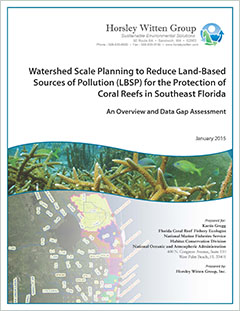
Watershed Scale Planning to Reduce Land-Based
Sources of Pollution (LBSP) for the Protection of
Coral Reefs in Southeast Florida:
An Overview and Data Gap Assessment

This project provides an assessment framework for evaluating the impacts of land-based sources of pollution (LBSP) on the coral reef ecosystem in southeast coastal waters of Martin, Palm Beach, Broward, and Miami-Dade counties. Rapid population growth and intense increases in land development in this region over the past 50-100 years have put the coral reef ecosystem and supporting estuarine habitats under significant stress. Pollutants from these land-based human activities include nutrients (e.g. nitrogen and phosphorus), sediments, pathogens pharmaceutical and personal care products, and other LBSPs. These pollutants are discharged to the southeast Florida coastal ecosystem in large part in stormwater runoff (both urban and agricultural) and wastewater effluent and the management of stormwater and wastewater in southeast Florida affects the pollutants loads and ecosystem impacts.
The purpose of this document is to assist the National Oceanic and Atmospheric Administration (NOAA) and other Southeast Florida Coral Reef Initiative (SEFCRI) partners in tackling the problems associated with LBSP by identifying sources of pollution, data availability and gaps, and sources of information from past planning and management activities in southeastern Florida. This report creates a watershed-based framework for understanding and assessing the pollutant sources and loads, and uses nine coastal inlets in the region as the basis for defining the contributing watersheds. This report will provide a roadmap for future LBSP-related data collection and pollution reduction efforts in southeast Florida.
This project mapped the linkage of land-to-inlet by delineating watersheds or inlet contributing areas (ICAs) to the nine inlets in SE Florida. Because the topography is extremely flat and the area is threaded with highly managed water canals, normal watershed delineation tools were not useful; therefore, the project used the hydraulic database (AHED) developed by the South Florida Water Management District (SFWMD) to identify the ICA boundaries. Flow directions and flow rates in the waterways often depend on the hydrological conditions at the given time; this study focused on the contributing areas associated with the "normal" or average condition. For the Intracoastal Waterway portions of the ICAs, published volumes of tidal prisms for each inlet were used to approximate the surface areas within each inlet. The salinity control structures (SCS), which represent the most upstream extent of salinity intrusion in each estuary, were also identified.
There are nine inlets in the study area that connect the Intracoastal Waterway with the Atlantic Ocean in the vicinity of the Southeast Florida coral tract. These ICAs are as follows, from north to south:
- St. Lucie Inlet
- Jupiter Inlet
- Lake Worth Inlet
- Boynton / South Lake Worth Inlet
- Boca Raton Inlet
- Hillsboro Inlet
- Port Everglades Inlet
- Baker's Haulover Inlet
- Government Cut Inlet
These ICAs differ in the degrees of watershed assessment and planning efforts undertaken to date. Watershed planning begins with whatever information and data are available at the time. Additional data can be incorporated into the management plan as it is revised over time. Key data for understanding current watershed conditions falls into several key categories: geographic information, water quality data, flow data, and watershed mechanics (hydrology, geology, natural resources). Data for this project were obtained from NOAA's Florida Coral Reef Tract (FCRT) project, NOAA's Atlantic Oceanographic and Meteorological Laboratory (AOML), SFWMD, Florida Department of Environmental Projection's (FDEP) STORET DATABASE, University of Florida's GeoPlan Center, Nova Southeastern University, and databases from the four counties in the study area.
Citation: Pickering, N. and Baker, E. 2015. Watershed Scale Planning to Reduce the Land-Based Sources of Pollution (LBSP) for the Protection of Coral Reefs in Southeast Florida. Prepared for the National Oceanographic and Atmospheric Administration. Horsley Witten Group. Sandwich, MA. 84 pp.


