noaa.gov

U.S. Pacific Remote Island Area (PRIA)

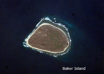
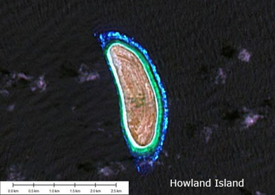
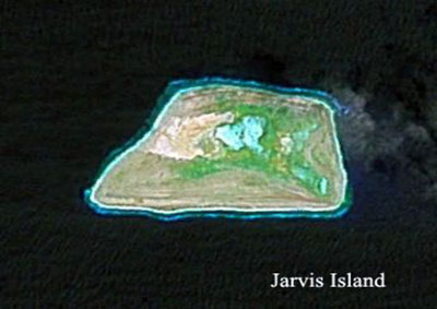
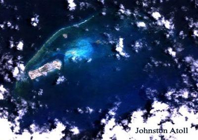
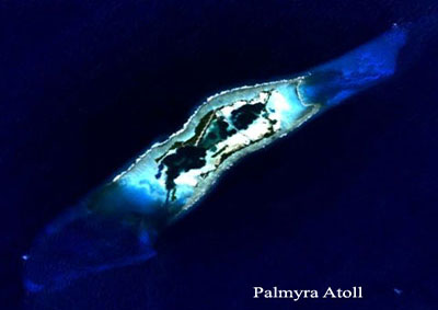
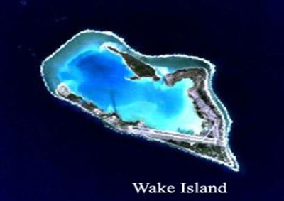
The U.S. Pacific Remote Island Area (PRIA) includes seven islands, atolls and reefs in the Central Pacific that are under the jurisdiction of the United States. Baker, Howland and Jarvis islands, Johnston Atoll, Palmyra Atoll (owned by the Nature Conservancy), and Kingman Reef lie between Hawai‘i and American Samoa. Wake Island is located between the Northwestern Hawaiian Islands and Guam. Wake Island is an unincorporated territory of the U.S. that is administered by the Department of the Interior (DOI) and the U.S. Air Force. All except Wake Island and Johnston Atoll are administered as National Wildlife Refuges (NWR) by the U.S. Fish and Wildlife Service (USFWS) of the DOI. Johnston Atoll is managed by the Department of Defense (DOD). Wake Island is under the jurisdiction of DOI, and managed by DOD.

Some sources include Rose Atoll (the easternmost of the Samoan Islands) and Midway Atoll (located near the northern end of the Northwestern Hawaiian Islands) among PRIA.

The U.S. claimed most of these uninhabited islands under the Guano Act of 1856. In the absence of human activities, the coral reef ecosystems of PRIA remained undisturbed until the early 20th century. During World War II, the U.S. constructed and occupied military bases at Johnston and, Palmyra Atolls, Wake Island, Midway Atoll, and Baker Island. Jarvis and Howland Islands were also briefly occupied or utilized during the war. With the closure of the military base at Johnston Atoll in 2004, only Wake Island remains an active U.S. military base.

Even today, all of PRIA has escaped coral reef ecosystem degradation caused by coastal development, associated pollutants, and major shipping lanes. Public entry to the islands is by special-use permit from the USFWS only and generally restricted to scientists and educators. Only Midway and Palmyra Atolls have serviceable runways; Baker Island, Howland Island, and Johnston Atoll no longer have functional airstrips.

Pacific Remote Island Areas location map

Pacific Remote Island Areas location map

More Photos

Highlights

Coral Reef Condition: A Status Report for the Pacific Remote Islands (2018)

Publications

Pacific Reef Assessment and Monitoring Program. Data report : ecological monitoring 2012-2013 : reef fishes and benthic habitats of the main Hawaiian Islands, American Samoa, and Pacific Remote Island Areas

Status of Coral Reefs of the Pacific and Outlook: 2011

Executive orders, Secretarial Orders, and Congressional Acts

Report on the Status of Marine Protected Areas in Coral Reef Ecosystems of the United States. Volume 1: Marine Protected Areas Managed by U.S. States,Territories, and Commonwealths. NOAA Technical Memorandum CRCP 2 February 2007

Field Identification Guide to the Threatened Corals of the U.S. Pacific Islands

A close-up of A. retusa which can be found in U.S. Pacific Coral Reef Jurisdictions. Copyright Douglas Fenner.

A close-up of A. retusa which can be found in U.S. Pacific Coral Reef Jurisdictions. Copyright Douglas Fenner.

Status Reports

Coral Reef Condition: A Status Report for the Pacific Remote Islands (2018)

State of The Reefs Report (SOTR)

The State of Coral Reef Ecosystems of the United States and Pacific Freely Associated States: 2008.

The State of Coral Reef Ecosystems of the United States and Pacific Freely Associated States: 2005.

The State of Coral Reef Ecosystems of the United States and Pacific Freely Associated States: 2002.

Metadata, Data and Publications Search in CoRIS

Search the CoRIS Geoportal for U.S. Pacific Remote Island Areas (PRIAS) metadata, data and publications.

You may also enter the name of any atoll, island or reef in the CoRIS Geoportal search box and press the "Search" button.

ReefBase Coral Bleaching Reports

Select " U.S. Pacific Islands" in the Region window and select the name of the atoll, island, or reef in the Country window

Near-Real Time Monitoring Data

Coral Reef Watch Satellite Monitoring

Coral Reef Watch - Wake Atoll, Johnston Atoll, and Howland and Baker Atoll Virtual Stations

The Global Temperature-Salinity Profile Program

NOAA CO-OPS - Tide Data

National Data Buoy Center

Other Data

Pacific Islands Benthic Habitat Mapping Center - Pacific Remote Island Areas data

Benthic Habitat Mapping of Palmyra Atoll

Education and Outreach

Pacific Remote Islands Marine National Monument

Pacific Islands Fish And Wildlife Office

Marine Protected Areas/Marine Managed Areas

Marine Protected Areas of the United States Home Page

The Marine Protected Areas Inventory

Federal MPA Legislation

Marine Federal Areas Fact Sheet

Executive order 13158: Marine Protected Areas

Baker Island National Wildlife Refuge

Howland island National Wildlife Refuge

Jarvis Island National Wildlife Refuge

Johnston Island National Wildlife Refuge

Kingman Reef National Wildlife Refuge

Pacific Remote Islands Marine National Monument

Palmyra Atoll National Wildlife Refuge

Wake Atoll National Wildlife Refuge