This site has been replaced by https://coralreef.noaa.gov/digital-corals/. Please bookmark the new page. You will no longer be able to access this site (CoRIS) after 02/23/2026.
The Republic of the Marshall Islands is a collection of 1,225 islands and islets of which only five are single islands. The rest are grouped into 29 coral atolls and five solitary low coral islands, which together make up more than 10 percent of all the atolls in the world. They lie in two parallel chains known as sunrise (Ratak) and sunset (Ralik). They are narrow and low and encircle large central lagoon.
The Marshall Islands are spread out over an exclusive economic zone of nearly 1 million square miles. It is one of only four atoll nations in the world and is also one of the world’s youngest nations, independent since 1986. Majuro atoll, capital of the Marshall Islands, is the most developed atoll with a thriving commercial and political center and a population of nearly 30,000. The Marshall’s Kwajalein Atoll is the largest atoll in the world.
In general, the reefs of the Marshall Islands are in good condition and have experienced minimal damage from bleaching, destructive fishing techniques, and sedimentation. Even those in the former nuclear test sites have shown remarkable recovery. However, there is some evidence of unsustainable resource exploitation. For example, the largest giant clams have been harvested and the current take of grouper, reef shark, and Napoleon wrasse may not be sustainable. The reefs near the urban areas of Majuro are stressed, but still have an abundance of fishes and invertebrates. Localized outbreaks of crown-of-thorns starfish, Acanthasterplanci, and coral disease were observed around Majuro in 2005.
Republic of the Marshall Islands satellite map
Highlights
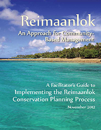
Facilitator's Guide to Implementing the Reimaanlok Conservation Planning Process
The Field Guide was developed to fill the need for a conservation area planning framework and "develop principles, process, and guidelines for the design, establishment, and management of conservation areas that are fully owned, led, and endorsed by local communities based on their needs, values, and cultural heritage." This step-by-step guide includes management tools and examples that will help facilitators establish resource management plans and community-based conservation areas that consider current and future trends (including climate change), locally and globally, that affect the islands' resources and their sustainability. The Guide is published and available online at: https://library.oarcloud.noaa.gov/noaa_documents.lib/Sea_Grant_documents/Hawaii/UNIHI-SEAGRANT-BB-12-01.pdf.
Search the CoRIS Geoportal for Marshall Islands metadata, data and publications, or enter the name of any of its components, such as "Kwajalein Atoll", in the CoRIS Geoportal search box and press the "Search" button.