Navassa
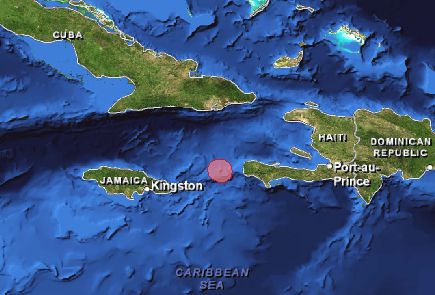
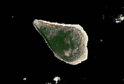
Navassa is a small, uninhabited, and isolated oceanic island located in the Windward Passage approximately 55 km west of the southwestern tip of Haiti. The Island is administered by the U.S. Fish and Wildlife Service as a U.S. National Wildlife Refuge. The refuge includes a 12 mile radius of marine habitat. Because of its remote location and uninhabited status, Navassa's surrounding marine ecosystem is relatively healthy. Although there are no permanent residents, transient Haitian subsistence fishers regularly visit the island.
Publications
Reef and Fisheries Assessment of Navassa Island National Wildlife Refuge (2002-2009)
Sponges of Navassa: A photographic key
A preliminary study of the marine biota at Navassa island, Caribbean Sea
Status of reef resources of Navassa Island: cruise report Nov. 2002
Characterization of Navassa National Wildlife Refuge: A preliminary report for NF-06- 05 (NOAA ship Nancy Foster, April 18-30, 2006). NOAA Technical Memorandum NOS NCCOS #38
Navassa Island Expedition 2009
Observations on Fisheries Activities at Navassa Island
Oral history and contemporary assessment of Navassa Island fishermen.
Report on the Status of Marine Protected Areas in Coral Reef Ecosystems of the United States. Volume 1: Marine Protected Areas Managed by U.S. States,Territories, and Commonwealths. NOAA Technical Memorandum CRCP 2 February 2007
State of The Reefs report (SOTR)
The State of Coral Reef Ecosystems of the United States and Pacific Freely Associated States: 2008.
The State of Coral Reef Ecosystems of the United States and Pacific Freely Associated States: 2005.
The State of Coral Reef Ecosystems of the United States and Pacific Freely Associated States: 2002.
Metadata, Data and Publications search in CoRIS
Search the CoRIS Geoportal for Navassa metadata, data and publications.
ReefBase Coral Bleaching Reports
Select "U.S. Caribbean" in the region window and "Navassa Island (USA) " in the Country window.
Near-real-time Data
Coral Reef Watch Satellite Monitoring
The Global Temperature-Salinity Profile Program
Other Data
Flora of Navassa Island
Nonindigenous Aquatic Species (NAS)
USGS Water Resources Links for: 21030002 - Navassa
Fractal Analysis of the Navassa Island Seascape
Navassa Island Maps - Perry-Castañeda Library Map Collection
Education and Outreach
Navassa Island - World Fact Book
U.S. Department of the Interior / Office of Insular Affairs
- Navassa Island
- Order to delegate the Secretary of the Interior's responsibilities for the administration
of Navassa Island to the Director of the Office of Insular Affairs and
to establish the process for entry onto Navassa.
Order No. 3205
Marine Protected Areas/Marine Managed Areas(MPA)
Marine Protected Areas of the United States Home Page
The Marine Protected Areas Inventory
Federal MPA Legislation
Marine Federal Areas Fact Sheet
Executive order 13158: Marine Protected Areas
Navassa National Wildlife Refuge