noaa.gov

American Samoa

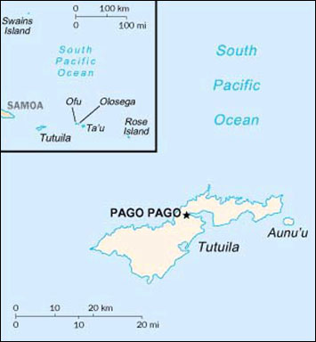
The U.S. Territory of American Samoa is the United States' southernmost territory. American Samoa consists of five volcanic islands and two atolls (Rose Atoll and Swains Island) and is located in the central South Pacific Ocean, approximately 2610 miles (4,200 km) south of the Main Hawaiian Islands. The five volcanic islands, Tutuila, Aunu'u, Ofu, Olosega, and Ta'u, are the major inhabited islands. Tutuila is the largest island and the center of government. Ofu, Olosega, and Ta'u are collectively referred to as the Manu'a Islands.

These islands are small, ranging in size from Tutuila (53 mi or 138 km²) to the uninhabited and remote Rose Atoll (1.5 mi or 4 km²). Swains Island (approximately 0.7 mi or 2 km²) is an unbroken circle of land with an enclosed lagoon. The limited shallow water coral reef habitats surrounding all of the islands consist primarily of fringing coral reefs, a few offshore banks, and two atolls.

Many species of Indo-Pacific corals, other invertebrates, and fishes are members of the American Samoa coral reef ecosystem. Although the corals have largely recovered from a number of natural disturbances, including a major crown-of-thorns starfish invasion, several mass bleaching events, and powerful damaging cyclones, maintaining the health of the ecosystem is an ongoing task. Harmful fishing practices, coastal construction, pollution, coral bleaching, and invasive algal outbreaks have taken their toll. Management actions such as regulating SCUBA spearfishing, protecting large reef species, and relocation of tuna cannery outfall pipes have worked to mitigate some of the impacts and protect the coral ecosystem.

Samoa location map

Samoa location map

Highlights

OCM Coastal Impact Stories: Coral Reef Conservation Program in American Samoa

Coral Reef Condition: A Status Report for American Samoa (2018)

National Coral Reef Monitoring Program Socioeconomic Monitoring Component Summary Findings for American Samoa (2014)

Publications

American Samoa's Coral Reef Management Priorities (2010)

American Samoa Capacity Assessment Report and Coral Reef Conservation Timeline

Field Guide to the Corals of the Samoan Archipelago

MPA Poster: Some Fish Need Larger Marine Protected Areas to Live and Reproduce

Baseline Assessment of Faga'alu Watershed: A Ridge to Reef Assessment in Support of Sediment Reduction Activities and Future Evaluation of their Success

National Coral Reef Monitoring Program Socioeconomic Monitoring Component Summary Findings for American Samoa (2014)

Socioeconomic Assessment for Marine Protected Areas and Watershed Management Areas in American Samoa

Socioeconomic survey on the Marine Environment, Pollution, and Village Adaptive Capacity: Vatia, Aunu’u and Faga’alu Villages Survey Results (October and November 2014)

Biogeographic Assessment of the Samoan Archipelago

Long term monitoring of Fagatele Bay National Marine Sanctuary, Tutuila Island (American Samoa)

Coral Reef Ecosystem Monitoring Report for American Samoa: 2002-2006

Coral Reef Ecosystems of American Samoa: a 2002-2010 Overview

Fagatele Bay 2007 Condition Report

Mesophotic Communities of the Insular Shelf at Tutuila, American Samoa

Natural History Guide to American Samoa

American Samoa: Local Action Strategy

Description of Wetlands in American Samoa by Richard D.Volk

Proceedings of the American Samoa Coral Reef Fishery Workshop

Report on the Status of Marine Protected Areas in Coral Reef Ecosystems of the United States.Volume 1: Marine Protected Areas Managed by U.S. States,Territories, and Commonwealths (NOAA Technical Memorandum CRCP 2 February 2007)

Coral Identification Guides

An encrusting colony of crateriformis in American Samoa. This shows the typical color, and the small ridges. Copyright Douglas Fenner.

An encrusting colony of crateriformis in American Samoa. This shows the typical color, and the small ridges.
Copyright Douglas Fenner.

Status Reports

Coral Reef Condition: A Status Report for American Samoa (2018)

State of The Reefs report (SOTR)

The State of Coral Reef Ecosystems of the United States and Pacific Freely Associated States: 2008.

The State of Coral Reef Ecosystems of the United States and Pacific Freely Associated States: 2005.

The State of Coral Reef Ecosystems of the United States and Pacific Freely Associated States: 2002.

Local Action Strategy

American Samoa Local Action Strategy Fact Sheet

The United States Territory of American Samoa: three-year local action strategies 2004-2007

Management Activities

American Samoa Climate Change Mitigation Executive Order 03-2012

Territorial Climate Change Adaptation Framework

Strengthen the management and monitoring of Samoa's community-based marine management and MPAs network

Watershed Management Plans

Faga'alu Village watershed management and conservation plan

Fagaalu Watershed Plan Implementation Supplement

Metadata, Data and Publications search in CoRIS

Search the CoRIS Geoportal for American Samoa metadata, data and publications

You may also enter the name of any atoll, island or reef, uch as "Aunu'u", "Ofu", "Olosega", "Ta'u", "Rose Atoll", or "Swains Island" in the CoRIS Geoportal search box and press the "Search" button.

Reef Base Coral Bleaching Reports

Select "Micronesia" in the Region window and "American Samoa" in the Country window

Near-real-time Data

Coral Reef Watch Satellite Monitoring

Coral Reef Watch - Samoa and Southwest Pacific Virtual Stations

The Global Temperature-Salinity Profile Program

NOAA/National Weather Service - Data from American Samoa

Weather observations - Pago Pago

USGS Water Resources - Data for American Samoa

NOAA CO-OPS - Tide Data

NOAA Tide Predictions - American Samoa

NOAA's National Data Buoy Center

Fagatele Bay Ocean Acidification Monitoring Buoy

Other Data

Shallow-Water Benthic Habitats of American Samoa, Guam, and the Commonwealth of the Northern Mariana Islands

Pacific Islands Benthic Habitat Mapping Center - American Samoa

Fagatele Bay National Marine Sanctuary (FBNMS) GIS Data Archive

Fishes of National Park of American Samoa

Corals of National Park of American Samoa

Marine Invertebrates of the National Park of American Samoa

Geologic setting and ecological functioning of coral reefs in American Samoa

NOAA's National Oceanographic Data Center - American Samoa data

National Park Service - Pacific Islands Network Inventory and Monitoring Program

Coral Reef Monitoring Program for American Samoa

American Samoa Environmental Sensitivity Index (ESI) Atlas

Coastal Change Analysis Program (C-CAP) - American Samoa Land Cover Data

USGS Projected Flood Extent for American Samoa

Education and Outreach

American Samoa photographs

American Samoa history and general information

Coral Reef Program - National Park of the American Samoa

National Marine Sanctuary of American Samoa - About Your Sanctuary

Marine Protected Areas/Marine Managed Areas

Marine Protected Areas of the United States Home Page

The Marine Protected Areas Inventory

Federal MPA Legislation

Marine Federal Areas Fact Sheet

Executive order 13158: Marine Protected Areas

Alofau Village Marine Protected Area

Amanave Village Village Marine Protected Area

Amaua and Auto Marine Protected Area

Aoa Marine Protected Area

Aua Marine Protected Area

Fagamab Village Marine Protected Area

Leone Pala Special Management Area

Masausi Village Marine Protected Area

Matu'u & Faganeanea Village Marine Protected Area

National Marine Sanctuary of American Samoa

National Park of American Samoa

Nu'uuli Pala Special Management Area

Ofu Vaoto Marine Park

Poloa Village Marine Protected Area

Rose Atoll Marine National Moument

Rose Atoll National Wildlife Refuge

Sa'ilele Village Marine Protected Area

Vaota Territorial Marine Park

Vatia Village Marine Protected Area